Estimated Value: $236,000 - $262,000
3
Beds
1
Bath
1,008
Sq Ft
$249/Sq Ft
Est. Value
About This Home
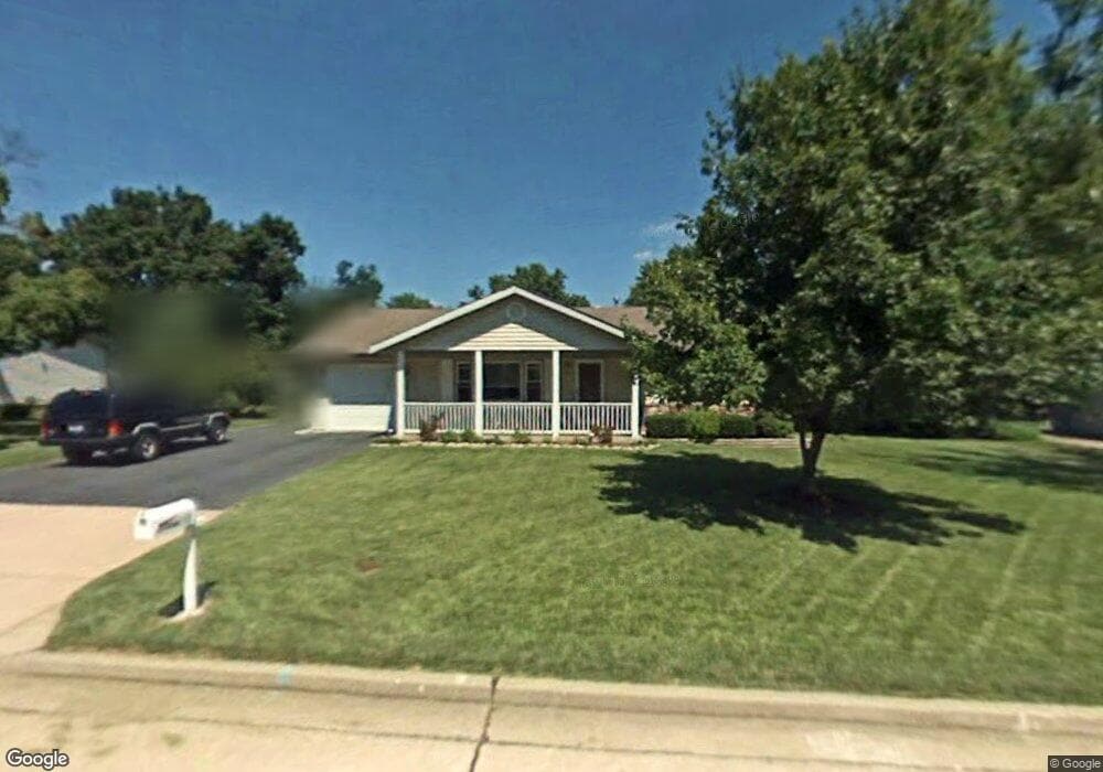
This home is located at 20 Faye Ave, Saint Charles, MO 63301 and is currently estimated at $251,033, approximately $249 per square foot. 20 Faye Ave is a home located in St. Charles County with nearby schools including Monroe Elementary School, Jefferson Intermediate School, and Hardin Middle School.
Ownership History
Date
Name
Owned For
Owner Type
Purchase Details
Closed on
Dec 5, 2005
Sold by
Kessler Daniel R
Bought by
Ermeling Nancy and Dearing Zoe A
Current Estimated Value
Home Financials for this Owner
Home Financials are based on the most recent Mortgage that was taken out on this home.
Original Mortgage
$115,600
Interest Rate
6.12%
Mortgage Type
Fannie Mae Freddie Mac
Purchase Details
Closed on
Jul 20, 2004
Sold by
Beauchamp Daniel W and Beauchamp Diane K
Bought by
Kessler Daniel R
Home Financials for this Owner
Home Financials are based on the most recent Mortgage that was taken out on this home.
Original Mortgage
$140,000
Interest Rate
6.32%
Mortgage Type
Purchase Money Mortgage
Create a Home Valuation Report for This Property
The Home Valuation Report is an in-depth analysis detailing your home's value as well as a comparison with similar homes in the area
Home Values in the Area
Average Home Value in this Area
Purchase History
| Date | Buyer | Sale Price | Title Company |
|---|---|---|---|
| Ermeling Nancy | $144,500 | Us Title Co | |
| Kessler Daniel R | -- | -- |
Source: Public Records
Mortgage History
| Date | Status | Borrower | Loan Amount |
|---|---|---|---|
| Closed | Ermeling Nancy | $115,600 | |
| Previous Owner | Kessler Daniel R | $140,000 |
Source: Public Records
Tax History Compared to Growth
Tax History
| Year | Tax Paid | Tax Assessment Tax Assessment Total Assessment is a certain percentage of the fair market value that is determined by local assessors to be the total taxable value of land and additions on the property. | Land | Improvement |
|---|---|---|---|---|
| 2025 | $2,464 | $39,847 | -- | -- |
| 2023 | $2,460 | $38,260 | $0 | $0 |
| 2022 | $2,063 | $29,859 | $0 | $0 |
| 2021 | $2,065 | $29,859 | $0 | $0 |
| 2020 | $1,922 | $26,687 | $0 | $0 |
| 2019 | $1,906 | $26,687 | $0 | $0 |
| 2018 | $1,728 | $22,974 | $0 | $0 |
| 2017 | $1,704 | $22,974 | $0 | $0 |
| 2016 | $1,754 | $22,794 | $0 | $0 |
| 2015 | $1,751 | $22,794 | $0 | $0 |
| 2014 | $1,769 | $22,737 | $0 | $0 |
Source: Public Records
Map
Nearby Homes
- 8 Faye Ave
- 10 Fairways Cir Unit E
- 9 Fairways Cir Unit B
- 4 Fairways Cir Unit A
- 104 Dornoch Dr
- 7 Fairways Cir Unit B
- 2895 Fairways Cir Unit M
- 128 Tom Sawyer Dr
- 127 Yankee Dr
- 3401 Droste Rd
- 2242 Bolton St
- 1710 Forest Hills Dr Unit C
- 141 Becky Thatcher Dr
- 3303 Ipswich Ln
- 521 Norwich Dr
- 7 Wayne St
- 915 King Dr Unit 2C
- 2741 Penbrooke Ln
- 1468 Hawks Nest Ct Unit C
- 1464 Hawks Nest Ct Unit 27