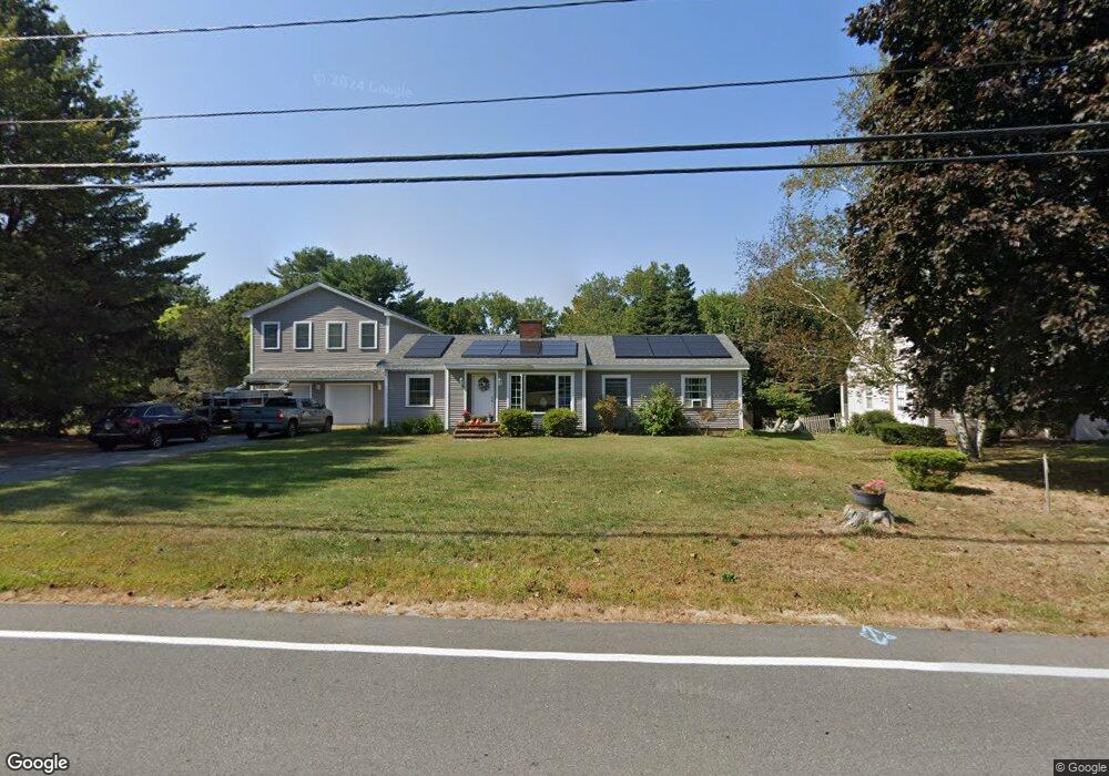
20 Locke Rd Hampton, NH 03842
Estimated Value: $859,000 - $968,000
4
Beds
3
Baths
3,152
Sq Ft
$289/Sq Ft
Est. Value
About This Home
This home is located at 20 Locke Rd, Hampton, NH 03842 and is currently estimated at $909,608, approximately $288 per square foot. 20 Locke Rd is a home located in Rockingham County with nearby schools including Hampton Centre School, Adeline C. Marston Elementary School, and Hampton Academy.
Ownership History
Date
Name
Owned For
Owner Type
Purchase Details
Closed on
Sep 22, 2014
Sold by
Lilly Stephen M
Bought by
Lilly David E and Brinkman-Lilly Callie
Current Estimated Value
Home Financials for this Owner
Home Financials are based on the most recent Mortgage that was taken out on this home.
Original Mortgage
$285,000
Outstanding Balance
$216,922
Interest Rate
4.14%
Mortgage Type
Purchase Money Mortgage
Estimated Equity
$692,686
Purchase Details
Closed on
Jun 15, 1993
Bought by
Lilly David E and Brinkman-Lilly Callie
Create a Home Valuation Report for This Property
The Home Valuation Report is an in-depth analysis detailing your home's value as well as a comparison with similar homes in the area
Home Values in the Area
Average Home Value in this Area
Purchase History
| Date | Buyer | Sale Price | Title Company |
|---|---|---|---|
| Lilly David E | -- | -- | |
| Lilly David E | -- | -- |
Source: Public Records
Mortgage History
| Date | Status | Borrower | Loan Amount |
|---|---|---|---|
| Open | Lilly David E | $285,000 | |
| Previous Owner | Lilly David E | $245,000 | |
| Previous Owner | Lilly David E | $203,000 |
Source: Public Records
Tax History Compared to Growth
Tax History
| Year | Tax Paid | Tax Assessment Tax Assessment Total Assessment is a certain percentage of the fair market value that is determined by local assessors to be the total taxable value of land and additions on the property. | Land | Improvement |
|---|---|---|---|---|
| 2024 | $9,477 | $769,200 | $282,900 | $486,300 |
| 2023 | $8,893 | $530,900 | $188,600 | $342,300 |
| 2022 | $8,316 | $525,000 | $188,600 | $336,400 |
| 2021 | $8,316 | $525,000 | $188,600 | $336,400 |
| 2020 | $8,351 | $524,200 | $188,600 | $335,600 |
| 2019 | $5,912 | $524,200 | $188,600 | $335,600 |
| 2018 | $8,033 | $491,500 | $171,400 | $320,100 |
| 2017 | $8,046 | $491,500 | $171,400 | $320,100 |
| 2016 | $7,501 | $491,500 | $171,400 | $320,100 |
Source: Public Records
Map
Nearby Homes
- 11 Carlson Rd
- 3 Playhouse Cir
- 7 Moulton Rd
- 10 Mcdermott Rd
- 47 Seabury
- 55 Seabury
- 330 High St
- 403 High St
- 22 Mace Rd
- 407 Lafayette Rd
- 78 Dearborn Ave
- 10 Hemlock St Unit 3
- 24 Milbern Ave
- 430 High St
- 7 Hunter Dr
- 16 Bruce St
- 7 Anns Ln Unit s 1 & 2
- 550 Winnacunnet Rd Unit 206
- 550 Winnacunnet Rd Unit 318
- 550 Winnacunnet Rd Unit 319
- 22 Locke Rd
- 16 Locke Rd
- 21 Locke Rd
- 54 Edgewood Dr
- 318 Winnacunnet Rd
- 50 Edgewood Dr
- 292 Winnacunnet Rd
- 46 Edgewood Dr
- 309 Winnacunnet Rd
- 27 Locke Rd
- 62 Edgewood Dr
- 322 Winnacunnet Rd
- 301 Winnacunnet Rd
- 284 Winnacunnet Rd
- 42 Edgewood Dr
- 315 Winnacunnet Rd
- 315 Winnacunnet Rd Unit 3
- 34 Locke Rd
- 55 Edgewood Dr
- 297 Winnacunnet Rd