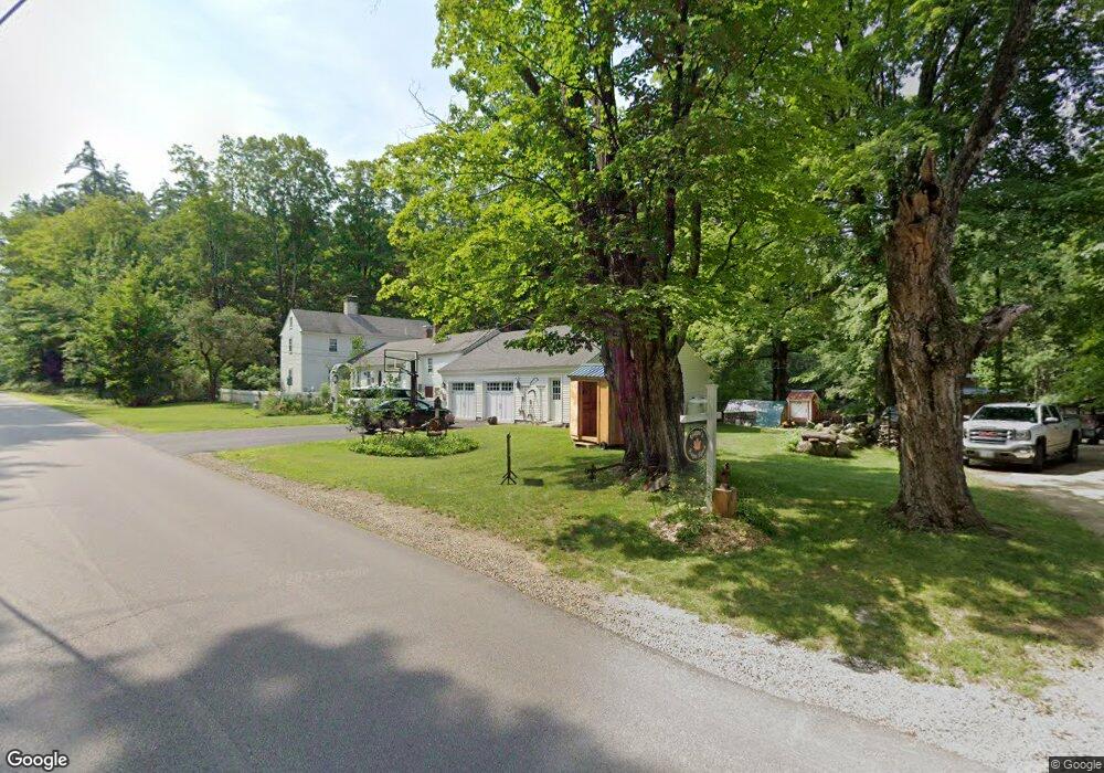
20 S New Boston Rd Francestown, NH 03043
Estimated Value: $613,000 - $714,000
4
Beds
4
Baths
2,919
Sq Ft
$227/Sq Ft
Est. Value
About This Home
This home is located at 20 S New Boston Rd, Francestown, NH 03043 and is currently estimated at $661,979, approximately $226 per square foot. 20 S New Boston Rd is a home with nearby schools including Francestown Elementary School, Great Brook School, and Conval Regional High School.
Ownership History
Date
Name
Owned For
Owner Type
Purchase Details
Closed on
Jan 3, 2006
Sold by
Johnson Florence T
Bought by
Peters 3Rd John J
Current Estimated Value
Home Financials for this Owner
Home Financials are based on the most recent Mortgage that was taken out on this home.
Original Mortgage
$269,900
Interest Rate
6.39%
Mortgage Type
Purchase Money Mortgage
Create a Home Valuation Report for This Property
The Home Valuation Report is an in-depth analysis detailing your home's value as well as a comparison with similar homes in the area
Home Values in the Area
Average Home Value in this Area
Purchase History
| Date | Buyer | Sale Price | Title Company |
|---|---|---|---|
| Peters 3Rd John J | $299,900 | -- |
Source: Public Records
Mortgage History
| Date | Status | Borrower | Loan Amount |
|---|---|---|---|
| Open | Peters 3Rd John J | $256,297 | |
| Closed | Peters 3Rd John J | $268,000 | |
| Closed | Peters 3Rd John J | $269,900 |
Source: Public Records
Tax History Compared to Growth
Tax History
| Year | Tax Paid | Tax Assessment Tax Assessment Total Assessment is a certain percentage of the fair market value that is determined by local assessors to be the total taxable value of land and additions on the property. | Land | Improvement |
|---|---|---|---|---|
| 2024 | $9,304 | $579,300 | $188,100 | $391,200 |
| 2023 | $8,869 | $318,100 | $100,300 | $217,800 |
| 2022 | $8,220 | $318,100 | $100,300 | $217,800 |
| 2021 | $7,800 | $318,100 | $100,300 | $217,800 |
| 2020 | $7,471 | $288,900 | $100,300 | $188,600 |
| 2019 | $6,983 | $288,900 | $100,300 | $188,600 |
| 2018 | $6,610 | $247,200 | $77,000 | $170,200 |
| 2017 | $6,140 | $247,200 | $77,000 | $170,200 |
| 2016 | $6,306 | $247,200 | $77,000 | $170,200 |
| 2015 | $6,227 | $247,200 | $77,000 | $170,200 |
| 2014 | $6,195 | $247,200 | $77,000 | $170,200 |
| 2013 | $6,264 | $275,100 | $102,300 | $172,800 |
Source: Public Records
Map
Nearby Homes
- Lot 2 Journeys End Rd
- Lot 3 Journeys End Rd
- Lot 1 Journeys End Rd
- 0 Woodward Hill Rd Unit LOT E 4984900
- 0 Woodward Hill Rd Unit LOT B 4984898
- 1 Cross Rd
- 263 Cochran Hill Rd
- 496 Mountain Rd
- 60 Scobie Rd
- 57 Richardson Rd
- 236 Old Coach Rd Unit 56-3
- 379 New Boston Rd
- 63 New Boston (Route 136) Rd
- 1519 New Boston Rd
- 171 S Hill Rd
- 3 Old County Rd S
- Lot 1-50-3 Colburn Rd
- Lot 1-50-1 Colburn Rd
- 2 Wallace Ln
- 204 Colburn Rd
- 21 S New Boston Rd
- 1743 2nd Nh Turnpike S
- 1682 2nd Nh Turnpike S
- 76 S New Boston Rd
- 00 Russell Station Rd
- 2-3-1 Russell Station Rd
- 67 S New Boston Rd
- 79 S New Boston Rd
- 1836 2nd Nh Turnpike
- 1852 2nd Nh Turnpike
- 1691 2nd Nh Turnpike S
- 1968 2nd Nh Turnpike
- 1895 2nd Nh Turnpike
- 1937 2nd Nh Turnpike
- 43 Russell Station Rd
- 43 S New Boston Rd
- 1577 2nd Nh Turnpike S
- 83 Russell Station Rd
- 295 Avery Rd
- 106 Russell Station Rd