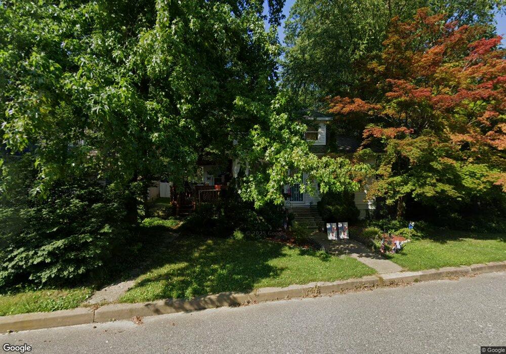
20 Silverside Rd Wilmington, DE 19809
Estimated Value: $345,000 - $471,000
3
Beds
2
Baths
1,150
Sq Ft
$347/Sq Ft
Est. Value
About This Home
This home is located at 20 Silverside Rd, Wilmington, DE 19809 and is currently estimated at $398,962, approximately $346 per square foot. 20 Silverside Rd is a home located in New Castle County with nearby schools including Maple Lane Elementary School, Pierre S. Dupont Middle School, and Mount Pleasant High School.
Ownership History
Date
Name
Owned For
Owner Type
Purchase Details
Closed on
Oct 27, 2005
Sold by
Keller Michelle L
Bought by
Corini Frank and Mattes Catherine
Current Estimated Value
Home Financials for this Owner
Home Financials are based on the most recent Mortgage that was taken out on this home.
Original Mortgage
$178,400
Outstanding Balance
$96,250
Interest Rate
5.79%
Mortgage Type
Fannie Mae Freddie Mac
Estimated Equity
$302,712
Purchase Details
Closed on
Feb 3, 2003
Sold by
Mooney Bert E and Mooney Lena J
Bought by
Keller Michelle L
Create a Home Valuation Report for This Property
The Home Valuation Report is an in-depth analysis detailing your home's value as well as a comparison with similar homes in the area
Home Values in the Area
Average Home Value in this Area
Purchase History
| Date | Buyer | Sale Price | Title Company |
|---|---|---|---|
| Corini Frank | $223,000 | -- | |
| Keller Michelle L | $134,900 | Transnation Title Ins Co |
Source: Public Records
Mortgage History
| Date | Status | Borrower | Loan Amount |
|---|---|---|---|
| Open | Corini Frank | $178,400 |
Source: Public Records
Tax History
| Year | Tax Paid | Tax Assessment Tax Assessment Total Assessment is a certain percentage of the fair market value that is determined by local assessors to be the total taxable value of land and additions on the property. | Land | Improvement |
|---|---|---|---|---|
| 2024 | $761 | $48,500 | $13,400 | $35,100 |
| 2023 | $543 | $48,500 | $13,400 | $35,100 |
| 2022 | $709 | $48,500 | $13,400 | $35,100 |
| 2021 | $555 | $48,500 | $13,400 | $35,100 |
| 2020 | $1,721 | $48,500 | $13,400 | $35,100 |
| 2019 | $1,795 | $48,500 | $13,400 | $35,100 |
| 2018 | $1,646 | $48,500 | $13,400 | $35,100 |
| 2017 | $1,620 | $48,500 | $13,400 | $35,100 |
| 2016 | $1,618 | $48,500 | $13,400 | $35,100 |
| 2015 | $1,490 | $48,500 | $13,400 | $35,100 |
| 2014 | $1,488 | $48,500 | $13,400 | $35,100 |
Source: Public Records
Map
Nearby Homes
- 6 Aldee Ln
- 400 W Holly Oak Rd
- 201 Clayton Ave
- 305 W Delaware Ave
- 8 Garrett Rd
- 805 Woodsdale Rd
- 1302 Stanford Rd
- 707 Parkside Blvd
- 512 Eskridge Dr
- 1410 Drake Rd
- 0 Bell Hill Rd
- 2520 Reynolds Ave
- 814 Naudain Ave
- 1425 Bucknell Rd
- 7 Hillside Rd
- 409 Baynard Blvd
- 32 Woods Way
- 104 Danforth Place
- 1231 Grinnell Rd
- 731 Governor House Cir Unit 74
- 22 Silverside Rd
- 18 Silverside Rd
- 1310 Jefferson Ave
- 100 Silverside Rd
- 5 Brookside Place
- 16 Silverside Rd
- 19 Silverside Rd
- 21 Silverside Rd
- 1401 Lincoln Ave
- 3 Brookside Place
- 17 Silverside Rd
- 102 Silverside Rd
- 15 Silverside Rd
- 103 Silverside Rd
- 4 Aldee Ln
- 15 W Clearview Ave
- 13 W Clearview Ave
- 17 W Clearview Ave
- 11 W Clearview Ave
- 13 Silverside Rd
Your Personal Tour Guide
Ask me questions while you tour the home.