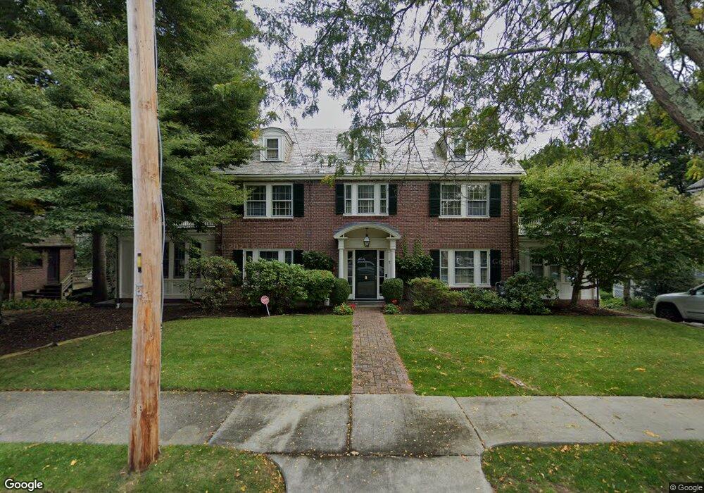
20 Wamesit Rd Waban, MA 02468
Waban NeighborhoodEstimated Value: $2,039,389 - $2,747,000
6
Beds
4
Baths
3,441
Sq Ft
$676/Sq Ft
Est. Value
About This Home
This home is located at 20 Wamesit Rd, Waban, MA 02468 and is currently estimated at $2,327,097, approximately $676 per square foot. 20 Wamesit Rd is a home located in Middlesex County with nearby schools including Angier Elementary School, Charles E Brown Middle School, and Newton South High School.
Ownership History
Date
Name
Owned For
Owner Type
Purchase Details
Closed on
Jan 31, 1995
Sold by
Shea John F and Shea Janet A
Bought by
May Herbert G and May Teddi M
Current Estimated Value
Home Financials for this Owner
Home Financials are based on the most recent Mortgage that was taken out on this home.
Original Mortgage
$380,000
Interest Rate
9.24%
Mortgage Type
Purchase Money Mortgage
Create a Home Valuation Report for This Property
The Home Valuation Report is an in-depth analysis detailing your home's value as well as a comparison with similar homes in the area
Home Values in the Area
Average Home Value in this Area
Purchase History
| Date | Buyer | Sale Price | Title Company |
|---|---|---|---|
| May Herbert G | $530,000 | -- |
Source: Public Records
Mortgage History
| Date | Status | Borrower | Loan Amount |
|---|---|---|---|
| Open | May Herbert G | $373,700 | |
| Closed | May Herbert G | $378,500 | |
| Closed | May Herbert G | $380,000 | |
| Previous Owner | May Herbert G | $153,100 |
Source: Public Records
Tax History
| Year | Tax Paid | Tax Assessment Tax Assessment Total Assessment is a certain percentage of the fair market value that is determined by local assessors to be the total taxable value of land and additions on the property. | Land | Improvement |
|---|---|---|---|---|
| 2025 | $19,790 | $2,019,400 | $1,325,400 | $694,000 |
| 2024 | $19,135 | $1,960,600 | $1,286,800 | $673,800 |
| 2023 | $18,348 | $1,802,400 | $993,300 | $809,100 |
| 2022 | $17,557 | $1,668,900 | $919,700 | $749,200 |
| 2021 | $16,941 | $1,574,400 | $867,600 | $706,800 |
| 2020 | $16,437 | $1,574,400 | $867,600 | $706,800 |
| 2019 | $15,973 | $1,528,500 | $842,300 | $686,200 |
| 2018 | $14,965 | $1,383,100 | $765,700 | $617,400 |
| 2017 | $14,509 | $1,304,800 | $722,400 | $582,400 |
| 2016 | $13,877 | $1,219,400 | $675,100 | $544,300 |
| 2015 | $12,728 | $1,096,300 | $630,900 | $465,400 |
Source: Public Records
Map
Nearby Homes
- 0 Metacomet Rd
- 33 Metacomet Rd
- 91 Waban Ave
- 20 Kinmonth Rd Unit 203
- 20 Kinmonth Rd Unit 306
- 20 Kinmonth Rd Unit 4
- 31 Wilde Rd
- 115 Windsor Rd
- 64 Varick Rd
- 177 Varick Rd
- 26 Varick Hill Rd
- 29 Montclair Rd
- 447 Waban Ave
- 110 Avalon Rd
- 34 Larchmont Ave
- 18 Moffat Rd
- 1438 Beacon St
- 15 Gammons Rd
- 1754 Washington St
- 32 Lantern Ln
Your Personal Tour Guide
Ask me questions while you tour the home.