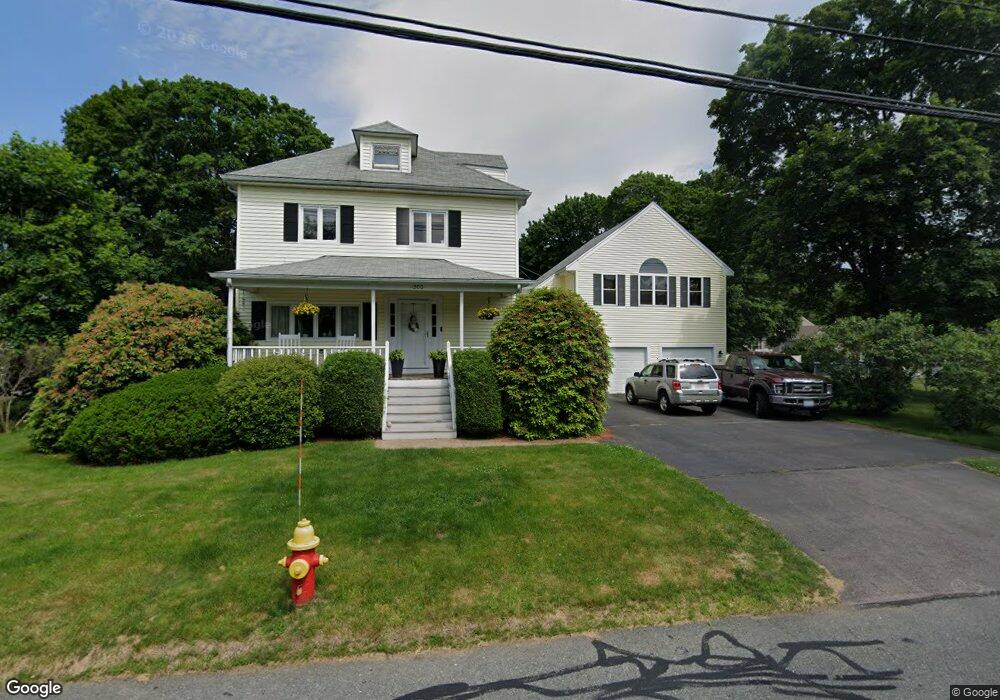
200 Branch St Mansfield, MA 02048
Estimated Value: $738,274 - $913,000
3
Beds
3
Baths
2,793
Sq Ft
$295/Sq Ft
Est. Value
About This Home
This home is located at 200 Branch St, Mansfield, MA 02048 and is currently estimated at $824,569, approximately $295 per square foot. 200 Branch St is a home located in Bristol County with nearby schools including Everett W. Robinson Elementary School, Jordan/Jackson Elementary School, and Harold L. Qualters Middle School.
Ownership History
Date
Name
Owned For
Owner Type
Purchase Details
Closed on
Oct 21, 1999
Sold by
Tully Bernard J and Tully Paula D
Bought by
Tegnell Johan I and Tegnell Annika E
Current Estimated Value
Purchase Details
Closed on
Sep 30, 1992
Sold by
Ferrara James A and Ferrara Heather B
Bought by
Tully Bernard J and Tully Paula D
Create a Home Valuation Report for This Property
The Home Valuation Report is an in-depth analysis detailing your home's value as well as a comparison with similar homes in the area
Home Values in the Area
Average Home Value in this Area
Purchase History
| Date | Buyer | Sale Price | Title Company |
|---|---|---|---|
| Tegnell Johan I | $212,000 | -- | |
| Tully Bernard J | $155,000 | -- |
Source: Public Records
Mortgage History
| Date | Status | Borrower | Loan Amount |
|---|---|---|---|
| Open | Tully Bernard J | $175,000 | |
| Closed | Tully Bernard J | $190,250 |
Source: Public Records
Tax History
| Year | Tax Paid | Tax Assessment Tax Assessment Total Assessment is a certain percentage of the fair market value that is determined by local assessors to be the total taxable value of land and additions on the property. | Land | Improvement |
|---|---|---|---|---|
| 2025 | $8,621 | $654,600 | $253,800 | $400,800 |
| 2024 | $8,678 | $642,800 | $253,800 | $389,000 |
| 2023 | $8,289 | $588,300 | $253,800 | $334,500 |
| 2022 | $8,204 | $540,800 | $235,100 | $305,700 |
| 2021 | $4,819 | $500,400 | $205,700 | $294,700 |
| 2020 | $4,445 | $451,600 | $195,900 | $255,700 |
| 2019 | $6,890 | $452,700 | $163,200 | $289,500 |
| 2018 | $2,372 | $432,300 | $155,800 | $276,500 |
| 2017 | $6,350 | $422,800 | $151,500 | $271,300 |
| 2016 | $5,961 | $386,800 | $144,000 | $242,800 |
| 2015 | $5,673 | $366,000 | $144,000 | $222,000 |
Source: Public Records
Map
Nearby Homes
- 97 East St
- 7 Fieldstone Dr
- 1 Deer Path Ln
- 2 N Main St Unit B201
- 46 Hope St
- 28 Court St
- 122 Samoset Ave
- 107 Church St
- 14 Windchime Dr
- 22 Pleasant St Unit B
- 25 Kingman Ave
- 631 East St Unit L101
- 166 Chauncy St
- 28 Angell St
- 7 Liberty St
- 619 N Main St
- 19 Barberry Rd
- 212 Mill St
- 16 Holly Rd
- 4 Erick Rd Unit 90
Your Personal Tour Guide
Ask me questions while you tour the home.