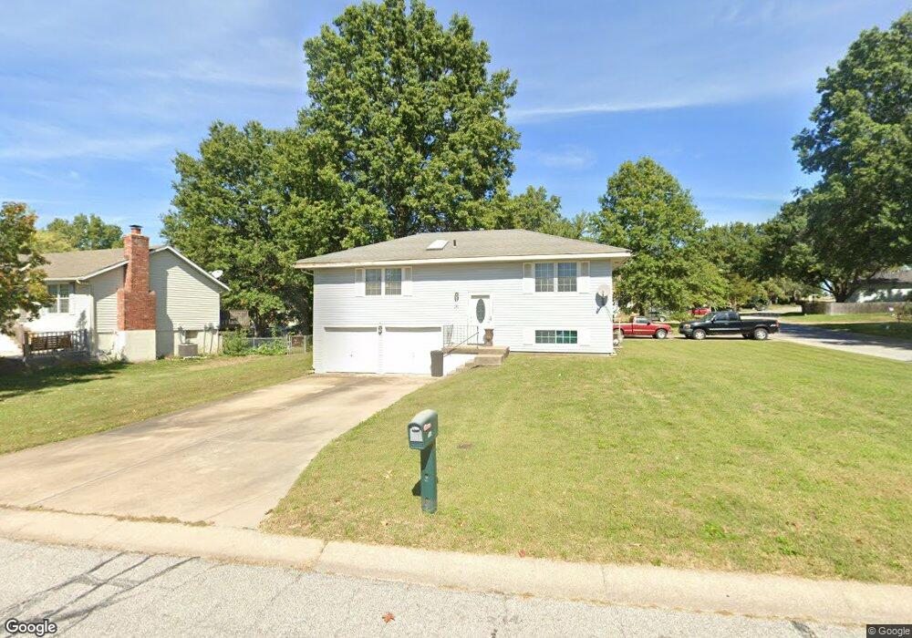
200 Brent Rd Belton, MO 64012
Estimated Value: $212,000 - $249,000
3
Beds
2
Baths
960
Sq Ft
$237/Sq Ft
Est. Value
About This Home
This home is located at 200 Brent Rd, Belton, MO 64012 and is currently estimated at $227,394, approximately $236 per square foot. 200 Brent Rd is a home located in Cass County with nearby schools including Cambridge Elementary School, Belton Middle School, and Mill Creek Upper Elementary School.
Ownership History
Date
Name
Owned For
Owner Type
Purchase Details
Closed on
Apr 21, 2006
Sold by
Davidson Randall C
Bought by
Richardson Mark A
Current Estimated Value
Home Financials for this Owner
Home Financials are based on the most recent Mortgage that was taken out on this home.
Original Mortgage
$129,500
Outstanding Balance
$73,464
Interest Rate
6.33%
Mortgage Type
New Conventional
Estimated Equity
$153,930
Create a Home Valuation Report for This Property
The Home Valuation Report is an in-depth analysis detailing your home's value as well as a comparison with similar homes in the area
Home Values in the Area
Average Home Value in this Area
Purchase History
| Date | Buyer | Sale Price | Title Company |
|---|---|---|---|
| Richardson Mark A | -- | -- |
Source: Public Records
Mortgage History
| Date | Status | Borrower | Loan Amount |
|---|---|---|---|
| Open | Richardson Mark A | $129,500 |
Source: Public Records
Tax History
| Year | Tax Paid | Tax Assessment Tax Assessment Total Assessment is a certain percentage of the fair market value that is determined by local assessors to be the total taxable value of land and additions on the property. | Land | Improvement |
|---|---|---|---|---|
| 2025 | $2,069 | $28,580 | $2,590 | $25,990 |
| 2024 | $2,069 | $25,100 | $2,360 | $22,740 |
| 2023 | $2,064 | $25,100 | $2,360 | $22,740 |
| 2022 | $1,840 | $22,170 | $2,360 | $19,810 |
| 2021 | $1,840 | $22,170 | $2,360 | $19,810 |
| 2020 | $1,813 | $21,720 | $2,360 | $19,360 |
| 2019 | $1,775 | $21,720 | $2,360 | $19,360 |
| 2018 | $1,579 | $19,480 | $1,890 | $17,590 |
| 2017 | $1,343 | $19,480 | $1,890 | $17,590 |
| 2016 | $1,343 | $16,480 | $1,890 | $14,590 |
| 2015 | $1,343 | $16,480 | $1,890 | $14,590 |
| 2014 | $1,348 | $16,480 | $1,890 | $14,590 |
| 2013 | -- | $16,480 | $1,890 | $14,590 |
Source: Public Records
Map
Nearby Homes
- 1112 S Scott Ave
- 212 W Cambridge Rd
- 200 Eldorado Dr
- 402 Park Ave
- 702 Park Cir
- 117 Melody Ln
- 206 Brookview Dr
- 402 Prairie Ln
- 703 York Dr
- 602 S Cedar St
- 000 Miller Dr
- 206-216 E South Ave
- 409 Robie Dr
- 215 W Walnut St
- 709 Hollis Ave
- 730 E Cambridge Rd
- 507 3 St
- TBD S State Route D Hwy
- 118 Mill St
- 18607 S Askew Ave
Your Personal Tour Guide
Ask me questions while you tour the home.