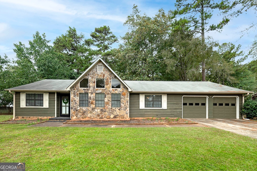
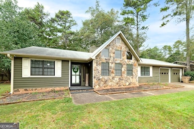
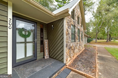
200 Cowan Dr Stockbridge, GA 30281
Estimated payment $1,667/month
Highlights
- No Units Above
- Partially Wooded Lot
- Sun or Florida Room
- Ranch Style House
- Wood Flooring
- High Ceiling
About This Home
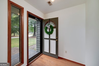
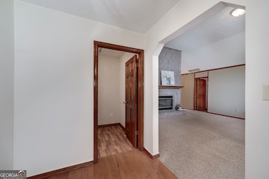
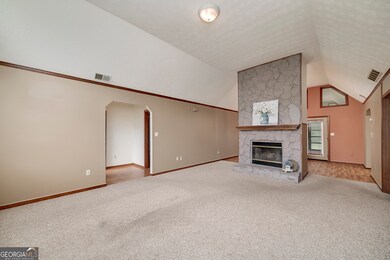
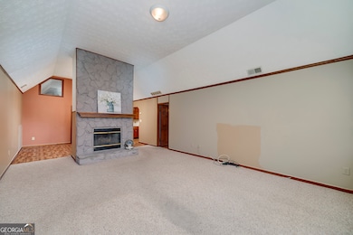
Welcome home to this spacious 3-bedroom, 2-bath ranch in a quiet, established neighborhood! This desirable roommate floor plan offers privacy with generously sized bedrooms, a formal dining room, and a cozy fireplace in the living area. Enjoy year-round comfort in the 14x15 sunroom and take advantage of the versatile mudroom/office space. The home also features a 2-car garage plus an additional storage shed in the fenced backyard-perfect for pets, hobbies, or outdoor entertaining. With its combination of space, functionality, and charm, this property is a must-see!
Home Details
Home Type
- Single Family
Est. Annual Taxes
- $4,192
Year Built
- Built in 1988
Lot Details
- 0.25 Acre Lot
- No Common Walls
- No Units Located Below
- Back Yard Fenced
- Level Lot
- Partially Wooded Lot
- Grass Covered Lot
Home Design
- Ranch Style House
- Block Foundation
- Composition Roof
- Wood Siding
- Press Board Siding
Interior Spaces
- 1,725 Sq Ft Home
- Roommate Plan
- High Ceiling
- Factory Built Fireplace
- Fireplace With Gas Starter
- Bay Window
- Mud Room
- Family Room
- Living Room with Fireplace
- Combination Dining and Living Room
- Sun or Florida Room
- Pull Down Stairs to Attic
- Fire and Smoke Detector
Kitchen
- Breakfast Area or Nook
- Oven or Range
- Dishwasher
Flooring
- Wood
- Carpet
- Laminate
Bedrooms and Bathrooms
- 3 Main Level Bedrooms
- Split Bedroom Floorplan
- Walk-In Closet
- 2 Full Bathrooms
Laundry
- Laundry Room
- Laundry in Kitchen
- Washer
Parking
- 2 Car Garage
- Parking Pad
- Parking Accessed On Kitchen Level
- Garage Door Opener
Outdoor Features
- Patio
- Outbuilding
Schools
- Cotton Indian Elementary School
- Stockbridge Middle School
- Stockbridge High School
Utilities
- Cooling Available
- Forced Air Heating System
- Heating System Uses Natural Gas
- Gas Water Heater
- Septic Tank
- High Speed Internet
- Cable TV Available
Community Details
- No Home Owners Association
- Brookwood Estates Subdivision
Listing and Financial Details
- Legal Lot and Block 7 / C
Map
Home Values in the Area
Average Home Value in this Area
Tax History
| Year | Tax Paid | Tax Assessment Tax Assessment Total Assessment is a certain percentage of the fair market value that is determined by local assessors to be the total taxable value of land and additions on the property. | Land | Improvement |
|---|---|---|---|---|
| 2025 | $746 | $115,832 | $14,000 | $101,832 |
| 2024 | $746 | $102,240 | $14,000 | $88,240 |
| 2023 | $488 | $109,280 | $10,000 | $99,280 |
| 2022 | $633 | $82,280 | $10,000 | $72,280 |
| 2021 | $633 | $67,760 | $10,000 | $57,760 |
| 2020 | $633 | $62,520 | $8,000 | $54,520 |
| 2019 | $633 | $58,880 | $8,000 | $50,880 |
| 2018 | $561 | $54,840 | $8,000 | $46,840 |
| 2016 | $541 | $49,040 | $8,000 | $41,040 |
| 2015 | $486 | $43,120 | $6,000 | $37,120 |
| 2014 | $449 | $40,080 | $4,800 | $35,280 |
Property History
| Date | Event | Price | List to Sale | Price per Sq Ft |
|---|---|---|---|---|
| 10/28/2025 10/28/25 | Pending | -- | -- | -- |
| 10/27/2025 10/27/25 | Price Changed | $250,000 | -5.7% | $145 / Sq Ft |
| 10/15/2025 10/15/25 | Price Changed | $265,000 | -3.6% | $154 / Sq Ft |
| 10/10/2025 10/10/25 | For Sale | $275,000 | -- | $159 / Sq Ft |
Purchase History
| Date | Type | Sale Price | Title Company |
|---|---|---|---|
| Warranty Deed | $163,000 | -- | |
| Deed | $125,900 | -- |
Mortgage History
| Date | Status | Loan Amount | Loan Type |
|---|---|---|---|
| Previous Owner | $113,310 | New Conventional |
Source: Georgia MLS
MLS Number: 10622632
APN: 067A-01-095-000
Disclaimer: Certain information contained herein is derived from information provided by parties other than Homes.com. All information provided is deemed reliable, but is not guaranteed to be accurate and should be independently verified.
![]() The data relating to real estate for sale on this web site comes in part from the Broker Reciprocity Program of Georgia MLS. Real estate listings held by brokerage firms other than Redfin are marked with the Broker Reciprocity logo and detailed information about them includes the name of the listing brokers. Information deemed reliable but not guaranteed. Copyright 2025 Georgia MLS. All rights reserved.
The data relating to real estate for sale on this web site comes in part from the Broker Reciprocity Program of Georgia MLS. Real estate listings held by brokerage firms other than Redfin are marked with the Broker Reciprocity logo and detailed information about them includes the name of the listing brokers. Information deemed reliable but not guaranteed. Copyright 2025 Georgia MLS. All rights reserved.
- 180 Cowan Dr
- 364 Sound Cir
- 0 Old Conyers Rd Unit 10574658
- 159 Brookwood Estates Trail
- 125 Johnsons Walk Unit 2
- 120 Montgomery Dr
- 104 Montgomery Dr
- 1527 Old Conyers Rd Unit 4
- 0 N Highway 42 Unit 10627424
- 0 Highway 155 N Unit 7649185
- 278 Sound Cir
- 2581 Union Church Rd SW
- 286 Sound Cir
- 65 Wynfield Dr
- 242 Summerford Place
- 0 W Hemphill Rd Unit 10295429
- 0 W Hemphill Rd Unit 10536232
- 95 Fern Ct
