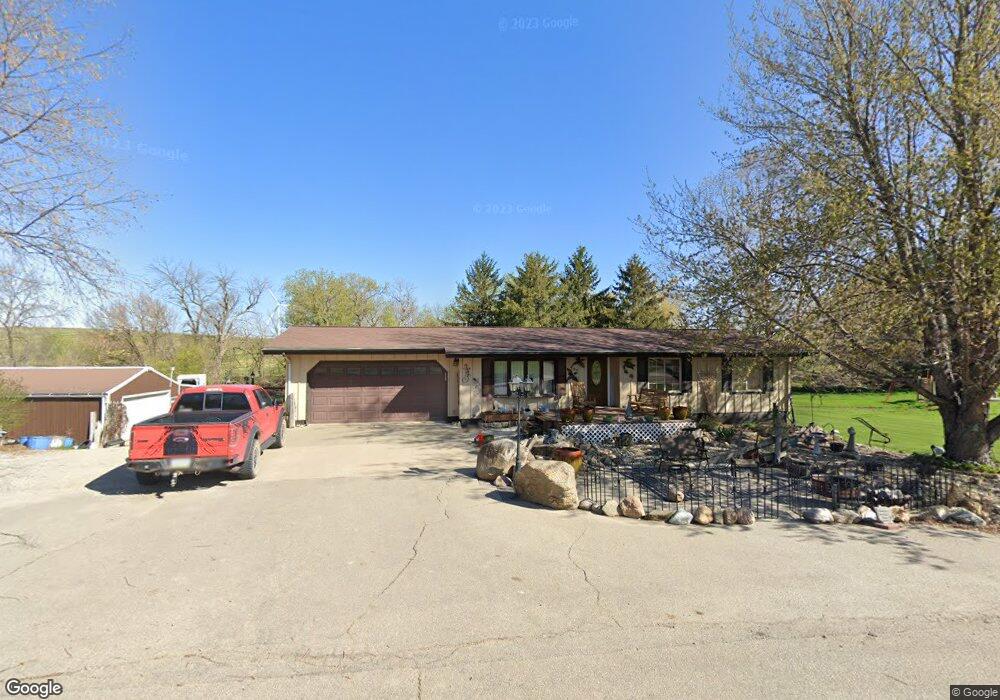
200 Jennys Ln Laurel, IA 50141
Estimated Value: $131,000 - $202,687
--
Bed
--
Bath
1,092
Sq Ft
$156/Sq Ft
Est. Value
About This Home
This home is located at 200 Jennys Ln, Laurel, IA 50141 and is currently estimated at $170,172, approximately $155 per square foot. 200 Jennys Ln is a home located in Marshall County with nearby schools including East Marshall Elementary School, East Marshall Middle School, and East Marshall Senior High School.
Ownership History
Date
Name
Owned For
Owner Type
Purchase Details
Closed on
Dec 2, 2021
Sold by
Medhus Martin O
Bought by
Medhus Martin O
Current Estimated Value
Home Financials for this Owner
Home Financials are based on the most recent Mortgage that was taken out on this home.
Original Mortgage
$137,600
Outstanding Balance
$126,261
Interest Rate
3.09%
Mortgage Type
New Conventional
Estimated Equity
$43,911
Purchase Details
Closed on
Feb 24, 2014
Sold by
Frese Chad Richard
Bought by
Frese Michelle M and Sawyer Michelle Marie Arney
Create a Home Valuation Report for This Property
The Home Valuation Report is an in-depth analysis detailing your home's value as well as a comparison with similar homes in the area
Home Values in the Area
Average Home Value in this Area
Purchase History
| Date | Buyer | Sale Price | Title Company |
|---|---|---|---|
| Medhus Martin O | -- | None Available | |
| Frese Michelle M | -- | None Available |
Source: Public Records
Mortgage History
| Date | Status | Borrower | Loan Amount |
|---|---|---|---|
| Open | Medhus Martin O | $137,600 |
Source: Public Records
Tax History Compared to Growth
Tax History
| Year | Tax Paid | Tax Assessment Tax Assessment Total Assessment is a certain percentage of the fair market value that is determined by local assessors to be the total taxable value of land and additions on the property. | Land | Improvement |
|---|---|---|---|---|
| 2025 | $1,502 | $195,510 | $7,380 | $188,130 |
| 2024 | $1,502 | $149,470 | $7,380 | $142,090 |
| 2023 | $2,156 | $149,470 | $7,380 | $142,090 |
| 2022 | $2,216 | $146,920 | $7,380 | $139,540 |
| 2021 | $2,054 | $146,920 | $7,380 | $139,540 |
| 2020 | $2,203 | $130,470 | $7,380 | $123,090 |
Source: Public Records
Map
Nearby Homes
- 106 E Church St
- 2739 310th St
- 180 Railway St
- 2658 H Reed Ave
- 0 Knapp Ave
- 210 E Church St
- 7824 & 7812 N 67th Ave E
- 3003 Lincoln Hwy
- 2581 Dillon Rd
- 214 2nd Street Dunbar
- 3311 Governor Rd
- 3002 S 8th St
- 2910 S 2nd St
- 906 Prairie Ln
- 836 W Merle Hibbs Blvd
- 802 Woodside Dr
- 2626 Knollway Dr
- 2622 Knollway Dr
- 2606 Knollway Dr
- 801 Woodside Dr