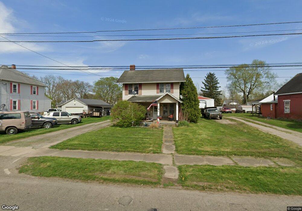
200 S 6th St Newark, OH 43055
Estimated Value: $120,000 - $174,000
3
Beds
1
Bath
1,260
Sq Ft
$110/Sq Ft
Est. Value
About This Home
This home is located at 200 S 6th St, Newark, OH 43055 and is currently estimated at $138,779, approximately $110 per square foot. 200 S 6th St is a home located in Licking County with nearby schools including Ben Franklin Elementary School, Heritage Middle School, and Newark High School.
Ownership History
Date
Name
Owned For
Owner Type
Purchase Details
Closed on
Jun 9, 2023
Sold by
Bolen Charles E and Bolen Barbara J
Bought by
Bolen Charles E and Bolen Sarah
Current Estimated Value
Purchase Details
Closed on
Jun 27, 1994
Sold by
Richard Holly J
Bought by
Lawson Gordon R
Home Financials for this Owner
Home Financials are based on the most recent Mortgage that was taken out on this home.
Original Mortgage
$37,500
Interest Rate
7.75%
Mortgage Type
New Conventional
Create a Home Valuation Report for This Property
The Home Valuation Report is an in-depth analysis detailing your home's value as well as a comparison with similar homes in the area
Home Values in the Area
Average Home Value in this Area
Purchase History
| Date | Buyer | Sale Price | Title Company |
|---|---|---|---|
| Bolen Charles E | -- | None Listed On Document | |
| Lawson Gordon R | $46,900 | -- |
Source: Public Records
Mortgage History
| Date | Status | Borrower | Loan Amount |
|---|---|---|---|
| Previous Owner | Lawson Gordon R | $37,500 |
Source: Public Records
Tax History Compared to Growth
Tax History
| Year | Tax Paid | Tax Assessment Tax Assessment Total Assessment is a certain percentage of the fair market value that is determined by local assessors to be the total taxable value of land and additions on the property. | Land | Improvement |
|---|---|---|---|---|
| 2024 | $959 | $26,750 | $4,100 | $22,650 |
| 2023 | $1,030 | $26,750 | $4,100 | $22,650 |
| 2022 | $917 | $22,370 | $3,190 | $19,180 |
| 2021 | $962 | $22,370 | $3,190 | $19,180 |
| 2020 | $984 | $22,370 | $3,190 | $19,180 |
| 2019 | $835 | $18,280 | $2,280 | $16,000 |
| 2018 | $836 | $0 | $0 | $0 |
| 2017 | $1,040 | $0 | $0 | $0 |
| 2016 | $851 | $0 | $0 | $0 |
| 2015 | $1,280 | $0 | $0 | $0 |
| 2014 | $802 | $0 | $0 | $0 |
| 2013 | $6,116 | $0 | $0 | $0 |
Source: Public Records
Map
Nearby Homes
- 315 Wehrle Ave
- 45 S 5th St
- 33 S 6th St
- 92 S 3rd St
- 233 Wilson St
- 210-212 Isabelle Rd
- 206-208 Isabelle Rd
- 116 S 1st St
- 507 Beacon Rd
- 105 Fleek Ave
- 158 Isabelle Rd
- 150/152 Isabelle Rd
- 332 W Main St
- 336 W Main St Unit 334
- 112 S 1st St
- 346 W Main St
- 265 W Church St
- 389 Kells Ct E
- 360 W Main St
- 362 W Main St