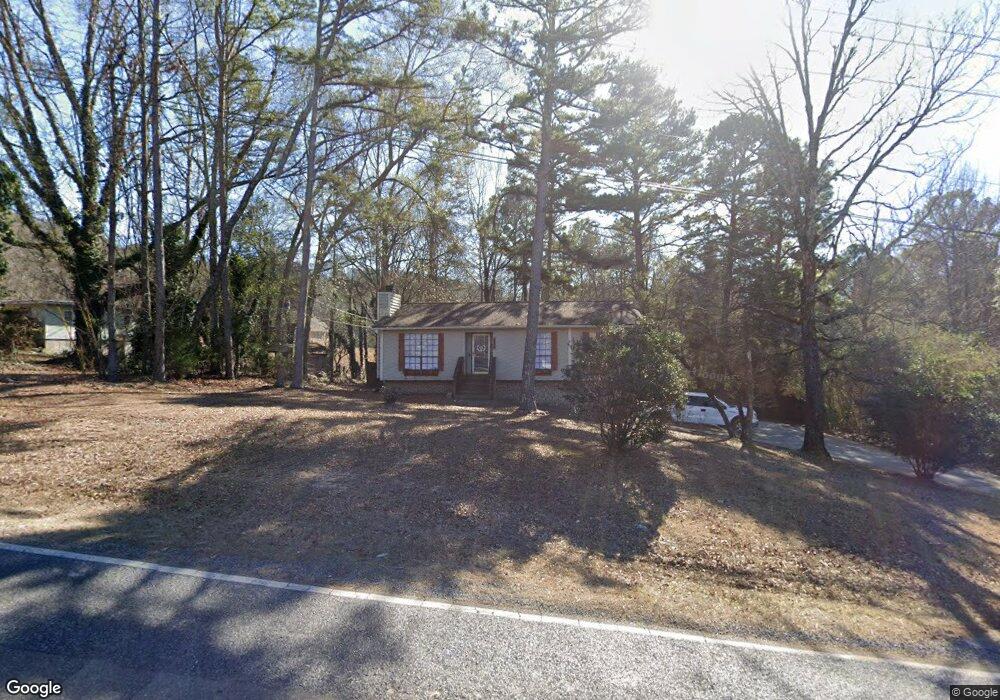
2000 1st Ave W Maylene, AL 35114
Estimated Value: $265,000 - $269,000
Studio
1
Bath
1,597
Sq Ft
$167/Sq Ft
Est. Value
About This Home
This home is located at 2000 1st Ave W, Maylene, AL 35114 and is currently estimated at $266,897, approximately $167 per square foot. 2000 1st Ave W is a home located in Shelby County with nearby schools including Thompson Intermediate School, Thompson Middle School, and Thompson High School.
Ownership History
Date
Name
Owned For
Owner Type
Purchase Details
Closed on
Sep 30, 2022
Sold by
Boothe Robert James and Boothe Anne
Bought by
Phillips Seth
Current Estimated Value
Home Financials for this Owner
Home Financials are based on the most recent Mortgage that was taken out on this home.
Original Mortgage
$211,000
Outstanding Balance
$202,494
Interest Rate
5.66%
Mortgage Type
Balloon
Estimated Equity
$64,403
Purchase Details
Closed on
Nov 27, 2006
Sold by
Burns Jesse P and Burns Maxine Y
Bought by
Boothe Robert James and Boothe Rebecca Anne
Home Financials for this Owner
Home Financials are based on the most recent Mortgage that was taken out on this home.
Original Mortgage
$131,289
Interest Rate
6.33%
Mortgage Type
FHA
Purchase Details
Closed on
Mar 7, 2003
Sold by
Burns Jesse P and Burns Maxine Y
Bought by
Burns Jesse P and Burns Maxine Y
Home Financials for this Owner
Home Financials are based on the most recent Mortgage that was taken out on this home.
Original Mortgage
$112,500
Interest Rate
5.86%
Purchase Details
Closed on
Jan 4, 2001
Sold by
Burns Jesse P and Burns Eunice F
Bought by
Burns Jesse P
Home Financials for this Owner
Home Financials are based on the most recent Mortgage that was taken out on this home.
Original Mortgage
$104,500
Interest Rate
6.85%
Create a Home Valuation Report for This Property
The Home Valuation Report is an in-depth analysis detailing your home's value as well as a comparison with similar homes in the area
Home Values in the Area
Average Home Value in this Area
Purchase History
| Date | Buyer | Sale Price | Title Company |
|---|---|---|---|
| Phillips Seth | $249,000 | -- | |
| Boothe Robert James | $133,350 | None Available | |
| Burns Jesse P | $500 | -- | |
| Burns Jesse P | $500 | -- |
Source: Public Records
Mortgage History
| Date | Status | Borrower | Loan Amount |
|---|---|---|---|
| Open | Phillips Seth | $211,000 | |
| Previous Owner | Boothe Robert James | $131,289 | |
| Previous Owner | Burns Jesse P | $112,500 | |
| Previous Owner | Burns Jesse P | $104,500 |
Source: Public Records
Tax History
| Year | Tax Paid | Tax Assessment Tax Assessment Total Assessment is a certain percentage of the fair market value that is determined by local assessors to be the total taxable value of land and additions on the property. | Land | Improvement |
|---|---|---|---|---|
| 2024 | $1,128 | $20,880 | $0 | $0 |
| 2023 | $1,049 | $19,420 | $0 | $0 |
| 2022 | $935 | $18,080 | $0 | $0 |
| 2021 | $829 | $16,120 | $0 | $0 |
| 2020 | $723 | $14,140 | $0 | $0 |
| 2019 | $696 | $13,640 | $0 | $0 |
| 2017 | $656 | $12,900 | $0 | $0 |
| 2015 | $632 | $12,460 | $0 | $0 |
| 2014 | $617 | $12,180 | $0 | $0 |
Source: Public Records
Map
Nearby Homes
- 2001 1st Ave W
- 1805 Mohawk Dr
- 1807 Apache Way
- 445 Ramsgate Dr
- 542 Navajo Trail
- 1349 Old Boston Rd
- 120 Mayfair Park
- 1317 Old Boston Rd
- 306 Mayfair Cir
- 1307 3rd Ave SW
- 1317 W Navajo Dr
- 537 Ramsgate Dr
- 312 Cornwall Dr
- 208 Queens Gate
- 236 Queens Gate
- 501 Ramsgate Dr
- 309 Cedar Grove Ct
- 834 Burning Tree Trail
- 544 Ramsgate Dr
- 305 Cedar Grove Ct
Your Personal Tour Guide
Ask me questions while you tour the home.