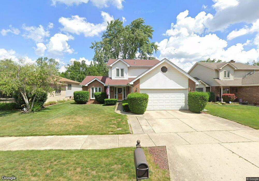
2000 Birchwood Ave Des Plaines, IL 60018
Estimated Value: $451,000 - $512,000
3
Beds
3
Baths
2,119
Sq Ft
$227/Sq Ft
Est. Value
About This Home
This home is located at 2000 Birchwood Ave, Des Plaines, IL 60018 and is currently estimated at $482,063, approximately $227 per square foot. 2000 Birchwood Ave is a home located in Cook County with nearby schools including South Elementary School, Algonquin Middle School, and Maine West High School.
Ownership History
Date
Name
Owned For
Owner Type
Purchase Details
Closed on
Jul 31, 2003
Sold by
Perez George and Perez Mariola
Bought by
Touff Peter and Horwitz Dyla
Current Estimated Value
Home Financials for this Owner
Home Financials are based on the most recent Mortgage that was taken out on this home.
Original Mortgage
$188,000
Outstanding Balance
$80,916
Interest Rate
5.31%
Mortgage Type
Unknown
Estimated Equity
$401,147
Purchase Details
Closed on
Jun 27, 1997
Sold by
Hardiman Baldi Joseph A
Bought by
Perez George and Perez Mariola
Home Financials for this Owner
Home Financials are based on the most recent Mortgage that was taken out on this home.
Original Mortgage
$153,375
Interest Rate
8%
Mortgage Type
FHA
Purchase Details
Closed on
Dec 26, 1996
Sold by
Hardiman Michael W
Bought by
Hardiman Michael W and Hardiman Pamela M
Create a Home Valuation Report for This Property
The Home Valuation Report is an in-depth analysis detailing your home's value as well as a comparison with similar homes in the area
Home Values in the Area
Average Home Value in this Area
Purchase History
| Date | Buyer | Sale Price | Title Company |
|---|---|---|---|
| Touff Peter | $317,000 | -- | |
| Perez George | $190,000 | -- | |
| Hardiman Michael W | -- | -- |
Source: Public Records
Mortgage History
| Date | Status | Borrower | Loan Amount |
|---|---|---|---|
| Open | Touff Peter | $188,000 | |
| Previous Owner | Perez George | $153,375 |
Source: Public Records
Tax History Compared to Growth
Tax History
| Year | Tax Paid | Tax Assessment Tax Assessment Total Assessment is a certain percentage of the fair market value that is determined by local assessors to be the total taxable value of land and additions on the property. | Land | Improvement |
|---|---|---|---|---|
| 2024 | $7,499 | $31,759 | $5,208 | $26,551 |
| 2023 | $7,292 | $31,759 | $5,208 | $26,551 |
| 2022 | $7,292 | $31,759 | $5,208 | $26,551 |
| 2021 | $6,318 | $23,884 | $4,340 | $19,544 |
| 2020 | $6,280 | $23,884 | $4,340 | $19,544 |
| 2019 | $6,299 | $26,837 | $4,340 | $22,497 |
| 2018 | $7,632 | $28,954 | $3,819 | $25,135 |
| 2017 | $7,515 | $28,954 | $3,819 | $25,135 |
| 2016 | $7,352 | $28,954 | $3,819 | $25,135 |
| 2015 | $6,529 | $24,219 | $3,298 | $20,921 |
| 2014 | $6,407 | $24,219 | $3,298 | $20,921 |
| 2013 | $6,230 | $24,219 | $3,298 | $20,921 |
Source: Public Records
Map
Nearby Homes
- 1928 Kennicott Ct
- 38 E Touhy Ave
- 1706 Buckingham Dr
- 1640 S River Rd
- 2500 Maple St
- 1966 Laura Ln
- 1721 Linden St
- 1641 E Touhy Ave
- 1629 E Touhy Ave
- 2609 Eisenhower Dr
- 2126 David Dr
- 22 Park Ln Unit 203
- 44 Park Ln Unit 435
- 2646 Maple St
- 1724 Illinois St
- 2017 Pine St Unit B
- 300 Boardwalk Place Unit T300
- 1689 S Elm St
- 1696 S Elm St
- 1757 Farwell Ave
- 1990 Birchwood Ave
- 2010 Birchwood Ave
- 1980 Birchwood Ave
- 2020 Birchwood Ave
- 2004 Welwyn Ave
- 1970 Birchwood Ave
- 1992 Welwyn Ave
- 2012 Welwyn Ave
- 1984 Welwyn Ave
- 2024 Welwyn Ave
- 2063 Cedar St
- 1972 Welwyn Ave
- 2032 Welwyn Ave
- 2083 Cedar St
- 2093 Cedar St
- 2064 S River Rd
- 1964 Welwyn Ave
- 2073 Cedar St
- 2040 Welwyn Ave
- 2030 Birchwood Ave