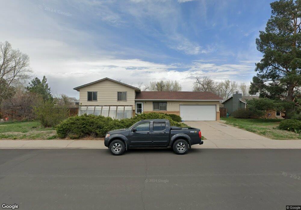
2000 Langshire Dr Fort Collins, CO 80526
Brown Farm NeighborhoodEstimated Value: $500,000 - $558,000
3
Beds
1
Bath
1,552
Sq Ft
$336/Sq Ft
Est. Value
About This Home
This home is located at 2000 Langshire Dr, Fort Collins, CO 80526 and is currently estimated at $520,866, approximately $335 per square foot. 2000 Langshire Dr is a home located in Larimer County with nearby schools including Bauder Elementary School, Blevins Middle School, and Rocky Mountain High School.
Ownership History
Date
Name
Owned For
Owner Type
Purchase Details
Closed on
Jan 20, 2005
Sold by
Webb Stephen E and Webb Janice R
Bought by
The Stephen & Janice Webb Revocable Tr
Current Estimated Value
Purchase Details
Closed on
Dec 1, 1993
Sold by
Sarver Pauline Louise
Bought by
Webb Janice R
Purchase Details
Closed on
Jun 1, 1992
Sold by
Anderson David J By Aif
Bought by
Sarver Pauline Louise
Create a Home Valuation Report for This Property
The Home Valuation Report is an in-depth analysis detailing your home's value as well as a comparison with similar homes in the area
Home Values in the Area
Average Home Value in this Area
Purchase History
| Date | Buyer | Sale Price | Title Company |
|---|---|---|---|
| The Stephen & Janice Webb Revocable Tr | -- | -- | |
| Webb Janice R | $100,000 | -- | |
| Sarver Pauline Louise | $86,000 | -- |
Source: Public Records
Tax History Compared to Growth
Tax History
| Year | Tax Paid | Tax Assessment Tax Assessment Total Assessment is a certain percentage of the fair market value that is determined by local assessors to be the total taxable value of land and additions on the property. | Land | Improvement |
|---|---|---|---|---|
| 2025 | $3,013 | $35,088 | $2,680 | $32,408 |
| 2024 | $2,867 | $35,088 | $2,680 | $32,408 |
| 2022 | $2,420 | $25,632 | $2,780 | $22,852 |
| 2021 | $2,446 | $26,369 | $2,860 | $23,509 |
| 2020 | $2,308 | $24,668 | $2,860 | $21,808 |
| 2019 | $2,318 | $24,668 | $2,860 | $21,808 |
| 2018 | $2,015 | $22,104 | $2,880 | $19,224 |
| 2017 | $2,008 | $22,104 | $2,880 | $19,224 |
| 2016 | $1,660 | $18,181 | $3,184 | $14,997 |
| 2015 | $1,648 | $18,180 | $3,180 | $15,000 |
| 2014 | $1,452 | $15,920 | $3,180 | $12,740 |
Source: Public Records
Map
Nearby Homes
- 2929 Ross Dr Unit P46
- 2930 W Stuart St Unit 24
- 2925 W Stuart St Unit 11
- 2960 W Stuart St Unit A304
- 3005 Ross Dr Unit W35
- 3005 Ross Dr Unit T5
- 3005 Ross Dr Unit T6
- 1943 Pecan St
- 2449 W Stuart St
- 1800 Rutledge Ct
- 1720 Azalea Ct
- 1615 Cedarwood Dr
- 1730 Palm Dr Unit 4
- 1736 Palm Dr Unit 3
- 3009 Knolls End Dr Unit 5
- 2167 Romney Ave
- 3219 Sumac St Unit 1
- 1507 Knotwood Ct
- 3200 Azalea Dr Unit 3
- 3200 Azalea Dr Unit M1
- 2006 Langshire Dr
- 101 Lot 101 Cushmans Lak
- 2000 White Rock Ct
- 2012 Langshire Dr
- 2001 White Rock Ct
- 2007 Langshire Dr
- 1924 Langshire Dr Unit D
- 1924 Langshire Dr Unit C
- 1924 Langshire Dr Unit B
- 1924 Langshire Dr Unit A
- 1924 Langshire Dr
- 2018 Langshire Dr
- 2013 Langshire Dr
- 2007 White Rock Ct
- 2012 White Rock Ct
- 1908 Langshire Dr
- 2019 Langshire Dr
- 1917 Langshire Dr Unit D
- 1917 Langshire Dr Unit C
- 1917 Langshire Dr Unit B