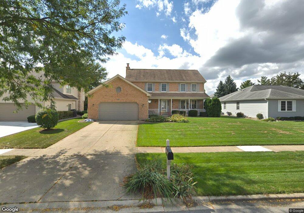
2001 Aspen Dr Algonquin, IL 60102
Estimated Value: $409,000 - $479,000
3
Beds
3
Baths
2,196
Sq Ft
$198/Sq Ft
Est. Value
About This Home
This home is located at 2001 Aspen Dr, Algonquin, IL 60102 and is currently estimated at $435,252, approximately $198 per square foot. 2001 Aspen Dr is a home located in McHenry County with nearby schools including Algonquin Lakes Elementary School, Algonquin Middle School, and Dundee-Crown High School.
Ownership History
Date
Name
Owned For
Owner Type
Purchase Details
Closed on
May 26, 2021
Sold by
Zimmerman Robin B and Zimmerman Melanie J
Bought by
Zimmerman Robin B and Zimmerman Melanie J
Current Estimated Value
Purchase Details
Closed on
Aug 15, 2007
Sold by
Klugiewicz Stanley M and Klugiewicz Carol L
Bought by
Zimmerman Robin B and Zimmerman Melanie J
Home Financials for this Owner
Home Financials are based on the most recent Mortgage that was taken out on this home.
Original Mortgage
$252,800
Outstanding Balance
$158,157
Interest Rate
6.79%
Mortgage Type
Purchase Money Mortgage
Estimated Equity
$277,095
Create a Home Valuation Report for This Property
The Home Valuation Report is an in-depth analysis detailing your home's value as well as a comparison with similar homes in the area
Purchase History
| Date | Buyer | Sale Price | Title Company |
|---|---|---|---|
| Zimmerman Robin B | -- | None Available | |
| Zimmerman Robin B | $316,000 | Pntn |
Source: Public Records
Mortgage History
| Date | Status | Borrower | Loan Amount |
|---|---|---|---|
| Open | Zimmerman Robin B | $252,800 |
Source: Public Records
Tax History
| Year | Tax Paid | Tax Assessment Tax Assessment Total Assessment is a certain percentage of the fair market value that is determined by local assessors to be the total taxable value of land and additions on the property. | Land | Improvement |
|---|---|---|---|---|
| 2024 | $8,681 | $126,978 | $27,082 | $99,896 |
| 2023 | $8,837 | $113,565 | $24,221 | $89,344 |
| 2022 | $7,473 | $93,142 | $20,766 | $72,376 |
| 2021 | $7,167 | $86,773 | $19,346 | $67,427 |
| 2020 | $6,977 | $83,701 | $18,661 | $65,040 |
| 2019 | $6,805 | $80,112 | $17,861 | $62,251 |
| 2018 | $7,497 | $84,652 | $16,912 | $67,740 |
| 2017 | $7,344 | $79,747 | $15,932 | $63,815 |
| 2016 | $7,235 | $74,796 | $14,943 | $59,853 |
| 2013 | -- | $68,787 | $13,939 | $54,848 |
Source: Public Records
Map
Nearby Homes
- 1321 Big Sur Pkwy
- 2 Cumberland Pkwy
- 1782 Cumberland Pkwy
- 1730 Tanglewood Dr
- 1906 Ozark Pkwy
- 1923 Ozark Pkwy
- 2027 Teton Pkwy
- 1625 Powder Horn Dr
- 1770 E Algonquin Rd
- Lot 4 b Ryan Pkwy
- 1511 Glacier Pkwy Unit 2
- 1031 Timberwood Ln
- 2150 E Algonquin Rd
- 1620 Glacier Pkwy
- 1670 Yosemite Pkwy
- 1188 E Algonquin Rd
- 953 Old Oak Cir
- 9 Echowood Dr
- 719 Webster St
- 1439 Lowe Dr
Your Personal Tour Guide
Ask me questions while you tour the home.