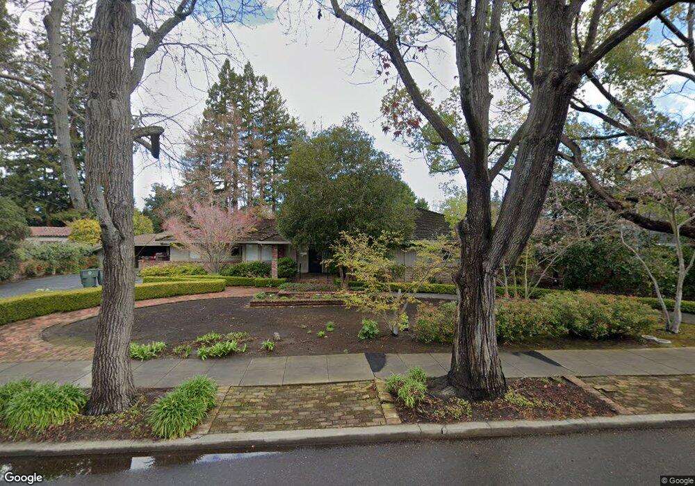
2001 Bryant St Palo Alto, CA 94301
Old Palo Alto NeighborhoodEstimated Value: $7,342,000 - $21,138,710
4
Beds
3
Baths
3,061
Sq Ft
$4,652/Sq Ft
Est. Value
About This Home
This home is located at 2001 Bryant St, Palo Alto, CA 94301 and is currently estimated at $14,240,355, approximately $4,652 per square foot. 2001 Bryant St is a home located in Santa Clara County with nearby schools including Walter Hays Elementary, Frank S. Greene Jr. Middle, and Palo Alto High School.
Ownership History
Date
Name
Owned For
Owner Type
Purchase Details
Closed on
Apr 25, 2018
Sold by
Clinch Elizabeth C and The Clinch Family Trust
Bought by
2001 Bryant St Llc
Current Estimated Value
Purchase Details
Closed on
Jan 18, 1995
Sold by
Clinch Nicholas B and Clinch Elizabeth C
Bought by
Clinch Nicholas B and Clinch Elizabeth C
Create a Home Valuation Report for This Property
The Home Valuation Report is an in-depth analysis detailing your home's value as well as a comparison with similar homes in the area
Home Values in the Area
Average Home Value in this Area
Purchase History
| Date | Buyer | Sale Price | Title Company |
|---|---|---|---|
| 2001 Bryant St Llc | $18,000,000 | Old Republic Title Co | |
| Clinch Nicholas B | -- | -- |
Source: Public Records
Tax History Compared to Growth
Tax History
| Year | Tax Paid | Tax Assessment Tax Assessment Total Assessment is a certain percentage of the fair market value that is determined by local assessors to be the total taxable value of land and additions on the property. | Land | Improvement |
|---|---|---|---|---|
| 2025 | $236,815 | $20,480,926 | $19,912,013 | $568,913 |
| 2024 | $236,815 | $20,079,340 | $19,521,582 | $557,758 |
| 2023 | $233,365 | $19,685,628 | $19,138,806 | $546,822 |
| 2022 | $230,735 | $19,299,636 | $18,763,536 | $536,100 |
| 2021 | $226,202 | $18,921,213 | $18,395,624 | $525,589 |
| 2020 | $221,407 | $18,727,200 | $18,207,000 | $520,200 |
| 2019 | $219,007 | $18,360,000 | $17,850,000 | $510,000 |
| 2018 | $5,586 | $401,756 | $190,108 | $211,648 |
| 2017 | $5,485 | $393,880 | $186,381 | $207,499 |
| 2016 | $5,335 | $386,158 | $182,727 | $203,431 |
| 2015 | $5,275 | $380,359 | $179,983 | $200,376 |
| 2014 | $5,084 | $372,909 | $176,458 | $196,451 |
Source: Public Records
Map
Nearby Homes
- 1932 Emerson St
- 444 Tennyson Ave
- 184 Tennyson Ave
- 1827 Cowper St
- 2399 South Ct
- 1730 Webster St
- 125 Lowell Ave
- 627 Tennyson Ave
- 2573 Park Blvd Unit U204
- 1555 Alma St
- 151 Colorado Ave
- 200 Sheridan Ave Unit 304
- 200 Sheridan Ave Unit 303
- 200 Sheridan Ave Unit 103
- 200 Sheridan Ave Unit 307
- 1630 Portola Ave
- 1711 Guinda St
- 2590 Webster St
- 410 Sheridan Ave Unit 446
- 148 Kingsley Ave
- 1991 Bryant St
- 2025 Bryant St
- 323 Santa Rita Ave
- 0 Bryant St
- 1975 Bryant St
- 333 Santa Rita Ave
- 301 Santa Rita Ave
- 345 Santa Rita Ave
- 2000 Bryant St
- 2030 Waverley St
- 2020 Bryant St
- 2020 Waverley St
- 1944 Waverley St
- 1955 Bryant St
- 355 Santa Rita Ave
- 1960 Bryant St
- 1952 Waverley St
- 272 Rinconada Ave
- 2050 Waverley St
- 2046 Bryant St