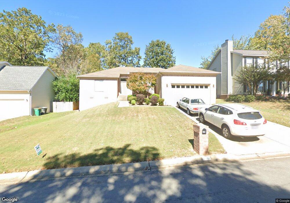
2001 Cherrybend Dr Little Rock, AR 72211
Western Little Rock NeighborhoodEstimated Value: $265,596 - $291,000
Studio
2
Baths
1,757
Sq Ft
$160/Sq Ft
Est. Value
About This Home
This home is located at 2001 Cherrybend Dr, Little Rock, AR 72211 and is currently estimated at $281,649, approximately $160 per square foot. 2001 Cherrybend Dr is a home located in Pulaski County with nearby schools including Terry Elementary School, Pinnacle View Middle School, and LISA Academy West Elementary School.
Ownership History
Date
Name
Owned For
Owner Type
Purchase Details
Closed on
Feb 9, 2000
Sold by
Conway Charnley
Bought by
Conway Catherine C
Current Estimated Value
Home Financials for this Owner
Home Financials are based on the most recent Mortgage that was taken out on this home.
Original Mortgage
$70,000
Outstanding Balance
$23,022
Interest Rate
8.09%
Mortgage Type
Purchase Money Mortgage
Estimated Equity
$258,627
Purchase Details
Closed on
May 21, 1999
Sold by
Winrock Development Company
Bought by
Conway Charnley
Home Financials for this Owner
Home Financials are based on the most recent Mortgage that was taken out on this home.
Original Mortgage
$108,000
Interest Rate
9%
Mortgage Type
Purchase Money Mortgage
Create a Home Valuation Report for This Property
The Home Valuation Report is an in-depth analysis detailing your home's value as well as a comparison with similar homes in the area
Home Values in the Area
Average Home Value in this Area
Purchase History
| Date | Buyer | Sale Price | Title Company |
|---|---|---|---|
| Conway Catherine C | $111,000 | Lenders Title Company | |
| Conway Charnley | $27,000 | -- |
Source: Public Records
Mortgage History
| Date | Status | Borrower | Loan Amount |
|---|---|---|---|
| Open | Conway Catherine C | $70,000 | |
| Closed | Conway Charnley | $108,000 |
Source: Public Records
Tax History
| Year | Tax Paid | Tax Assessment Tax Assessment Total Assessment is a certain percentage of the fair market value that is determined by local assessors to be the total taxable value of land and additions on the property. | Land | Improvement |
|---|---|---|---|---|
| 2025 | $2,202 | $44,981 | $5,800 | $39,181 |
| 2024 | $2,202 | $44,981 | $5,800 | $39,181 |
| 2023 | $2,202 | $44,981 | $5,800 | $39,181 |
| 2022 | $2,202 | $44,981 | $5,800 | $39,181 |
| 2021 | $2,218 | $35,240 | $7,200 | $28,040 |
| 2020 | $1,827 | $35,240 | $7,200 | $28,040 |
| 2019 | $1,827 | $35,240 | $7,200 | $28,040 |
| 2018 | $1,852 | $35,240 | $7,200 | $28,040 |
| 2017 | $1,852 | $35,240 | $7,200 | $28,040 |
| 2016 | $2,202 | $35,860 | $5,000 | $30,860 |
| 2015 | $2,205 | $31,459 | $5,000 | $26,459 |
| 2014 | $2,205 | $31,459 | $5,000 | $26,459 |
Source: Public Records
Map
Nearby Homes
- 1910 Cherrybend Dr
- 2623 Bowman Rd
- 12601 Misty Creek Dr
- 2101 Hickorynut Ct
- 1814 Calgary Trail
- 1408 S Bowman Rd
- 8 Wagon Wheel Ct
- 12408 Brodie Creek Trail
- 2905 Woodsgate Dr
- 3 Spur Cove
- 12425 Brodie Creek Trail
- 11 Westglen Cove
- 12825 Westglen Dr
- 1501 Calgary Cove
- 0000 Kanis Unit 13500
- 13512 Teton Dr
- 13418 Teton Dr
- 13422 Teton Dr
- 13502 Teton Dr
- 11500 Kanis Rd
- 1917 Cherrybend Dr
- 2003 Cherrybend Dr
- 12209 Cherryside Dr
- 12213 Cherryside Dr
- 1911 Cherrybend Dr
- 2007 Cherrybend Dr
- 2000 Cherrybend Dr
- 12205 Cherryside Dr
- 1918 Cherrybend Dr
- 12217 Cherryside Dr
- 2002 Cherrybend Dr
- 1907 Cherrybend Dr
- 1916 Cherrybend Dr
- 2006 Cherrybend Dr
- 2015 Cherrybend Dr
- 12201 Cherryside Dr
- 0 Cherryside Dr
- 1914 Cherrybend Dr
- 1901 Cherrybend Dr
- 1912 Cherrybend Dr
Your Personal Tour Guide
Ask me questions while you tour the home.