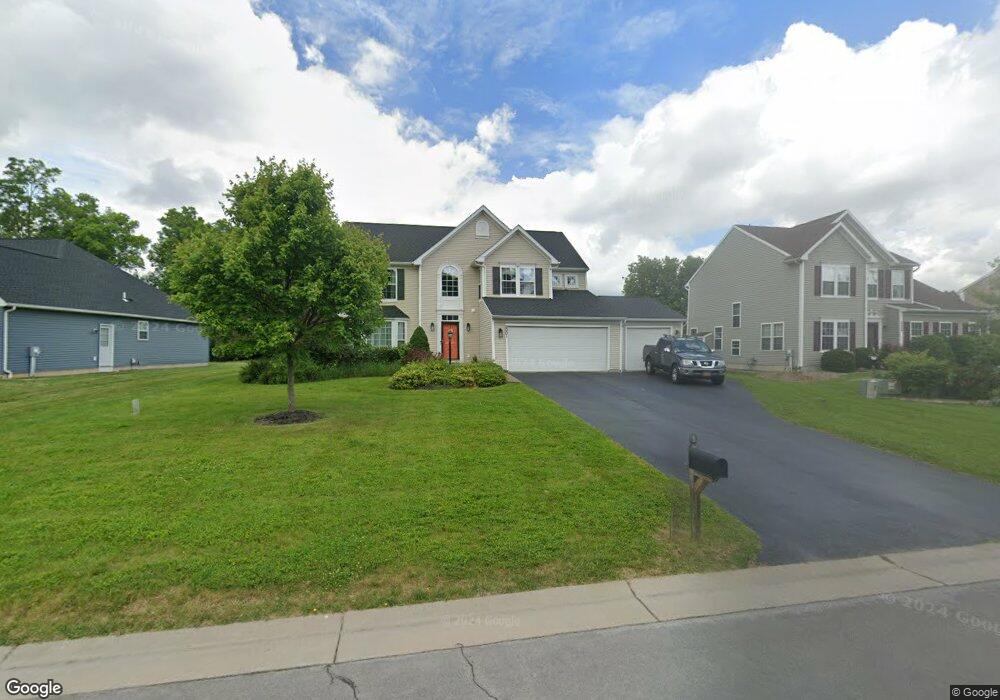
2001 Stablegate Dr Canandaigua, NY 14424
Estimated Value: $453,409 - $549,000
3
Beds
3
Baths
2,331
Sq Ft
$212/Sq Ft
Est. Value
About This Home
This home is located at 2001 Stablegate Dr, Canandaigua, NY 14424 and is currently estimated at $494,102, approximately $211 per square foot. 2001 Stablegate Dr is a home located in Ontario County with nearby schools including Canandaigua Primary-Elementary School, Canandaigua Middle School, and Canandaigua Academy.
Ownership History
Date
Name
Owned For
Owner Type
Purchase Details
Closed on
Jan 28, 2008
Sold by
Nvr Inc. D/B/A Ryan Homes Of New York
Bought by
Rox Patrick E
Current Estimated Value
Home Financials for this Owner
Home Financials are based on the most recent Mortgage that was taken out on this home.
Original Mortgage
$183,592
Interest Rate
6.17%
Create a Home Valuation Report for This Property
The Home Valuation Report is an in-depth analysis detailing your home's value as well as a comparison with similar homes in the area
Home Values in the Area
Average Home Value in this Area
Purchase History
| Date | Buyer | Sale Price | Title Company |
|---|---|---|---|
| Rox Patrick E | $239,040 | Michael Santariello |
Source: Public Records
Mortgage History
| Date | Status | Borrower | Loan Amount |
|---|---|---|---|
| Open | Rox Patrick E | $193,952 | |
| Closed | Rox Patrick E | $173,824 | |
| Closed | Rox Patrick E | $15,000 | |
| Closed | Rox Patrick E | $183,592 |
Source: Public Records
Tax History
| Year | Tax Paid | Tax Assessment Tax Assessment Total Assessment is a certain percentage of the fair market value that is determined by local assessors to be the total taxable value of land and additions on the property. | Land | Improvement |
|---|---|---|---|---|
| 2024 | $8,969 | $382,000 | $55,800 | $326,200 |
| 2023 | $9,151 | $382,000 | $55,800 | $326,200 |
| 2022 | $7,478 | $253,500 | $45,500 | $208,000 |
| 2021 | $7,283 | $253,500 | $45,500 | $208,000 |
| 2020 | $6,554 | $253,500 | $45,500 | $208,000 |
| 2019 | $0 | $253,500 | $45,500 | $208,000 |
| 2018 | $6,486 | $253,500 | $45,500 | $208,000 |
| 2017 | $6,399 | $245,000 | $45,500 | $199,500 |
| 2016 | $6,239 | $245,000 | $45,500 | $199,500 |
| 2015 | -- | $245,000 | $45,500 | $199,500 |
| 2014 | -- | $245,000 | $45,500 | $199,500 |
Source: Public Records
Map
Nearby Homes
- 1753 Maplewood Dr
- 5555 Purdy Rd Unit 55
- 1714 Jasper Dr
- 5978 Ivory Dr
- 15 Farmbrook Dr
- 1569 Alfalfa Crescent
- 1579 Meadowbrook Ln
- 5764 Clover Meadow Ln
- 6027 Ivory Dr
- 6137 Caleb Ct
- 6127 Caleb Ct
- 6109 Caleb Ct
- 6114 Caleb Ct
- 6103 Caleb Ct
- 1504 Osburn Ln
- 1549 Osburn Ln
- 7010 Cooper Place
- 6123 Ebony Ct
- 2033 County Road 8
- 1447 Emma Ln
- 1993 Stablegate Dr
- 2017 Stablegate Dr
- 1985 Stablegate Dr
- 2000 Stablegate Dr
- 2008 Stablegate Dr
- 1998 Stablegate Dr
- 2025 Stablegate Dr
- 2014 Stablegate Dr
- 1969 Stablegate Dr
- 1977 Stablegate Dr
- 1996 Stablegate Dr
- 2020 Stablegate Dr
- 6011 Palomino Ct
- 2033 Stablegate Dr
- 1961 Stablegate Dr
- 2034 Stablegate Dr
- 5988 Palomino Ct
- 2041 Stablegate Dr
- 6017 Palomino Ct
- 2036 Stablegate Dr
Your Personal Tour Guide
Ask me questions while you tour the home.