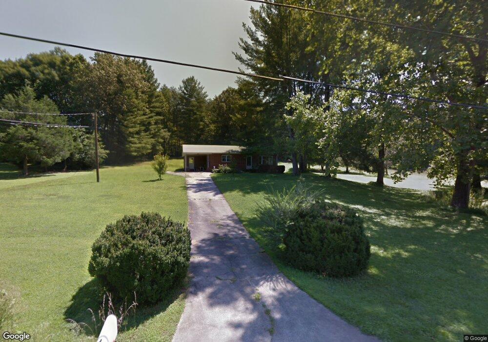
2001 Wall St Morganton, NC 28655
Estimated Value: $169,000 - $206,000
2
Beds
1
Bath
1,036
Sq Ft
$186/Sq Ft
Est. Value
About This Home
This home is located at 2001 Wall St, Morganton, NC 28655 and is currently estimated at $192,931, approximately $186 per square foot. 2001 Wall St is a home located in Burke County with nearby schools including Drexel Elementary School, Heritage Middle School, and Jimmy C. Draughn High School.
Ownership History
Date
Name
Owned For
Owner Type
Purchase Details
Closed on
May 8, 2024
Sold by
Tweed Curtis Ray and Tweed Marie
Bought by
Tweed William Travis
Current Estimated Value
Home Financials for this Owner
Home Financials are based on the most recent Mortgage that was taken out on this home.
Original Mortgage
$112,000
Outstanding Balance
$110,232
Interest Rate
6.25%
Mortgage Type
New Conventional
Estimated Equity
$82,699
Purchase Details
Closed on
Sep 21, 2012
Sold by
Tweed Mildred Jane and Ramsey Eliza Emma
Bought by
Tweed Curtis R
Create a Home Valuation Report for This Property
The Home Valuation Report is an in-depth analysis detailing your home's value as well as a comparison with similar homes in the area
Home Values in the Area
Average Home Value in this Area
Purchase History
| Date | Buyer | Sale Price | Title Company |
|---|---|---|---|
| Tweed William Travis | $140,000 | None Listed On Document | |
| Tweed William Travis | $140,000 | None Listed On Document | |
| Tweed Curtis R | $80,000 | None Available |
Source: Public Records
Mortgage History
| Date | Status | Borrower | Loan Amount |
|---|---|---|---|
| Open | Tweed William Travis | $112,000 | |
| Closed | Tweed William Travis | $112,000 |
Source: Public Records
Tax History
| Year | Tax Paid | Tax Assessment Tax Assessment Total Assessment is a certain percentage of the fair market value that is determined by local assessors to be the total taxable value of land and additions on the property. | Land | Improvement |
|---|---|---|---|---|
| 2025 | $1,143 | $160,500 | $28,517 | $131,983 |
| 2024 | $1,137 | $160,500 | $28,517 | $131,983 |
| 2023 | $1,137 | $158,888 | $28,517 | $130,371 |
| 2022 | $731 | $84,014 | $25,924 | $58,090 |
| 2021 | $725 | $84,014 | $25,924 | $58,090 |
| 2020 | $721 | $84,014 | $25,924 | $58,090 |
| 2019 | $721 | $84,014 | $25,924 | $58,090 |
| 2018 | $714 | $83,101 | $25,521 | $57,580 |
| 2017 | $712 | $83,101 | $25,521 | $57,580 |
| 2016 | $695 | $83,120 | $26,651 | $56,469 |
| 2015 | $692 | $83,120 | $26,651 | $56,469 |
| 2014 | $733 | $88,710 | $26,651 | $62,059 |
| 2013 | $733 | $88,710 | $26,651 | $62,059 |
Source: Public Records
Map
Nearby Homes
- 1855 Eastbrook Cir
- 1919 Highway 70 E
- 2088 E Winds Ave
- 2169 E Winds Ave
- 2290 U S 70
- 2491 Watts St
- 2986 Green Pasture Ln
- 0 Amherst Rd
- 0 Buford Dr
- 2715 Moose Lodge St
- 1307 E Union St
- 731 Summers Rd
- 108 Ones Branch Ct
- 113, 119 Byrd St
- 1205 E Union St
- 106 River Hills Way
- 108 Ivy Ct
- 102 Ivy Ct
- 100 Ivy Ct
- 303 Constitution Dr
- 1981 Wall St
- 2030 Wall St
- 1990 Wall St
- 2035 Wall St
- 1980 Wall St
- 1961 Wall St
- 2034 Keys St
- 2025 Eastbrook Cir
- 2055 Eastbrook Cir
- 1911 Wall St Unit 1915
- 1960 Wall St
- 2005 Eastbrook Cir
- 2045 Eastbrook Cir
- 1950 Wall St
- 2061 Wall St
- 1845 Eastbrook Cir
- 2097 Wall St
- 1901 Wall St
- 2010 Eastbrook Cir
- 2030 Eastbrook Cir
Your Personal Tour Guide
Ask me questions while you tour the home.