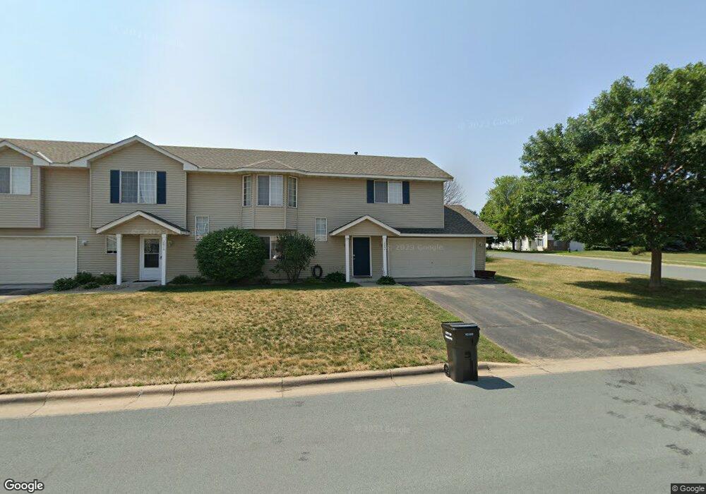
2002 Downing Ave Shakopee, MN 55379
Estimated Value: $256,000 - $273,000
3
Beds
2
Baths
1,428
Sq Ft
$186/Sq Ft
Est. Value
About This Home
This home is located at 2002 Downing Ave, Shakopee, MN 55379 and is currently estimated at $266,013, approximately $186 per square foot. 2002 Downing Ave is a home located in Scott County with nearby schools including Sun Path Elementary School, Shakopee West Middle School, and Shakopee Senior High School.
Ownership History
Date
Name
Owned For
Owner Type
Purchase Details
Closed on
May 10, 2010
Sold by
Minnesota Housing Finance Agency
Bought by
Dally Katherine S
Current Estimated Value
Purchase Details
Closed on
Apr 28, 2005
Sold by
Reyes Alejandro and Hernandez Marisa
Bought by
Martinez Melkin J and Martinez Paguada
Purchase Details
Closed on
Jan 27, 2003
Sold by
Anderson Terri
Bought by
Reyes Alejandro and Hernandez Marisa
Purchase Details
Closed on
Aug 25, 2000
Sold by
Mw Johnson Construction
Bought by
Anderson Terri
Create a Home Valuation Report for This Property
The Home Valuation Report is an in-depth analysis detailing your home's value as well as a comparison with similar homes in the area
Home Values in the Area
Average Home Value in this Area
Purchase History
| Date | Buyer | Sale Price | Title Company |
|---|---|---|---|
| Dally Katherine S | $112,000 | -- | |
| Martinez Melkin J | $185,400 | -- | |
| Reyes Alejandro | $164,900 | -- | |
| Anderson Terri | $137,000 | -- |
Source: Public Records
Tax History
| Year | Tax Paid | Tax Assessment Tax Assessment Total Assessment is a certain percentage of the fair market value that is determined by local assessors to be the total taxable value of land and additions on the property. | Land | Improvement |
|---|---|---|---|---|
| 2025 | $2,320 | $251,200 | $83,800 | $167,400 |
| 2024 | $2,398 | $239,800 | $79,800 | $160,000 |
| 2023 | $2,454 | $236,300 | $78,300 | $158,000 |
| 2022 | $2,424 | $238,100 | $80,100 | $158,000 |
| 2021 | $2,108 | $205,300 | $62,700 | $142,600 |
| 2020 | $2,192 | $198,500 | $55,100 | $143,400 |
| 2019 | $2,022 | $184,200 | $47,200 | $137,000 |
| 2018 | $1,980 | $0 | $0 | $0 |
| 2016 | $1,844 | $0 | $0 | $0 |
| 2014 | -- | $0 | $0 | $0 |
Source: Public Records
Map
Nearby Homes
- 2066 Mockingbird Ave
- 1596 Chartreux Ave
- 1928 Vierling Dr E
- 2350 Downing Ave
- 2423 Tyrone Dr
- 2399 Tyrone Dr
- 2351 Tyrone Dr
- 2574 Vierling Dr E
- 2006 Tyrone Dr
- 2655 King Ave
- 2795 Downing Ave
- 2817 Downing Ave
- 1227 Elmwood Ave Unit 85
- 1542 Philipp Way
- 1624 Philipp Way
- 2542 Mathias Rd
- 1667 Countryside Dr
- 2868 Trinity Dr
- 2871 Trinity Dr
- 1705 Tyrone Dr
- 2014 Downing Ave
- 2026 Downing Ave
- 1999 Downing Ave
- 2038 Downing Ave
- 2023 Downing Ave
- 1993 Downing Ave
- 1994 Brittany Ct
- 2050 Downing Ave
- 1942 Pintail Ave
- 1942 Pintail Ave Unit 1704
- 2035 Downing Ave
- 1964 Downing Ave
- 1977 Downing Ave
- 1945 Mockingbird Ave
- 1938 Pintail Ave
- 1998 Brittany Ct
- 1532 Hummingbird St
- 1995 Brittany Ct
- 2062 Downing Ave
- 2047 Downing Ave
Your Personal Tour Guide
Ask me questions while you tour the home.