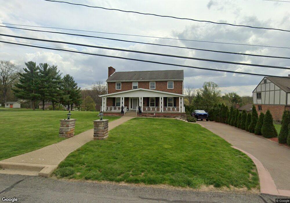
2002 Mohawk Rd Pittsburgh, PA 15241
Estimated Value: $549,000 - $668,000
5
Beds
3
Baths
3,194
Sq Ft
$191/Sq Ft
Est. Value
About This Home
This home is located at 2002 Mohawk Rd, Pittsburgh, PA 15241 and is currently estimated at $610,956, approximately $191 per square foot. 2002 Mohawk Rd is a home located in Allegheny County with nearby schools including Upper St. Clair High School, St. Louise De Marillac School, and Ave Maria Academy - Bethel Campus.
Ownership History
Date
Name
Owned For
Owner Type
Purchase Details
Closed on
Jan 14, 2025
Sold by
Pasquini Mary Jo and Pasquini Nicola Aldo
Bought by
Pasquini Mary Jo and Pasquini Nicola Aldo
Current Estimated Value
Purchase Details
Closed on
Feb 6, 2008
Sold by
Dellavecchia Andrew J
Bought by
Pasquini Nicola A
Home Financials for this Owner
Home Financials are based on the most recent Mortgage that was taken out on this home.
Original Mortgage
$189,000
Interest Rate
5.9%
Mortgage Type
New Conventional
Create a Home Valuation Report for This Property
The Home Valuation Report is an in-depth analysis detailing your home's value as well as a comparison with similar homes in the area
Home Values in the Area
Average Home Value in this Area
Purchase History
| Date | Buyer | Sale Price | Title Company |
|---|---|---|---|
| Pasquini Mary Jo | -- | -- | |
| Pasquini Mary Jo | -- | -- | |
| Pasquini Nicola A | $210,000 | -- |
Source: Public Records
Mortgage History
| Date | Status | Borrower | Loan Amount |
|---|---|---|---|
| Previous Owner | Pasquini Nicola A | $189,000 |
Source: Public Records
Tax History
| Year | Tax Paid | Tax Assessment Tax Assessment Total Assessment is a certain percentage of the fair market value that is determined by local assessors to be the total taxable value of land and additions on the property. | Land | Improvement |
|---|---|---|---|---|
| 2025 | $10,904 | $285,500 | $55,900 | $229,600 |
| 2024 | $10,904 | $285,500 | $55,900 | $229,600 |
| 2023 | $10,599 | $285,500 | $55,900 | $229,600 |
| 2022 | $10,313 | $284,600 | $55,000 | $229,600 |
| 2021 | $2,436 | $284,600 | $55,000 | $229,600 |
| 2020 | $9,943 | $284,600 | $55,000 | $229,600 |
| 2019 | $9,796 | $284,600 | $55,000 | $229,600 |
| 2017 | $9,361 | $284,600 | $55,000 | $229,600 |
Source: Public Records
Map
Nearby Homes
- 85 Marwood Dr
- 215 Brookside Blvd
- 3309 Bethel Church Rd
- 86 Country Club Dr
- 175 Mcmurray Rd
- 26 Seneca Rd
- 3390 Crestview Dr
- 1909 Highgate Rd
- 3335 Crestview Dr
- 134 Village Ct
- 110 Thames Place
- 2400 Mill Grove Rd
- 140 (Lot 111) Fair Acres Dr
- 209 (Lot 209) Barberry Ln
- 108 (Lot 103) Fair Acres Dr
- 0 Coral Johnston Unit 1706769
- 351 (Lot 127) Hays Rd
- 205 (Lot 210) Barberry Ln
- 220 (Lot 205) Barberry Ln
- 104 (Lot 102) Fair Acres Dr
Your Personal Tour Guide
Ask me questions while you tour the home.