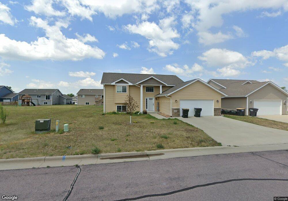
2002 Pratt Cir Saint Peter, MN 56082
Estimated Value: $350,154 - $371,000
4
Beds
2
Baths
2,005
Sq Ft
$178/Sq Ft
Est. Value
About This Home
This home is located at 2002 Pratt Cir, Saint Peter, MN 56082 and is currently estimated at $357,789, approximately $178 per square foot. 2002 Pratt Cir is a home located in Nicollet County with nearby schools including North Elementary School, South Elementary Early Learning Center, and St. Peter Middle School.
Ownership History
Date
Name
Owned For
Owner Type
Purchase Details
Closed on
Apr 30, 2021
Sold by
Payton Herbie A and Payton Abbey K
Bought by
Spear Michael Wayne and Zachman Michaela
Current Estimated Value
Home Financials for this Owner
Home Financials are based on the most recent Mortgage that was taken out on this home.
Original Mortgage
$295,122
Outstanding Balance
$267,036
Interest Rate
3%
Mortgage Type
New Conventional
Estimated Equity
$90,753
Purchase Details
Closed on
Oct 28, 2016
Bought by
Payton Herbie Herbie
Home Financials for this Owner
Home Financials are based on the most recent Mortgage that was taken out on this home.
Original Mortgage
$199,900
Interest Rate
3.47%
Create a Home Valuation Report for This Property
The Home Valuation Report is an in-depth analysis detailing your home's value as well as a comparison with similar homes in the area
Home Values in the Area
Average Home Value in this Area
Purchase History
| Date | Buyer | Sale Price | Title Company |
|---|---|---|---|
| Spear Michael Wayne | $304,252 | North American Title | |
| Payton Herbie Herbie | $199,900 | -- |
Source: Public Records
Mortgage History
| Date | Status | Borrower | Loan Amount |
|---|---|---|---|
| Open | Spear Michael Wayne | $295,122 | |
| Previous Owner | Payton Herbie Herbie | $199,900 |
Source: Public Records
Tax History
| Year | Tax Paid | Tax Assessment Tax Assessment Total Assessment is a certain percentage of the fair market value that is determined by local assessors to be the total taxable value of land and additions on the property. | Land | Improvement |
|---|---|---|---|---|
| 2025 | $4,830 | $336,400 | $33,800 | $302,600 |
| 2024 | $4,512 | $336,400 | $33,800 | $302,600 |
| 2023 | $4,354 | $332,300 | $33,800 | $298,500 |
| 2022 | $4,036 | $311,000 | $33,800 | $277,200 |
| 2021 | $3,248 | $259,700 | $33,800 | $225,900 |
| 2020 | $3,130 | $211,700 | $29,200 | $182,500 |
| 2019 | $3,004 | $210,400 | $29,200 | $181,200 |
| 2018 | $2,244 | $203,400 | $29,200 | $174,200 |
| 2017 | -- | $158,300 | $0 | $0 |
| 2016 | $442 | $0 | $0 | $0 |
| 2015 | -- | $0 | $0 | $0 |
Source: Public Records
Map
Nearby Homes
- 2056 Pratt Cir
- 0 Tbd Cty 20 Fields Unit 7038067
- 2015 Essler Dr
- 2012 Essler Dr
- 2105 Lunden St
- 2113 Lunden St
- 840 N 9th St
- 430 S 7th St
- 1205 Lloyd Ln
- 720 W Madison St
- 1202 Pine Pointe Curve
- 626 Austin Dr
- 804 S 4th St
- S S 4th St
- 1315 N Washington Ave
- 326 Jefferson Ave
- 326 Jefferson St
- 0 Riverview Rd
- 310 N Minnesota Ave
- 1816 Haralson Ct
- 2002 Pratt Cir
- 2000 Pratt Cir
- 2078 Pratt Cir
- 2080 Pratt Cir
- 2080 Pratt Cir
- 2078 Pratt Cir
- 2076 2076 Pratt
- 2076 Pratt Cir
- 2008 Pratt Cir
- 2001 Pratt Cir
- 2003 Pratt Cir
- 2072 Pratt Cir
- 2012 Pratt Cir
- 2070 Pratt Cir
- 2011 2011 Pratt Cir
- 2011 Pratt Cir
- 2068 Pratt Cir
- 2079 Pratt Cir
- 2089 Pratt Cir
- 2075 Pratt Cir
Your Personal Tour Guide
Ask me questions while you tour the home.