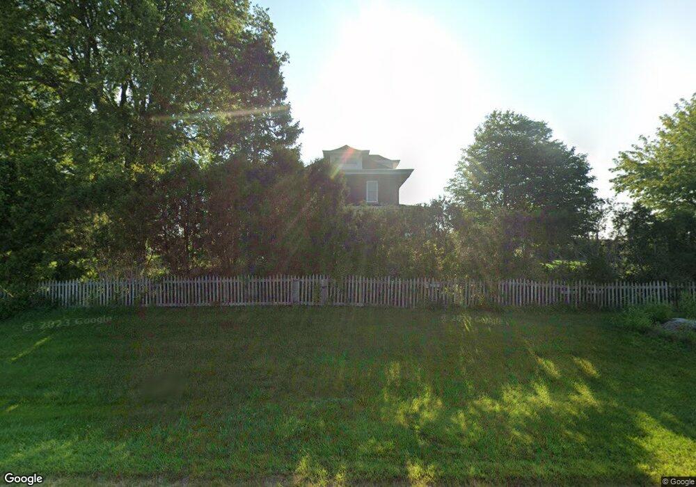
20024 Freeport Rd Sterling, IL 61081
Estimated Value: $269,000 - $367,786
3
Beds
3
Baths
2,200
Sq Ft
$143/Sq Ft
Est. Value
About This Home
This home is located at 20024 Freeport Rd, Sterling, IL 61081 and is currently estimated at $315,697, approximately $143 per square foot. 20024 Freeport Rd is a home located in Whiteside County.
Ownership History
Date
Name
Owned For
Owner Type
Purchase Details
Closed on
Jun 9, 2020
Sold by
Buis Josh L and Buis Colony E
Bought by
Buis Josh P and Buis Colony E
Current Estimated Value
Home Financials for this Owner
Home Financials are based on the most recent Mortgage that was taken out on this home.
Original Mortgage
$161,500
Outstanding Balance
$113,533
Interest Rate
3.2%
Mortgage Type
New Conventional
Estimated Equity
$202,164
Purchase Details
Closed on
Nov 19, 2013
Bought by
Buis Josh and Colony Linville
Create a Home Valuation Report for This Property
The Home Valuation Report is an in-depth analysis detailing your home's value as well as a comparison with similar homes in the area
Home Values in the Area
Average Home Value in this Area
Purchase History
| Date | Buyer | Sale Price | Title Company |
|---|---|---|---|
| Buis Josh P | -- | None Available | |
| Buis Josh | $215,000 | -- |
Source: Public Records
Mortgage History
| Date | Status | Borrower | Loan Amount |
|---|---|---|---|
| Open | Buis Josh P | $161,500 |
Source: Public Records
Tax History Compared to Growth
Tax History
| Year | Tax Paid | Tax Assessment Tax Assessment Total Assessment is a certain percentage of the fair market value that is determined by local assessors to be the total taxable value of land and additions on the property. | Land | Improvement |
|---|---|---|---|---|
| 2024 | $7,280 | $113,039 | $16,675 | $96,364 |
| 2023 | $6,761 | $105,270 | $15,529 | $89,741 |
| 2022 | $6,268 | $96,102 | $14,177 | $81,925 |
| 2021 | $5,142 | $78,469 | $2,479 | $75,990 |
| 2020 | $4,911 | $74,681 | $2,340 | $72,341 |
| 2019 | $4,915 | $73,344 | $2,285 | $71,059 |
| 2018 | $4,869 | $72,924 | $2,434 | $70,490 |
| 2017 | $4,902 | $71,199 | $2,357 | $68,842 |
| 2016 | $5,170 | $74,376 | $2,449 | $71,927 |
| 2015 | $4,746 | $62,018 | $2,297 | $59,721 |
| 2014 | $5,143 | $73,370 | $2,390 | $70,980 |
| 2013 | $4,746 | $62,018 | $2,297 | $59,721 |
Source: Public Records
Map
Nearby Homes
- 21631 Hoover Rd
- 0 Pilgrim Rd Unit 22272762
- 23018 Freeport Rd
- 104 Gaston St
- 1725 Heritage Dr
- 4305 Hillcrest Ln
- Lot 5 Lenox Rd
- Lot 4 Lenox Rd
- Lot 3 Lenox Rd
- 17421 Timber Dr
- 0 E Lincolnway Unit MRD12284937
- 17619 Grandview Dr
- 2209 15th Ave
- 2208 4th Ave
- Lot 4 E 19th St
- Lot 1 E 19th St
- 905 E 21st St
- 3900 Pine Hill Rd
- 1824 16th Ave
- Lot 403 E 21st St
- 19877 Freeport Rd
- 20227 Freeport Rd
- 20342 Freeport Rd
- 20436 Freeport Rd
- 20436 Freeport Rd
- 19555 Freeport Rd
- 29610 Capp Rd
- 19531 Freeport Rd
- 19380 Freeport Rd
- 30721 Capp Rd
- 20734 Freeport Rd
- 19202 Freeport Rd
- 20021 Polo Rd
- 20911 Freeport Rd
- 20914 Freeport Rd
- 29545 Penrose Rd
- 20287 Polo Rd
- 000 Polo Rd
- 19986 Polo Rd