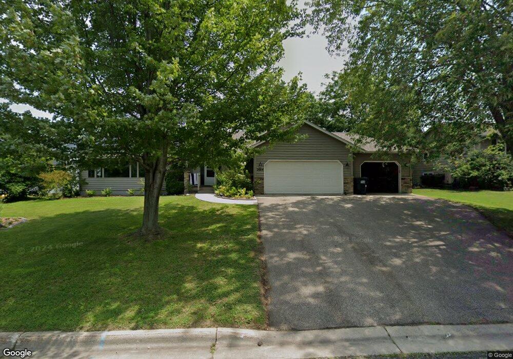
2004 Johnson Ct Northfield, MN 55057
Estimated Value: $467,000 - $484,849
5
Beds
4
Baths
1,884
Sq Ft
$253/Sq Ft
Est. Value
About This Home
This home is located at 2004 Johnson Ct, Northfield, MN 55057 and is currently estimated at $476,462, approximately $252 per square foot. 2004 Johnson Ct is a home located in Rice County with nearby schools including Bridgewater Elementary School, Northfield Middle School, and Northfield Senior High School.
Ownership History
Date
Name
Owned For
Owner Type
Purchase Details
Closed on
Apr 18, 2019
Sold by
Farley Emy Jo and Farley Bret Adam
Bought by
Dunn William D
Current Estimated Value
Purchase Details
Closed on
Feb 28, 2019
Sold by
Dunn William D and Dunn Amanda G
Bought by
Anderson Martin J and Anderson Krissa A
Purchase Details
Closed on
Mar 7, 2018
Sold by
Farley Emy Jo and Farley Bret Adam
Bought by
Dunn William D
Home Financials for this Owner
Home Financials are based on the most recent Mortgage that was taken out on this home.
Original Mortgage
$308,750
Interest Rate
4.15%
Mortgage Type
New Conventional
Purchase Details
Closed on
May 18, 2015
Sold by
Harding James James
Bought by
Farley Bret Bret
Home Financials for this Owner
Home Financials are based on the most recent Mortgage that was taken out on this home.
Original Mortgage
$268,546
Interest Rate
3.85%
Create a Home Valuation Report for This Property
The Home Valuation Report is an in-depth analysis detailing your home's value as well as a comparison with similar homes in the area
Home Values in the Area
Average Home Value in this Area
Purchase History
| Date | Buyer | Sale Price | Title Company |
|---|---|---|---|
| Dunn William D | $500 | Dhi Title Of Minnesota Inc | |
| Anderson Martin J | $313,000 | Trademark Title Services Inc | |
| Dunn William D | $325,000 | Dhi Title Of Minnesota Inc | |
| Farley Bret Bret | $288,600 | -- |
Source: Public Records
Mortgage History
| Date | Status | Borrower | Loan Amount |
|---|---|---|---|
| Previous Owner | Dunn William D | $308,750 | |
| Previous Owner | Farley Bret Bret | $268,546 |
Source: Public Records
Tax History Compared to Growth
Tax History
| Year | Tax Paid | Tax Assessment Tax Assessment Total Assessment is a certain percentage of the fair market value that is determined by local assessors to be the total taxable value of land and additions on the property. | Land | Improvement |
|---|---|---|---|---|
| 2025 | $8,096 | $470,000 | $77,700 | $392,300 |
| 2024 | $8,096 | $436,400 | $71,000 | $365,400 |
| 2023 | $6,362 | $436,400 | $71,000 | $365,400 |
| 2022 | $5,822 | $394,900 | $66,600 | $328,300 |
| 2021 | $5,572 | $352,900 | $59,900 | $293,000 |
| 2020 | $5,460 | $334,000 | $57,700 | $276,300 |
| 2019 | $4,826 | $321,200 | $55,500 | $265,700 |
| 2018 | $4,674 | $283,100 | $51,000 | $232,100 |
| 2017 | $4,258 | $270,000 | $48,800 | $221,200 |
| 2016 | $4,066 | $267,400 | $48,800 | $218,600 |
| 2015 | $4,000 | $244,900 | $48,800 | $196,100 |
| 2014 | -- | $242,600 | $48,800 | $193,800 |
Source: Public Records
Map
Nearby Homes
- 1819 Truman Ct
- 709 Carter Dr
- 2116 Park Pointe Dr
- 2206 Grant Ct
- 1741 Roosevelt Dr
- 2200 Greenfield Dr W
- 1707 Jackson Ct
- 2220 Greenfield Dr E
- 2004 Lincoln St S
- 1513 Senate Ln
- XXXX Division St S
- 1301 Presidential Dr
- 1603 Washington St
- 1011 Poplar St
- 2620 Oak Lawn Dr
- Outlot Honeylocust Dr
- 2704 Oak Lawn Dr
- 2708 Oak Lawn Dr
- 421 Ford St E
- 318 Ford St E
- 2000 Johnson Ct
- 2008 Johnson Ct
- 2005 Johnson Ct
- 2012 Johnson Ct
- 1936 Tyler Ct
- 2001 Johnson Ct
- 1948 Roosevelt Dr
- 2009 Johnson Ct
- 2001 Park Pointe Ct
- 2017 Johnson Ct
- 2000 Park Pointe Ct
- 1932 Tyler Ct
- 2013 Johnson Ct
- 1940 Tyler Ct
- 2005 Park Pointe Ct
- 2004 Park Pointe Ct
- 1925 Roosevelt Dr
- 1854 Kennedy Ct
- 2008 Park Pointe Ct
- 1928 Tyler Ct