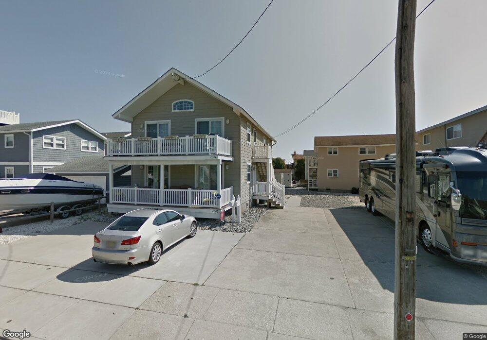
2005 7th Ave Unit 2005 Avalon, NJ 08202
Estimated Value: $1,204,000 - $1,961,000
--
Bed
--
Bath
1,100
Sq Ft
$1,337/Sq Ft
Est. Value
About This Home
This home is located at 2005 7th Ave Unit 2005, Avalon, NJ 08202 and is currently estimated at $1,470,554, approximately $1,336 per square foot. 2005 7th Ave Unit 2005 is a home located in Cape May County with nearby schools including Avalon Elementary School.
Ownership History
Date
Name
Owned For
Owner Type
Purchase Details
Closed on
Oct 14, 2014
Sold by
Bailey Charles F and Bailey Phyllis
Bought by
Cunningham Gary E and Delfini Vincent J
Current Estimated Value
Home Financials for this Owner
Home Financials are based on the most recent Mortgage that was taken out on this home.
Original Mortgage
$380,000
Outstanding Balance
$274,521
Interest Rate
2.61%
Mortgage Type
Adjustable Rate Mortgage/ARM
Estimated Equity
$1,196,033
Purchase Details
Closed on
May 17, 2007
Sold by
Ava Stone Llc
Bought by
Bailey Charles F and Bailey Phyllis
Home Financials for this Owner
Home Financials are based on the most recent Mortgage that was taken out on this home.
Original Mortgage
$62,000
Interest Rate
6.17%
Mortgage Type
Credit Line Revolving
Create a Home Valuation Report for This Property
The Home Valuation Report is an in-depth analysis detailing your home's value as well as a comparison with similar homes in the area
Home Values in the Area
Average Home Value in this Area
Purchase History
| Date | Buyer | Sale Price | Title Company |
|---|---|---|---|
| Cunningham Gary E | $475,000 | Seaboard Title Agency | |
| Bailey Charles F | $620,000 | Congress Title |
Source: Public Records
Mortgage History
| Date | Status | Borrower | Loan Amount |
|---|---|---|---|
| Open | Cunningham Gary E | $380,000 | |
| Previous Owner | Bailey Charles F | $62,000 | |
| Previous Owner | Bailey Charles F | $496,000 |
Source: Public Records
Tax History Compared to Growth
Tax History
| Year | Tax Paid | Tax Assessment Tax Assessment Total Assessment is a certain percentage of the fair market value that is determined by local assessors to be the total taxable value of land and additions on the property. | Land | Improvement |
|---|---|---|---|---|
| 2025 | $3,010 | $490,300 | $400,000 | $90,300 |
| 2024 | $3,010 | $490,300 | $400,000 | $90,300 |
| 2023 | $2,986 | $490,300 | $400,000 | $90,300 |
| 2022 | $2,785 | $490,300 | $400,000 | $90,300 |
| 2021 | $2,682 | $490,300 | $400,000 | $90,300 |
| 2020 | $2,579 | $490,300 | $400,000 | $90,300 |
| 2019 | $2,501 | $490,300 | $400,000 | $90,300 |
| 2018 | $2,393 | $490,300 | $400,000 | $90,300 |
| 2017 | $2,325 | $418,100 | $325,000 | $93,100 |
| 2016 | $2,300 | $418,100 | $325,000 | $93,100 |
| 2015 | $2,262 | $418,100 | $325,000 | $93,100 |
| 2014 | $2,237 | $418,100 | $325,000 | $93,100 |
Source: Public Records
Map
Nearby Homes
- 647 Barry Rd
- 503 20th St
- 440 21st St Unit South (B)
- 415 20th St
- 431 24th St
- 890 21st St
- 389 22nd St
- 704 Old Avalon Blvd
- 297 24th St Unit 297
- 297 24th St
- 2425 Harbor Ave Unit 2425
- 211 23rd St
- 178 19th St
- 212 25th St
- 212 25th St Unit East Unit
- 279 13th St Unit C-6
- 279 13th St
- 174 23rd St
- 161 24th St
- 9 Seabreeze Ln
- 2005 7th Ave Unit First
- 2007 7th Ave Unit 2007
- 699 21st St Unit 2nd Floor
- 695 21st St Unit A
- 695 21st St
- 695 21st St Unit 2nd Floor
- 695 21st St Unit 1st Floor
- 697 21st St
- 685 21st St
- 698 Sunrise Dr
- 696 Sunrise Dr
- 696 Sunrise Dr
- 696 Sunrise Dr Unit A
- 677 21st St Unit 2nd Floor
- 677 21st St
- 684 Sunrise Dr
- 675 21st St
- 675 21st St Unit A
- 675 21st St Unit 2nd Floor
- 675 21st St Unit 1st Floor