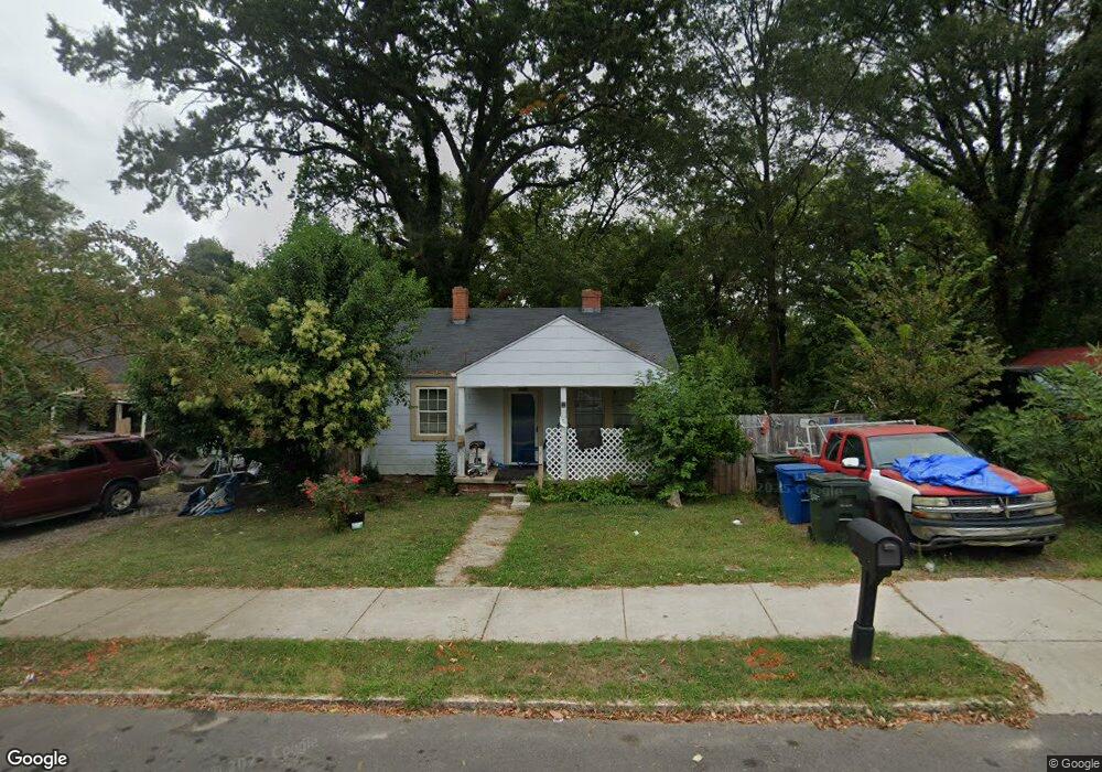
2005 Ashe St Durham, NC 27703
East Durham NeighborhoodEstimated Value: $152,000 - $222,000
2
Beds
1
Bath
790
Sq Ft
$247/Sq Ft
Est. Value
About This Home
This home is located at 2005 Ashe St, Durham, NC 27703 and is currently estimated at $194,978, approximately $246 per square foot. 2005 Ashe St is a home located in Durham County with nearby schools including Y E Smith Elementary, W.G. Pearson Elementary School, and Brogden Middle.
Ownership History
Date
Name
Owned For
Owner Type
Purchase Details
Closed on
Sep 25, 2024
Sold by
Bcratic Inc
Bought by
Stalker Kenneth E
Current Estimated Value
Purchase Details
Closed on
Feb 6, 2020
Sold by
Jazz Up Indy Inc
Bought by
Bcratic Inc
Purchase Details
Closed on
Oct 17, 2019
Sold by
Acm Vision V Llc
Bought by
Jazz Up Indy Inc
Purchase Details
Closed on
Nov 25, 2013
Sold by
M15s Lp
Bought by
Acm Vision V Llc
Purchase Details
Closed on
Jun 21, 2011
Sold by
Branch Banking & Trust Company
Bought by
M15s Lp
Purchase Details
Closed on
Oct 28, 2010
Sold by
Atlantic Business Corporation
Bought by
Branch Banking & Trust Company
Purchase Details
Closed on
Mar 25, 2008
Sold by
Ogomo Bernard and Sabaya Jane A
Bought by
Atlantic Business Corp
Home Financials for this Owner
Home Financials are based on the most recent Mortgage that was taken out on this home.
Original Mortgage
$185,000
Interest Rate
5.97%
Mortgage Type
Purchase Money Mortgage
Purchase Details
Closed on
Mar 24, 2008
Sold by
Belvin Road Developers Llc
Bought by
Atlantic Business Corp
Home Financials for this Owner
Home Financials are based on the most recent Mortgage that was taken out on this home.
Original Mortgage
$185,000
Interest Rate
5.97%
Mortgage Type
Purchase Money Mortgage
Purchase Details
Closed on
Feb 13, 2008
Sold by
Ogomo Bernard and Sabaya Jane A
Bought by
Ogomo Bernard and Sabaya Jane A
Home Financials for this Owner
Home Financials are based on the most recent Mortgage that was taken out on this home.
Original Mortgage
$185,000
Interest Rate
5.97%
Mortgage Type
Purchase Money Mortgage
Purchase Details
Closed on
Jan 29, 2008
Sold by
Belvin Road Developers Llc
Bought by
Ogomo Bernard and Sabaya Jane A
Home Financials for this Owner
Home Financials are based on the most recent Mortgage that was taken out on this home.
Original Mortgage
$185,000
Interest Rate
5.97%
Mortgage Type
Purchase Money Mortgage
Purchase Details
Closed on
Dec 22, 2006
Sold by
Smiths Realty Inc Of Durham
Bought by
Belvin Road Developers Llc
Create a Home Valuation Report for This Property
The Home Valuation Report is an in-depth analysis detailing your home's value as well as a comparison with similar homes in the area
Home Values in the Area
Average Home Value in this Area
Purchase History
| Date | Buyer | Sale Price | Title Company |
|---|---|---|---|
| Stalker Kenneth E | $22,000 | None Listed On Document | |
| Bcratic Inc | $5,000 | None Available | |
| Jazz Up Indy Inc | -- | None Available | |
| Acm Vision V Llc | -- | None Available | |
| M15s Lp | -- | None Available | |
| Branch Banking & Trust Company | $15,340 | None Available | |
| Atlantic Business Corp | -- | Blackacre Title Insurance Co | |
| Atlantic Business Corp | $160,000 | Blackacre Title Ins Agency | |
| Ogomo Bernard | -- | None Available | |
| Ogomo Bernard | $68,000 | Blackacre Title Insurance Co | |
| Belvin Road Developers Llc | $150,000 | None Available |
Source: Public Records
Mortgage History
| Date | Status | Borrower | Loan Amount |
|---|---|---|---|
| Previous Owner | Atlantic Business Corp | $185,000 |
Source: Public Records
Tax History
| Year | Tax Paid | Tax Assessment Tax Assessment Total Assessment is a certain percentage of the fair market value that is determined by local assessors to be the total taxable value of land and additions on the property. | Land | Improvement |
|---|---|---|---|---|
| 2025 | $1,699 | $171,361 | $104,400 | $66,961 |
| 2024 | $870 | $62,397 | $26,077 | $36,320 |
| 2023 | $817 | $62,397 | $26,077 | $36,320 |
| 2022 | $799 | $62,397 | $26,077 | $36,320 |
| 2021 | $795 | $62,397 | $26,077 | $36,320 |
| 2020 | $776 | $62,397 | $26,077 | $36,320 |
| 2019 | $776 | $62,397 | $26,077 | $36,320 |
| 2018 | $743 | $54,745 | $14,487 | $40,258 |
| 2017 | $737 | $54,745 | $14,487 | $40,258 |
| 2016 | $712 | $54,745 | $14,487 | $40,258 |
| 2015 | $691 | $49,895 | $10,322 | $39,573 |
| 2014 | $691 | $49,895 | $10,322 | $39,573 |
Source: Public Records
Map
Nearby Homes
- 1914 Hart St
- 101 S Maple St
- 1902 Angier Ave
- 1900 Angier Ave
- 1816 Vale St
- 1704 E Main St
- 2065 Bull City Bend Unit 403
- 111 N Guthrie Ave
- 205 S Briggs Ave
- 101 S Briggs Ave
- 310 Cody St
- 2302 Angier Ave
- 2407 Hart St Unit A
- 2318 E Main St
- 303 Truce St Unit B
- 506 Bruce St
- 2337 E Main St
- 618 Troy St
- 600 Bernice St
- 415 Sowell St
Your Personal Tour Guide
Ask me questions while you tour the home.