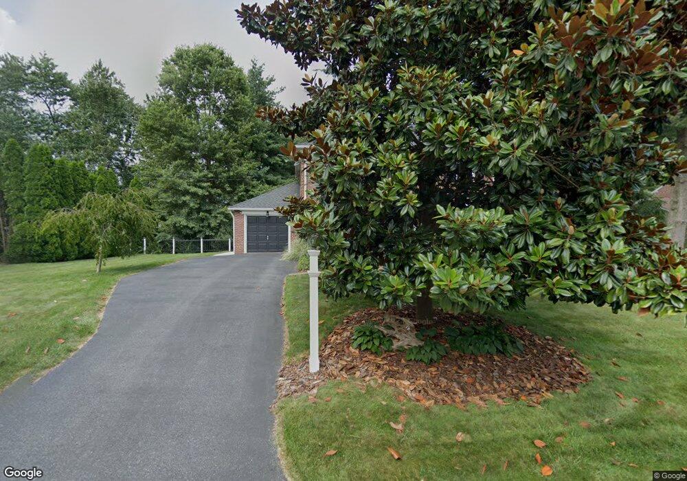
2005 Ferndale Dr Wilmington, DE 19810
Estimated Value: $491,000 - $539,582
3
Beds
2
Baths
1,925
Sq Ft
$267/Sq Ft
Est. Value
About This Home
This home is located at 2005 Ferndale Dr, Wilmington, DE 19810 and is currently estimated at $514,646, approximately $267 per square foot. 2005 Ferndale Dr is a home located in New Castle County with nearby schools including Forwood Elementary School, Talley Middle School, and Mount Pleasant High School.
Ownership History
Date
Name
Owned For
Owner Type
Purchase Details
Closed on
Sep 30, 2009
Sold by
Smith Joseph R and Smith Karen J
Bought by
Worthington Robert C and Worthington Sheri L
Current Estimated Value
Home Financials for this Owner
Home Financials are based on the most recent Mortgage that was taken out on this home.
Original Mortgage
$150,000
Outstanding Balance
$98,147
Interest Rate
5.12%
Mortgage Type
New Conventional
Estimated Equity
$416,499
Create a Home Valuation Report for This Property
The Home Valuation Report is an in-depth analysis detailing your home's value as well as a comparison with similar homes in the area
Home Values in the Area
Average Home Value in this Area
Purchase History
| Date | Buyer | Sale Price | Title Company |
|---|---|---|---|
| Worthington Robert C | $325,000 | The Security Title Guarantee |
Source: Public Records
Mortgage History
| Date | Status | Borrower | Loan Amount |
|---|---|---|---|
| Open | Worthington Robert C | $150,000 |
Source: Public Records
Tax History Compared to Growth
Tax History
| Year | Tax Paid | Tax Assessment Tax Assessment Total Assessment is a certain percentage of the fair market value that is determined by local assessors to be the total taxable value of land and additions on the property. | Land | Improvement |
|---|---|---|---|---|
| 2024 | $3,340 | $100,900 | $21,500 | $79,400 |
| 2023 | $3,009 | $100,900 | $21,500 | $79,400 |
| 2022 | $3,069 | $100,900 | $21,500 | $79,400 |
| 2021 | $3,169 | $100,900 | $21,500 | $79,400 |
| 2020 | $3,170 | $100,900 | $21,500 | $79,400 |
| 2019 | $3,486 | $100,900 | $21,500 | $79,400 |
| 2018 | $3,412 | $100,900 | $21,500 | $79,400 |
| 2017 | $3,359 | $100,900 | $21,500 | $79,400 |
| 2016 | $3,356 | $100,900 | $21,500 | $79,400 |
| 2015 | $3,088 | $100,900 | $21,500 | $79,400 |
| 2014 | $3,086 | $100,900 | $21,500 | $79,400 |
Source: Public Records
Map
Nearby Homes
- 1900 Beechwood Dr
- 1607 Silverside Rd
- 1224 Grinnell Rd
- 1425 Bucknell Rd
- 1218 Winstead Rd
- 2247 Silverside Rd
- 133 Marcella Rd
- 1400 Carson Rd
- 1602 Harvey Rd
- 2010 Kynwyd Rd
- 2212 Grubb Rd
- 1905 Harvey Rd
- 2115 Coventry Dr
- 29 N Cliffe Dr
- 2106 Millers Rd
- 1902 Longcome Dr
- 2311 Empire Dr
- 814 Naudain Ave
- 1108 Graylyn Rd
- 1820 Foulk Rd
- 2007 Ferndale Dr
- 2003 Ferndale Dr
- 2004 Fairfield Dr
- 2002 Fairfield Dr
- 2004 Ferndale Dr
- 2000 Ferndale Dr
- 2009 Ferndale Dr
- 1801 Forrest Rd
- 1801 Forrest Rd Unit P 8
- 2006 Fairfield Dr
- 2006 Ferndale Dr
- 2000 Fairfield Dr
- 2001 Beechwood Dr
- 2005 Fairfield Dr
- 2008 Ferndale Dr
- 2005 Beechwood Dr
- 2011 Ferndale Dr
- 2008 Fairfield Dr
- 1802 Forrest Rd
- 1913 Beechwood Dr