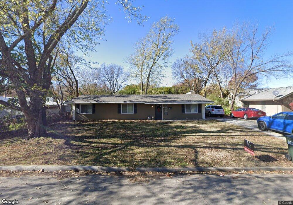
2005 Mitchell St Lawrence, KS 66046
Centennial NeighborhoodEstimated Value: $253,513 - $270,000
3
Beds
1
Bath
1,512
Sq Ft
$174/Sq Ft
Est. Value
About This Home
This home is located at 2005 Mitchell St, Lawrence, KS 66046 and is currently estimated at $262,378, approximately $173 per square foot. 2005 Mitchell St is a home located in Douglas County with nearby schools including Cordley Elementary School, Liberty Memorial Central Middle School, and Lawrence High School.
Ownership History
Date
Name
Owned For
Owner Type
Purchase Details
Closed on
Feb 3, 2020
Sold by
Keating Joseph and Keating Gina
Bought by
Keating Andrew and Keating Andrew Joseph
Current Estimated Value
Home Financials for this Owner
Home Financials are based on the most recent Mortgage that was taken out on this home.
Original Mortgage
$110,000
Outstanding Balance
$97,582
Interest Rate
3.7%
Mortgage Type
Future Advance Clause Open End Mortgage
Estimated Equity
$164,796
Purchase Details
Closed on
Feb 8, 2007
Sold by
Sli Properties Llc
Bought by
Keating Joe and Keating Gina
Create a Home Valuation Report for This Property
The Home Valuation Report is an in-depth analysis detailing your home's value as well as a comparison with similar homes in the area
Home Values in the Area
Average Home Value in this Area
Purchase History
| Date | Buyer | Sale Price | Title Company |
|---|---|---|---|
| Keating Andrew | -- | None Available | |
| Keating Joe | -- | Kansas Secured Title |
Source: Public Records
Mortgage History
| Date | Status | Borrower | Loan Amount |
|---|---|---|---|
| Open | Keating Andrew | $110,000 |
Source: Public Records
Tax History
| Year | Tax Paid | Tax Assessment Tax Assessment Total Assessment is a certain percentage of the fair market value that is determined by local assessors to be the total taxable value of land and additions on the property. | Land | Improvement |
|---|---|---|---|---|
| 2025 | $2,908 | $24,024 | $9,200 | $14,824 |
| 2024 | $2,687 | $22,284 | $8,625 | $13,659 |
| 2023 | $2,537 | $20,087 | $6,900 | $13,187 |
| 2022 | $2,318 | $18,261 | $6,325 | $11,936 |
| 2021 | $2,062 | $15,608 | $5,175 | $10,433 |
| 2020 | $1,971 | $15,008 | $5,175 | $9,833 |
| 2019 | $1,985 | $15,134 | $4,947 | $10,187 |
| 2018 | $1,808 | $13,708 | $4,720 | $8,988 |
| 2017 | $1,678 | $12,604 | $4,720 | $7,884 |
| 2016 | $1,468 | $11,558 | $4,025 | $7,533 |
| 2015 | -- | $11,983 | $4,025 | $7,958 |
| 2014 | -- | $12,225 | $4,025 | $8,200 |
Source: Public Records
Map
Nearby Homes
- 1214 W 21st St
- 1103 W 19th Terrace
- 1112 W 22nd St
- 1801 Missouri St
- 1807 Alabama St
- 1831 Illinois St
- 1704 W 20th St
- 1701 Alabama St
- 2214 Ousdahl Rd
- 1805 W 21st Terrace
- 2210 Louisiana St
- 1923 Tennessee St
- 2414 Jasu Dr
- 1616 Louisiana St
- 730 W 25th St
- 2409 Ohio St
- 2115 Massachusetts St
- 1715 W 25th St
- 2561 Jasu Dr
- 2208 Massachusetts St
- 2005 Mitchell Rd
- 2001 Mitchell St
- 1206 W 20th Terrace
- 2006 Mitchell Rd
- 2006 Mitchell St
- 1205 W 20th St
- 2008 Mitchell St
- 1940 Naismith Dr
- 1308 W 20th St
- 2020 Naismith Dr
- 1302 W 20th St
- 1203 W 20th Terrace
- 2015 Naismith Dr
- 1009 W 20th Terrace
- 1208 W 20th St
- 926 W 20th Terrace
- 2003 Naismith Dr
- 1109 W 20th St
- 2009 Naismith Dr
- 1934 1/2 Naismith Dr
Your Personal Tour Guide
Ask me questions while you tour the home.