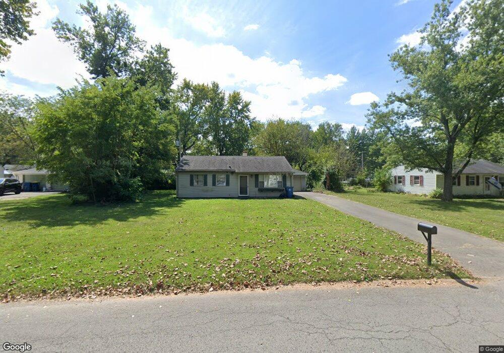
2005 Randall Rd Indianapolis, IN 46240
Ravenswood NeighborhoodEstimated Value: $212,000 - $230,000
3
Beds
2
Baths
1,189
Sq Ft
$185/Sq Ft
Est. Value
About This Home
This home is located at 2005 Randall Rd, Indianapolis, IN 46240 and is currently estimated at $219,929, approximately $184 per square foot. 2005 Randall Rd is a home located in Marion County with nearby schools including Clearwater Elementary School, Eastwood Middle School, and North Central High School.
Ownership History
Date
Name
Owned For
Owner Type
Purchase Details
Closed on
Jun 26, 2014
Sold by
Lowery Boca Ratan
Bought by
Lu Chao Bin
Current Estimated Value
Home Financials for this Owner
Home Financials are based on the most recent Mortgage that was taken out on this home.
Original Mortgage
$68,800
Outstanding Balance
$21,786
Interest Rate
4.11%
Mortgage Type
New Conventional
Estimated Equity
$198,143
Purchase Details
Closed on
Jun 26, 2013
Sold by
Lowery Boca Ratan
Bought by
Lu Chao Bin
Create a Home Valuation Report for This Property
The Home Valuation Report is an in-depth analysis detailing your home's value as well as a comparison with similar homes in the area
Home Values in the Area
Average Home Value in this Area
Purchase History
| Date | Buyer | Sale Price | Title Company |
|---|---|---|---|
| Lu Chao Bin | -- | Chicago Title Company Llc | |
| Lu Chao Bin | $88,000 | Chicago Title |
Source: Public Records
Mortgage History
| Date | Status | Borrower | Loan Amount |
|---|---|---|---|
| Open | Lu Chao Bin | $68,800 |
Source: Public Records
Tax History Compared to Growth
Tax History
| Year | Tax Paid | Tax Assessment Tax Assessment Total Assessment is a certain percentage of the fair market value that is determined by local assessors to be the total taxable value of land and additions on the property. | Land | Improvement |
|---|---|---|---|---|
| 2024 | $1,098 | $135,600 | $23,400 | $112,200 |
| 2023 | $1,098 | $115,500 | $23,400 | $92,100 |
| 2022 | $1,506 | $115,500 | $23,400 | $92,100 |
| 2021 | $1,182 | $108,600 | $12,100 | $96,500 |
| 2020 | $1,049 | $103,500 | $12,100 | $91,400 |
| 2019 | $1,047 | $107,500 | $12,100 | $95,400 |
| 2018 | $939 | $101,800 | $12,100 | $89,700 |
| 2017 | $964 | $104,400 | $12,100 | $92,300 |
| 2016 | $774 | $94,500 | $12,100 | $82,400 |
| 2014 | $482 | $87,000 | $12,100 | $74,900 |
| 2013 | $648 | $83,200 | $12,100 | $71,100 |
Source: Public Records
Map
Nearby Homes
- 7351 Evanston Ave
- 2107 Haynes Ave
- 2236 E 75th St
- 1573 E 73rd St
- 7250 Fitch Ave
- 7543 Terrace Beach
- 7186 Harbour Isle
- 7198 Harbour Isle
- 7669 River Rd Unit 28
- 7163 Sarto Dr
- 7685 River Rd
- 2101 Beach Ave
- Lot 115 of 2605 Beach Ave
- 7707 River Rd Unit 10
- 7711 River Rd
- 6750 Spirit Lake Dr Unit 301
- 2932 Parr Dr
- 1802 E 66th St
- 6926 Wesley Ct
- 6650 Page Blvd Unit 402
- 1941 Randall Rd
- 2011 Randall Rd
- 2004 Ruth Dr
- 1940 Ruth Dr
- 1935 Randall Rd
- 2010 Ruth Dr
- 2012 Randall Rd
- 2006 Randall Rd
- 2017 Randall Rd
- 1929 Randall Rd
- 7350 Evanston Ave
- 1936 Randall Rd
- 2016 Ruth Dr
- 1928 Ruth Dr
- 1934 Ruth Dr
- 7356 Evanston Ave
- 7362 Evanston Ave
- 1930 Randall Rd
- 1923 Randall Rd
- 7366 Evanston Ave
