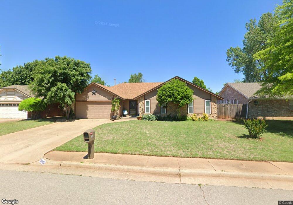
2005 Shamrock Dr Edmond, OK 73003
Oak Brook NeighborhoodEstimated Value: $223,026 - $249,000
3
Beds
2
Baths
1,673
Sq Ft
$139/Sq Ft
Est. Value
About This Home
This home is located at 2005 Shamrock Dr, Edmond, OK 73003 and is currently estimated at $232,007, approximately $138 per square foot. 2005 Shamrock Dr is a home located in Oklahoma County with nearby schools including Ida Freeman Elementary School, Cheyenne Middle School, and North High School.
Ownership History
Date
Name
Owned For
Owner Type
Purchase Details
Closed on
Sep 27, 2012
Sold by
Lincoln Samuel R and Lincoln Jamie S
Bought by
Acord Lorrie
Current Estimated Value
Home Financials for this Owner
Home Financials are based on the most recent Mortgage that was taken out on this home.
Original Mortgage
$140,409
Outstanding Balance
$95,183
Interest Rate
3.37%
Mortgage Type
FHA
Estimated Equity
$136,824
Create a Home Valuation Report for This Property
The Home Valuation Report is an in-depth analysis detailing your home's value as well as a comparison with similar homes in the area
Home Values in the Area
Average Home Value in this Area
Purchase History
| Date | Buyer | Sale Price | Title Company |
|---|---|---|---|
| Acord Lorrie | $143,000 | Stewart Abstract & Title Of |
Source: Public Records
Mortgage History
| Date | Status | Borrower | Loan Amount |
|---|---|---|---|
| Open | Acord Lorrie | $140,409 |
Source: Public Records
Tax History
| Year | Tax Paid | Tax Assessment Tax Assessment Total Assessment is a certain percentage of the fair market value that is determined by local assessors to be the total taxable value of land and additions on the property. | Land | Improvement |
|---|---|---|---|---|
| 2025 | $1,839 | $19,063 | $2,570 | $16,493 |
| 2023 | $1,769 | $17,969 | $2,546 | $15,423 |
| 2022 | $1,721 | $17,446 | $2,774 | $14,672 |
| 2021 | $1,660 | $16,938 | $3,088 | $13,850 |
| 2020 | $1,628 | $16,445 | $3,218 | $13,227 |
| 2019 | $1,630 | $16,390 | $3,218 | $13,172 |
| 2018 | $1,628 | $16,280 | $0 | $0 |
| 2017 | $1,591 | $16,004 | $3,218 | $12,786 |
| 2016 | $1,588 | $16,004 | $3,125 | $12,879 |
| 2015 | $1,560 | $15,758 | $3,103 | $12,655 |
| 2014 | $1,510 | $15,299 | $3,125 | $12,174 |
Source: Public Records
Map
Nearby Homes
- 300 N Lockeport Dr
- 109 N Grand Fork Dr
- 2109 Castle Rock
- 84 Kimberly Dr
- 2220 Crosstrails
- 2319 Bent Trail Cir
- 781 N Santa fe Ave
- 15 Coventry Ct
- 16 Coventry Ct
- 1717 Rocky Mountain Way
- 2401 Santa fe Cir
- 2316 Bradford Place
- 113 Woodbridge Cir
- 713 Lapwing Rd
- 117 Woodbridge Cir
- 813 Lapwing Rd
- 2421 Jeannes Trail
- 412 Abilene Ave
- 1717 Park View Place
- 1632 Laurel Place
- 2009 Shamrock Dr
- 2001 Shamrock Dr
- 2004 Castle Rock
- 2008 Castle Rock
- 405 N Lockeport Dr
- 2013 Shamrock Dr
- 308 N Grand Fork Dr
- 309 N Lockeport Dr
- 2012 Castle Rock
- 416 N Lockeport Dr
- 2017 Shamrock Dr
- 304 N Grand Fork Dr
- 305 N Lockeport Dr
- 400 N Lockeport Dr
- 404 N Lockeport Dr
- 312 N Lockeport Dr
- 309 N Grand Fork Dr
- 408 N Lockeport Dr
- 308 N Lockeport Dr
- 2009 Castle Rock
Your Personal Tour Guide
Ask me questions while you tour the home.