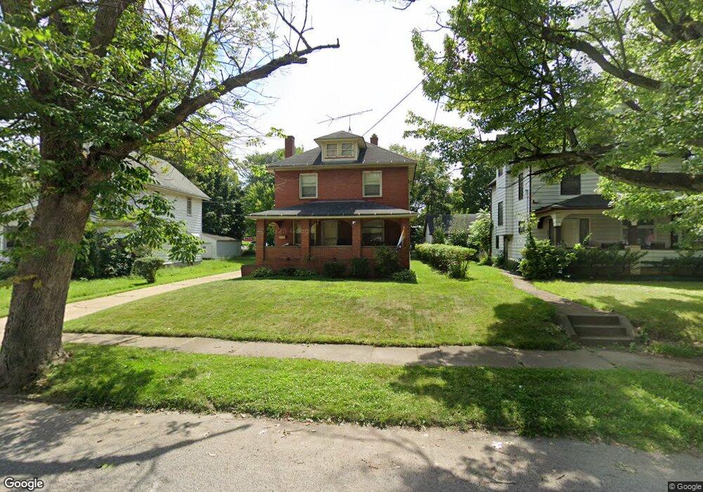
2007 S Heights Ave Youngstown, OH 44502
Buckeye Plat NeighborhoodEstimated Value: $57,000 - $97,000
3
Beds
1
Bath
1,556
Sq Ft
$49/Sq Ft
Est. Value
About This Home
This home is located at 2007 S Heights Ave, Youngstown, OH 44502 and is currently estimated at $75,641, approximately $48 per square foot. 2007 S Heights Ave is a home located in Mahoning County with nearby schools including Paul C. Bunn Elementary School, Chaney High School, and Summit Academy Secondary School - Youngstown.
Ownership History
Date
Name
Owned For
Owner Type
Purchase Details
Closed on
May 21, 2004
Sold by
Walker Lisa R
Bought by
Walker Paul and Walker Lisa R
Current Estimated Value
Home Financials for this Owner
Home Financials are based on the most recent Mortgage that was taken out on this home.
Original Mortgage
$41,785
Interest Rate
5.72%
Mortgage Type
FHA
Purchase Details
Closed on
May 6, 1997
Sold by
Jupp Nancy J
Bought by
Walker Lisa R
Purchase Details
Closed on
Feb 22, 1989
Bought by
Jupp Nancy J
Create a Home Valuation Report for This Property
The Home Valuation Report is an in-depth analysis detailing your home's value as well as a comparison with similar homes in the area
Home Values in the Area
Average Home Value in this Area
Purchase History
| Date | Buyer | Sale Price | Title Company |
|---|---|---|---|
| Walker Paul | -- | Liberty Title Company | |
| Walker Lisa R | $40,000 | -- | |
| Jupp Nancy J | -- | -- |
Source: Public Records
Mortgage History
| Date | Status | Borrower | Loan Amount |
|---|---|---|---|
| Closed | Walker Paul | $41,785 | |
| Closed | Walker Lisa R | $0 |
Source: Public Records
Tax History Compared to Growth
Tax History
| Year | Tax Paid | Tax Assessment Tax Assessment Total Assessment is a certain percentage of the fair market value that is determined by local assessors to be the total taxable value of land and additions on the property. | Land | Improvement |
|---|---|---|---|---|
| 2024 | $627 | $13,130 | $1,070 | $12,060 |
| 2023 | $622 | $13,130 | $1,070 | $12,060 |
| 2022 | $375 | $6,080 | $1,070 | $5,010 |
| 2021 | $375 | $6,080 | $1,070 | $5,010 |
| 2020 | $378 | $6,080 | $1,070 | $5,010 |
| 2019 | $384 | $5,520 | $970 | $4,550 |
| 2018 | $388 | $5,520 | $970 | $4,550 |
| 2017 | $385 | $5,520 | $970 | $4,550 |
| 2016 | $737 | $11,420 | $970 | $10,450 |
| 2015 | $722 | $11,420 | $970 | $10,450 |
| 2014 | $717 | $11,420 | $970 | $10,450 |
| 2013 | $707 | $11,420 | $970 | $10,450 |
Source: Public Records
Map
Nearby Homes
- 2007 E Midlothian Blvd
- 2016 Pointview Ave
- 1954 Everett Ave
- 0 Crescent Dr Unit 5124984
- 2020 Medford Ave
- 1928 Medford Ave
- 3509 Lenox Ave
- 2001 Brownlee Ave
- 1646 Weston Ave
- 3448 Neilson Ave
- 1653 Brownlee Ave
- 1654 Wakefield Ave
- 2562 Mount Vernon Ave
- 3337 Powers Way
- 1633 Wakefield Ave
- 2577 E Midlothian Blvd
- 4528 Sheridan Rd
- 1560 Wakefield Ave
- 3551 Shirley Rd
- 2743 Mount Vernon Ave
- 2011 S Heights Ave
- 2001 S Heights Ave
- 2017 S Heights Ave
- 2023 S Heights Ave
- 2014 S Heights Ave
- 2029 S Heights Ave
- 1941 S Heights Ave
- 2004 S Heights Ave
- 2002 S Heights Ave
- 1960 E Midlothian Blvd
- 1954 E Midlothian Blvd
- 2022 S Heights Ave
- 2033 S Heights Ave
- 1939 S Heights Ave
- 2028 E Midlothian Blvd
- 1950 S Heights Ave
- 2028 S Heights Ave
- 1946 S Heights Ave
- 3701 Irma St
- 2037 S Heights Ave