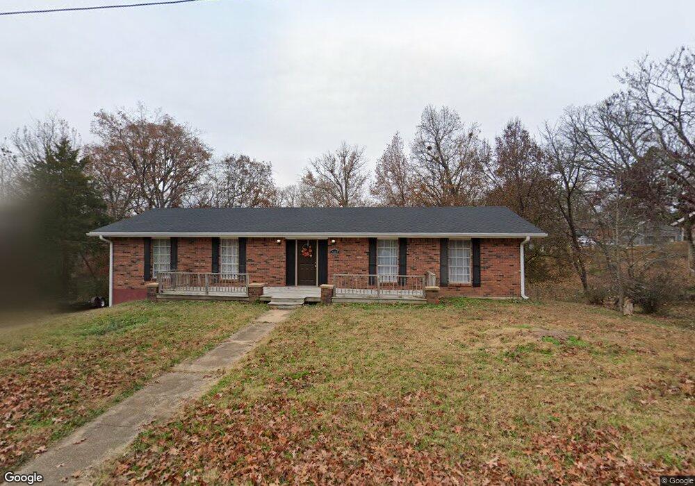
2007 Snider Rd Poplar Bluff, MO 63901
Estimated Value: $127,000 - $199,000
3
Beds
2
Baths
1,508
Sq Ft
$118/Sq Ft
Est. Value
About This Home
This home is located at 2007 Snider Rd, Poplar Bluff, MO 63901 and is currently estimated at $177,664, approximately $117 per square foot. 2007 Snider Rd is a home located in Butler County with nearby schools including O'Neal Elementary School, Poplar Bluff Fifth & Sixth Grade Center, and Poplar Bluff Junior High School.
Ownership History
Date
Name
Owned For
Owner Type
Purchase Details
Closed on
Jan 7, 2014
Sold by
Secretary Of Hud Of Washington Dc
Bought by
Allen William C and Allen Vicky J
Current Estimated Value
Purchase Details
Closed on
Jul 8, 2013
Sold by
U S Bank Na
Bought by
Secretary Of Hud Of Washington Dc
Purchase Details
Closed on
Jun 13, 2013
Sold by
Johnson Gary A and Johnson Cynthia R
Bought by
U S Bank N A
Purchase Details
Closed on
Jul 25, 2008
Sold by
Parks Wilma Case and Parks Sammie L
Bought by
Johnson Gary A and Johnson Cynthia R
Home Financials for this Owner
Home Financials are based on the most recent Mortgage that was taken out on this home.
Original Mortgage
$11,734
Interest Rate
6.36%
Mortgage Type
FHA
Create a Home Valuation Report for This Property
The Home Valuation Report is an in-depth analysis detailing your home's value as well as a comparison with similar homes in the area
Home Values in the Area
Average Home Value in this Area
Purchase History
| Date | Buyer | Sale Price | Title Company |
|---|---|---|---|
| Allen William C | -- | None Available | |
| Secretary Of Hud Of Washington Dc | -- | None Available | |
| U S Bank N A | -- | Continental Title | |
| Johnson Gary A | -- | -- |
Source: Public Records
Mortgage History
| Date | Status | Borrower | Loan Amount |
|---|---|---|---|
| Previous Owner | Johnson Gary A | $11,734 |
Source: Public Records
Tax History
| Year | Tax Paid | Tax Assessment Tax Assessment Total Assessment is a certain percentage of the fair market value that is determined by local assessors to be the total taxable value of land and additions on the property. | Land | Improvement |
|---|---|---|---|---|
| 2025 | $1,078 | $22,860 | $0 | $0 |
| 2024 | $10 | $21,340 | $0 | $0 |
| 2023 | $1,031 | $21,340 | $0 | $0 |
| 2022 | $1,000 | $20,730 | $0 | $0 |
| 2021 | $1,000 | $20,730 | $0 | $0 |
| 2020 | $946 | $19,340 | $0 | $0 |
| 2019 | $945 | $19,340 | $0 | $0 |
| 2018 | $945 | $19,340 | $0 | $0 |
| 2017 | -- | $19,340 | $0 | $0 |
| 2016 | -- | $19,340 | $0 | $0 |
| 2015 | -- | $19,340 | $0 | $0 |
| 2014 | -- | $18,230 | $0 | $0 |
| 2012 | $776 | $18,230 | $0 | $0 |
Source: Public Records
Map
Nearby Homes
- 2001 Woodhaven Rd
- 1557 Haven Hills Rd
- 1301 Lurlyn Rd
- 2001 King Rd
- 2105 Jackson Rd
- 1715 Big Bend Rd
- 1915 Old Orchard Rd
- 1723 Sunset Dr
- 2305 Lee St
- 1604 Big Bend Rd
- 2304 Lee St
- 2601 Forest View St
- 737 Price St
- 1824 Seifert Dr
- 1712 Seifert Dr
- Highway W
- 0 West St
- 00 West St
- 2418 Channon Dr
- 2462 Roxie Rd
Your Personal Tour Guide
Ask me questions while you tour the home.