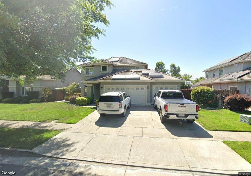
2007 Swanson Dr Escalon, CA 95320
Estimated Value: $598,494 - $649,000
4
Beds
3
Baths
2,394
Sq Ft
$261/Sq Ft
Est. Value
About This Home
This home is located at 2007 Swanson Dr, Escalon, CA 95320 and is currently estimated at $625,374, approximately $261 per square foot. 2007 Swanson Dr is a home located in San Joaquin County with nearby schools including Dent Elementary School, El Portal Middle School, and Escalon High School.
Ownership History
Date
Name
Owned For
Owner Type
Purchase Details
Closed on
Jul 12, 2004
Sold by
Westwood Country Unit 1A Llc
Bought by
Titsworth Jeremy and Titsworth Angella
Current Estimated Value
Home Financials for this Owner
Home Financials are based on the most recent Mortgage that was taken out on this home.
Original Mortgage
$280,724
Outstanding Balance
$131,257
Interest Rate
5.25%
Mortgage Type
Purchase Money Mortgage
Estimated Equity
$494,117
Create a Home Valuation Report for This Property
The Home Valuation Report is an in-depth analysis detailing your home's value as well as a comparison with similar homes in the area
Home Values in the Area
Average Home Value in this Area
Purchase History
| Date | Buyer | Sale Price | Title Company |
|---|---|---|---|
| Titsworth Jeremy | $346,454 | First Amer Title Co |
Source: Public Records
Mortgage History
| Date | Status | Borrower | Loan Amount |
|---|---|---|---|
| Open | Titsworth Jeremy | $280,724 | |
| Closed | Titsworth Jeremy | $70,181 |
Source: Public Records
Tax History
| Year | Tax Paid | Tax Assessment Tax Assessment Total Assessment is a certain percentage of the fair market value that is determined by local assessors to be the total taxable value of land and additions on the property. | Land | Improvement |
|---|---|---|---|---|
| 2025 | $5,683 | $489,097 | $146,350 | $342,747 |
| 2024 | $5,502 | $479,508 | $143,481 | $336,027 |
| 2023 | $5,341 | $470,107 | $140,668 | $329,439 |
| 2022 | $5,057 | $460,890 | $137,910 | $322,980 |
| 2021 | $5,108 | $451,854 | $135,206 | $316,648 |
| 2020 | $5,065 | $447,222 | $133,820 | $313,402 |
| 2019 | $4,978 | $438,454 | $131,197 | $307,257 |
| 2018 | $4,920 | $429,858 | $128,625 | $301,233 |
| 2017 | $4,389 | $383,000 | $115,000 | $268,000 |
| 2016 | $4,229 | $365,000 | $104,000 | $261,000 |
| 2014 | $3,594 | $310,000 | $93,000 | $217,000 |
Source: Public Records
Map
Nearby Homes
- 1970 Mchenry Ave
- 1634 Judith Way
- 1526 3rd St
- 2310 Main St
- 931 Park Ave
- 2226 Edmart St
- 1647 Jerry Ave
- 1529 Mitchell Ave
- 2322 Main St
- 1506 Mitchell Ave
- 1 Jackson
- 2505 Jackson Ave Unit 113
- 2505 Jackson Ave Unit 132
- 2505 Jackson Ave Unit 138
- 2505 Jackson Ave Unit 178
- 2505 Jackson Ave Unit 207
- 2505 Jackson Ave Unit 197
- 2505 Jackson Ave Unit 193
- 2505 Jackson Ave Unit 136
- 2505 Jackson Ave Unit 179
- 2103 Swanson Dr
- 2001 Swanson Dr
- 2019 Swanson Dr
- 1502 Countrywood Ln
- 2000 Swanson Dr
- 1965 Swanson Dr
- 1501 Countrywood Ln
- 2025 Swanson Dr
- 1506 Countrywood Ln
- 1966 Swanson Dr
- 1505 Countrywood Ln
- 1959 Swanson Dr
- 2031 Swanson Dr
- 1510 Countrywood Ln
- 1494 Countrywood Ln
- 1498 Countrywood Ln
- 1504 Sophie Ln
- 1937 Deborah Cir
- 1937 Deborah Cir
- 1949 Deborah Cir
Your Personal Tour Guide
Ask me questions while you tour the home.