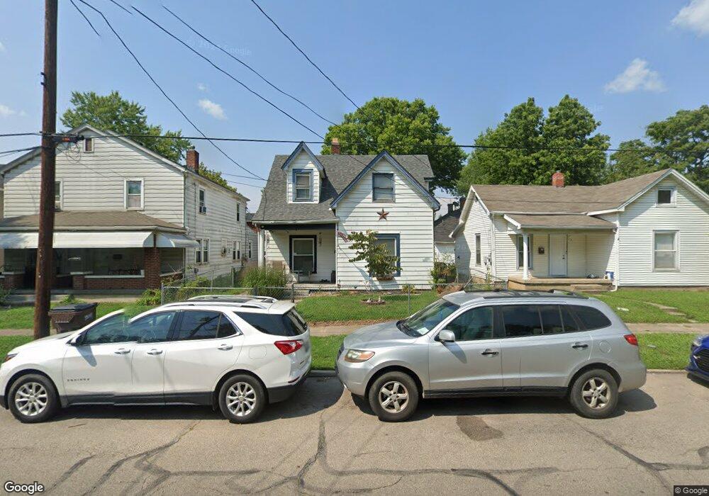
2007 Woodlawn Ave Middletown, OH 45044
Sherman NeighborhoodEstimated Value: $97,000 - $122,000
3
Beds
2
Baths
1,302
Sq Ft
$83/Sq Ft
Est. Value
About This Home
This home is located at 2007 Woodlawn Ave, Middletown, OH 45044 and is currently estimated at $107,947, approximately $82 per square foot. 2007 Woodlawn Ave is a home located in Butler County with nearby schools including Amanda Elementary School, Highview 6th Grade Center, and Middletown Middle School.
Ownership History
Date
Name
Owned For
Owner Type
Purchase Details
Closed on
Sep 28, 1998
Sold by
Shipley David H
Bought by
Landers James R and Landers Bonita L
Current Estimated Value
Home Financials for this Owner
Home Financials are based on the most recent Mortgage that was taken out on this home.
Original Mortgage
$39,366
Interest Rate
6.97%
Mortgage Type
FHA
Purchase Details
Closed on
Jun 9, 1994
Sold by
Hayes Shirley M
Bought by
Shipley David H
Purchase Details
Closed on
Apr 1, 1989
Purchase Details
Closed on
Jul 1, 1987
Create a Home Valuation Report for This Property
The Home Valuation Report is an in-depth analysis detailing your home's value as well as a comparison with similar homes in the area
Home Values in the Area
Average Home Value in this Area
Purchase History
| Date | Buyer | Sale Price | Title Company |
|---|---|---|---|
| Landers James R | $39,000 | -- | |
| Shipley David H | $38,000 | -- | |
| -- | $28,000 | -- | |
| -- | $19,500 | -- |
Source: Public Records
Mortgage History
| Date | Status | Borrower | Loan Amount |
|---|---|---|---|
| Previous Owner | Landers James R | $39,366 |
Source: Public Records
Tax History Compared to Growth
Tax History
| Year | Tax Paid | Tax Assessment Tax Assessment Total Assessment is a certain percentage of the fair market value that is determined by local assessors to be the total taxable value of land and additions on the property. | Land | Improvement |
|---|---|---|---|---|
| 2024 | $956 | $18,030 | $4,030 | $14,000 |
| 2023 | $950 | $17,980 | $4,030 | $13,950 |
| 2022 | $703 | $11,790 | $4,030 | $7,760 |
| 2021 | $676 | $11,790 | $4,030 | $7,760 |
| 2020 | $705 | $11,790 | $4,030 | $7,760 |
| 2019 | $701 | $9,670 | $4,030 | $5,640 |
| 2018 | $626 | $9,670 | $4,030 | $5,640 |
| 2017 | $627 | $9,670 | $4,030 | $5,640 |
| 2016 | $550 | $8,120 | $4,030 | $4,090 |
| 2015 | $542 | $8,120 | $4,030 | $4,090 |
| 2014 | $1,066 | $8,120 | $4,030 | $4,090 |
| 2013 | $1,066 | $17,360 | $4,030 | $13,330 |
Source: Public Records
Map
Nearby Homes
- 410 Moore St
- 408 Moore St
- 1814.5 Logan Ave
- 2124 Sherman Ave
- 319 Moore St
- 407 S Sutphin St
- 401 S Sutphin St
- 2109 Queen Ave
- 1814 Logan Ave
- 2100 Queen Ave
- 2208 Superior Ave
- 2128 Queen Ave
- 2016 Linden Ave
- 2406 S Sutphin St
- 2121 Roosevelt Blvd
- 2308 Queen Ave
- ALWICK Plan at Stonybrook - Stonybrook Crossing
- QUENTIN Plan at Stonybrook - Stonybrook Crossing
- SHELBURN Plan at Stonybrook - Stonybrook Crossing
- SAXON Plan at Stonybrook - Stonybrook Crossing
- 2003 Woodlawn Ave
- 2009 Woodlawn Ave
- 2001 Woodlawn Ave
- 2011 Woodlawn Ave
- 2013 Woodlawn Ave
- 2008 Woodlawn Ave
- 2015 Woodlawn Ave
- 523 Moore St
- 525 Moore St
- 521 Moore St
- 2017 Woodlawn Ave
- 2009 Wayne Ave
- 2002 Woodlawn Ave
- 2004 Woodlawn Ave
- 2000 Woodlawn Ave
- 517 Moore St
- 2019 Woodlawn Ave
- 2011 Wayne Ave
- 2006 Woodlawn Ave
- 515 Moore St