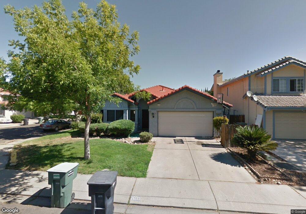
2009 Mount Hamilton Dr Modesto, CA 95358
Estimated Value: $419,000 - $458,000
3
Beds
2
Baths
1,500
Sq Ft
$297/Sq Ft
Est. Value
About This Home
This home is located at 2009 Mount Hamilton Dr, Modesto, CA 95358 and is currently estimated at $445,049, approximately $296 per square foot. 2009 Mount Hamilton Dr is a home located in Stanislaus County with nearby schools including Alberta Martone Elementary School, Roosevelt Junior High School, and Grace M. Davis High School.
Ownership History
Date
Name
Owned For
Owner Type
Purchase Details
Closed on
Jul 2, 1998
Sold by
Wikum Ronald Guy and Wikum Tina
Bought by
Swort Douglas L and Swort Catherine
Current Estimated Value
Home Financials for this Owner
Home Financials are based on the most recent Mortgage that was taken out on this home.
Original Mortgage
$112,100
Outstanding Balance
$22,134
Interest Rate
6.9%
Estimated Equity
$422,915
Create a Home Valuation Report for This Property
The Home Valuation Report is an in-depth analysis detailing your home's value as well as a comparison with similar homes in the area
Purchase History
| Date | Buyer | Sale Price | Title Company |
|---|---|---|---|
| Swort Douglas L | $118,000 | Chicago Title |
Source: Public Records
Mortgage History
| Date | Status | Borrower | Loan Amount |
|---|---|---|---|
| Open | Swort Douglas L | $112,100 |
Source: Public Records
Tax History
| Year | Tax Paid | Tax Assessment Tax Assessment Total Assessment is a certain percentage of the fair market value that is determined by local assessors to be the total taxable value of land and additions on the property. | Land | Improvement |
|---|---|---|---|---|
| 2025 | $2,044 | $181,833 | $54,860 | $126,973 |
| 2024 | $1,951 | $178,269 | $53,785 | $124,484 |
| 2023 | $1,921 | $174,775 | $52,731 | $122,044 |
| 2022 | $1,873 | $171,349 | $51,698 | $119,651 |
| 2021 | $1,760 | $167,990 | $50,685 | $117,305 |
| 2020 | $1,794 | $166,269 | $50,166 | $116,103 |
| 2019 | $1,751 | $163,010 | $49,183 | $113,827 |
| 2018 | $1,665 | $159,815 | $48,219 | $111,596 |
| 2017 | $1,624 | $156,682 | $47,274 | $109,408 |
| 2016 | $1,592 | $153,611 | $46,348 | $107,263 |
| 2015 | $1,569 | $151,304 | $45,652 | $105,652 |
| 2014 | $1,543 | $148,341 | $44,758 | $103,583 |
Source: Public Records
Map
Nearby Homes
- 1900 Berryessa Dr
- 800 Pacheco Place
- 1729 Alum Rock Ct
- 1725 Grassland Way
- 1017 Jayhawk Way
- 1131 N Rosemore Ave
- 808 Mercy Ave
- 1128 Diablo Ave
- 1412 Seneca Place
- 2425 Becker Ct
- 1520 Moccasin Dr
- 1410 Hillview Dr
- 206 Meadow Ln
- 1608 Dulwich Dr
- 1100 Mathia Dr
- 1824 California Ave
- 2701 Mozart Dr
- 301 S Emerald Ave
- 1602 Del Monte Ave
- 1721 Clayton Ave
- 2005 Mount Hamilton Dr
- 2020 Berryessa Dr
- 2001 Mount Hamilton Dr
- 2016 Berryessa Dr
- 901 Arroyo Hondo Place
- 905 Arroyo Hondo Place
- 2012 Berryessa Dr
- 2008 Mount Hamilton Dr
- 1925 Mount Hamilton Dr
- 909 Arroyo Hondo Place
- 2012 Mount Hamilton Dr
- 2004 Mount Hamilton Dr
- 2016 Mount Hamilton Dr
- 2008 Berryessa Dr
- 2000 Mount Hamilton Dr
- 913 Arroyo Hondo Place
- 1921 Mount Hamilton Dr
- 2100 Mount Hamilton Dr
- 2105 Mount Hamilton Dr
- 1924 Mount Hamilton Dr
Your Personal Tour Guide
Ask me questions while you tour the home.