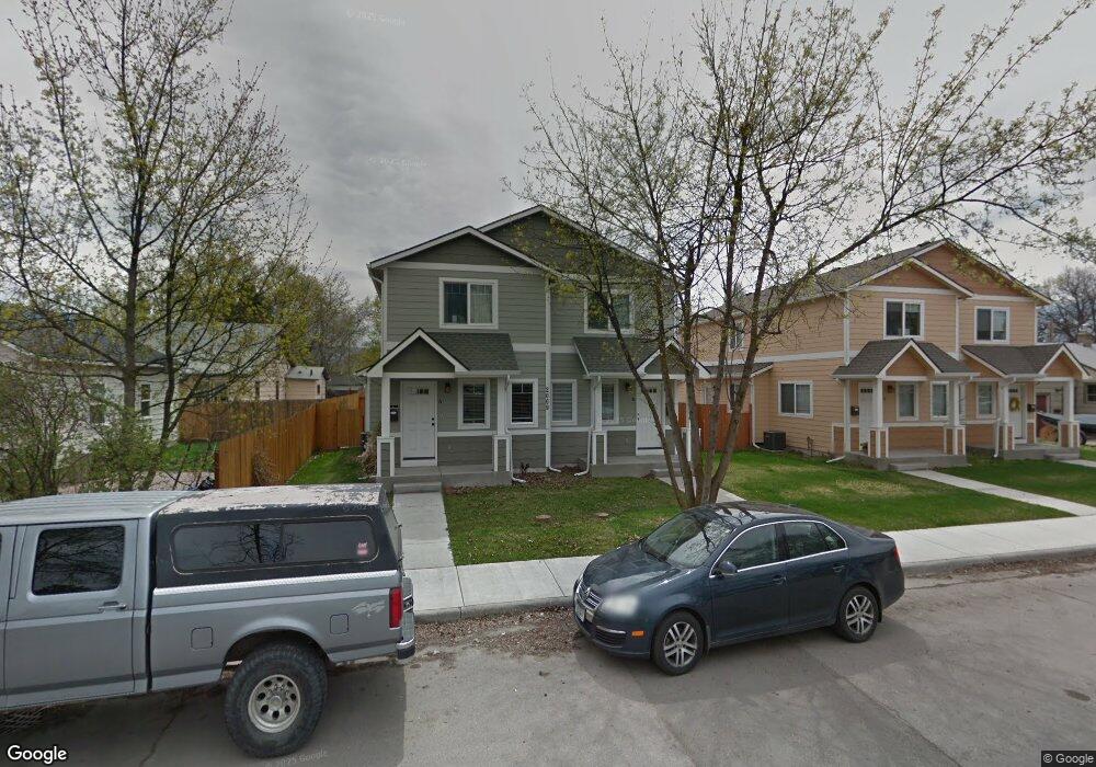
2009 S 7th St W Missoula, MT 59801
Franklin to the Fort NeighborhoodEstimated Value: $417,000 - $435,000
3
Beds
3
Baths
1,488
Sq Ft
$286/Sq Ft
Est. Value
About This Home
This home is located at 2009 S 7th St W, Missoula, MT 59801 and is currently estimated at $425,941, approximately $286 per square foot. 2009 S 7th St W is a home located in Missoula County with nearby schools including Franklin School, Porter Middle School, and Hellgate High School.
Ownership History
Date
Name
Owned For
Owner Type
Purchase Details
Closed on
May 11, 2011
Sold by
Nelson Thomas K and Nelson Mary S
Bought by
Joynt Karen N and Joiynt Stephen N
Current Estimated Value
Home Financials for this Owner
Home Financials are based on the most recent Mortgage that was taken out on this home.
Original Mortgage
$131,812
Outstanding Balance
$91,434
Interest Rate
4.84%
Mortgage Type
New Conventional
Estimated Equity
$334,507
Purchase Details
Closed on
Jun 11, 2008
Sold by
Epic Homes Llc
Bought by
Nelson Thomas K and Nelson Mary S
Create a Home Valuation Report for This Property
The Home Valuation Report is an in-depth analysis detailing your home's value as well as a comparison with similar homes in the area
Home Values in the Area
Average Home Value in this Area
Purchase History
| Date | Buyer | Sale Price | Title Company |
|---|---|---|---|
| Joynt Karen N | -- | None Available | |
| Nelson Thomas K | -- | First American Title Company |
Source: Public Records
Mortgage History
| Date | Status | Borrower | Loan Amount |
|---|---|---|---|
| Open | Joynt Karen N | $131,812 |
Source: Public Records
Tax History Compared to Growth
Tax History
| Year | Tax Paid | Tax Assessment Tax Assessment Total Assessment is a certain percentage of the fair market value that is determined by local assessors to be the total taxable value of land and additions on the property. | Land | Improvement |
|---|---|---|---|---|
| 2025 | $4,216 | $364,400 | $109,362 | $255,038 |
| 2024 | $4,044 | $332,300 | $54,600 | $277,700 |
| 2023 | $3,898 | $332,300 | $54,600 | $277,700 |
| 2022 | $3,402 | $251,600 | $0 | $0 |
| 2021 | $3,057 | $251,600 | $0 | $0 |
| 2020 | $2,922 | $223,200 | $0 | $0 |
| 2019 | $2,912 | $223,200 | $0 | $0 |
| 2018 | $2,742 | $204,400 | $0 | $0 |
| 2017 | $2,696 | $204,400 | $0 | $0 |
| 2016 | $2,461 | $194,900 | $0 | $0 |
| 2015 | $2,277 | $194,900 | $0 | $0 |
| 2014 | $1,790 | $86,231 | $0 | $0 |
Source: Public Records
Map
Nearby Homes
- 940 Kemp St Unit A
- 920 S Johnson St
- 1941 S 8th St W
- 1936 S 7th St W
- 2002 S 6th St W Unit 102
- 2004 S 10th St W
- 1815 S 8th St W
- 2225 S 8th St W
- 2223 S 5th St W
- 1854 S 4th St W
- 1310 Linnea Ln
- 2214 S 12th St W
- 1935 S 12th St W
- 2216 S 12th St W
- 1635 S 8th St W
- 2004 S 13th St W
- 1733 S 11th St W
- NHN S 13th St W Unit Lot 9A
- 2220 S 13th St W
- 2337 S 3rd St W Unit 7
- 2009 S 7th St W
- 2009 S 7th St W Unit b
- 2009 S 7th St W Unit A
- 2009 S 7th St W Unit B
- 2011 S 7th St W
- 2011 S 7th St W
- 2011 S 7th St W Unit B
- 2011 S 7th St W Unit A
- 919 S Johnson St
- 2005 S 7th St W
- 2019A S 7th St W
- 2019 S 7th St W
- 929 S Johnson St
- 2015 S 7th St W
- 2000 S 7th St W
- 2019 S 7th St W Unit B
- 2019 S 7th St W Unit A
- 2019 B S 7th
- 2019 S 7th St W
- 2019 S 7th St W Unit A