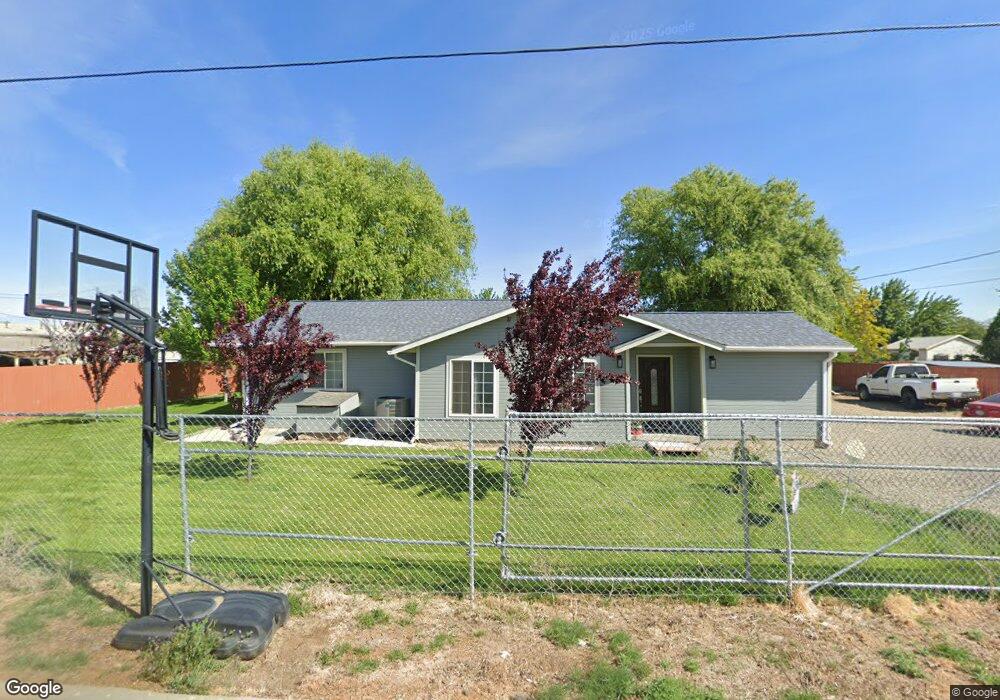
201 Aster Ln Wapato, WA 98951
Estimated Value: $301,000 - $340,496
3
Beds
2
Baths
1,565
Sq Ft
$206/Sq Ft
Est. Value
About This Home
This home is located at 201 Aster Ln, Wapato, WA 98951 and is currently estimated at $322,374, approximately $205 per square foot. 201 Aster Ln is a home located in Yakima County with nearby schools including Camas Elementary School, Satus Elementary School, and Adams Elementary School.
Ownership History
Date
Name
Owned For
Owner Type
Purchase Details
Closed on
Feb 24, 2006
Sold by
Torres Jose
Bought by
Mojica Valeria M
Current Estimated Value
Home Financials for this Owner
Home Financials are based on the most recent Mortgage that was taken out on this home.
Original Mortgage
$86,300
Outstanding Balance
$48,513
Interest Rate
6.08%
Mortgage Type
Fannie Mae Freddie Mac
Estimated Equity
$273,861
Purchase Details
Closed on
Jan 26, 2006
Sold by
Goode Gail and Estate Of Dick L Brestar
Bought by
Mojica Valeria M
Home Financials for this Owner
Home Financials are based on the most recent Mortgage that was taken out on this home.
Original Mortgage
$86,300
Outstanding Balance
$48,513
Interest Rate
6.08%
Mortgage Type
Fannie Mae Freddie Mac
Estimated Equity
$273,861
Create a Home Valuation Report for This Property
The Home Valuation Report is an in-depth analysis detailing your home's value as well as a comparison with similar homes in the area
Home Values in the Area
Average Home Value in this Area
Purchase History
| Date | Buyer | Sale Price | Title Company |
|---|---|---|---|
| Mojica Valeria M | -- | First American Title Comp | |
| Mojica Valeria M | $89,000 | First American Title Comp |
Source: Public Records
Mortgage History
| Date | Status | Borrower | Loan Amount |
|---|---|---|---|
| Open | Mojica Valeria M | $86,300 | |
| Closed | Mojica Valeria M | $86,300 |
Source: Public Records
Tax History Compared to Growth
Tax History
| Year | Tax Paid | Tax Assessment Tax Assessment Total Assessment is a certain percentage of the fair market value that is determined by local assessors to be the total taxable value of land and additions on the property. | Land | Improvement |
|---|---|---|---|---|
| 2025 | $3,369 | $337,200 | $97,600 | $239,600 |
| 2023 | $2,274 | $271,900 | $45,300 | $226,600 |
| 2022 | $1,956 | $187,200 | $47,400 | $139,800 |
| 2021 | $1,796 | $168,900 | $42,700 | $126,200 |
| 2019 | $1,433 | $127,400 | $35,900 | $91,500 |
| 2018 | $1,537 | $125,600 | $35,200 | $90,400 |
| 2017 | $1,406 | $121,900 | $35,200 | $86,700 |
| 2016 | $1,332 | $121,000 | $35,100 | $85,900 |
| 2015 | $1,332 | $115,600 | $35,100 | $80,500 |
| 2014 | $1,332 | $116,350 | $34,650 | $81,700 |
| 2013 | $1,332 | $116,350 | $34,650 | $81,700 |
Source: Public Records
Map
Nearby Homes
- 260 Truck Garden Ln
- 604 W 4th St
- 213 W C St
- nka W Rd
- 703 S Naches Ave
- 2284 Ashue Rd
- 115 E Elizabeth St
- nka Lateral A Prgrssve Rd Rd
- 221 Skone Way
- 4820 Lateral A Rd
- NNA Fort Rd Unit Fort Rd/Lateral B Rd
- 1423 Progressive Rd
- NKA Knights Lane Campbell Rd
- 100 Gordon Ln
- 481 W Parker Heights Rd
- 1601 Lateral B Rd
- NKA Branch Rd
- 240 Main St
- 281 Lateral C Rd
- 300 E Martin Ln