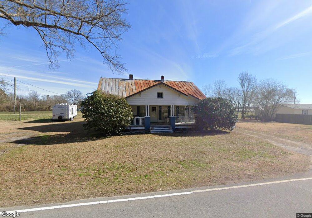
201 Banks Bridge Rd Richlands, NC 28574
Estimated Value: $227,000 - $273,000
4
Beds
2
Baths
2,034
Sq Ft
$124/Sq Ft
Est. Value
About This Home
This home is located at 201 Banks Bridge Rd, Richlands, NC 28574 and is currently estimated at $251,390, approximately $123 per square foot. 201 Banks Bridge Rd is a home located in Onslow County with nearby schools including Richlands Elementary School, Trexler Middle School, and Richlands High School.
Ownership History
Date
Name
Owned For
Owner Type
Purchase Details
Closed on
Mar 7, 2011
Sold by
Smith Donnie and Smith Linda
Bought by
Smith Donnie R and Smith Christina C
Current Estimated Value
Purchase Details
Closed on
Jan 31, 2011
Sold by
Smith Donnie and Smith Linda
Bought by
Smith Donnie R and Smith Christina C
Purchase Details
Closed on
Sep 29, 2006
Sold by
Mattocks Douglas B
Bought by
Mattocks Lori C
Purchase Details
Closed on
May 10, 2006
Sold by
Williams Wade Ferguson and Williams Janice
Bought by
Williams Allen Dean
Purchase Details
Closed on
Jul 30, 1999
Bought by
Owens Richard E and Jamesina Ros
Create a Home Valuation Report for This Property
The Home Valuation Report is an in-depth analysis detailing your home's value as well as a comparison with similar homes in the area
Home Values in the Area
Average Home Value in this Area
Purchase History
| Date | Buyer | Sale Price | Title Company |
|---|---|---|---|
| Smith Donnie R | -- | None Available | |
| Smith Donnie R | -- | None Available | |
| Mattocks Lori C | -- | None Available | |
| Williams Allen Dean | -- | None Available | |
| Owens Richard E | -- | -- |
Source: Public Records
Tax History Compared to Growth
Tax History
| Year | Tax Paid | Tax Assessment Tax Assessment Total Assessment is a certain percentage of the fair market value that is determined by local assessors to be the total taxable value of land and additions on the property. | Land | Improvement |
|---|---|---|---|---|
| 2025 | $645 | $98,493 | $28,130 | $70,363 |
| 2024 | $645 | $98,493 | $28,130 | $70,363 |
| 2023 | $645 | $98,493 | $28,130 | $70,363 |
| 2022 | $645 | $98,493 | $28,130 | $70,363 |
| 2021 | $491 | $69,580 | $20,630 | $48,950 |
| 2020 | $491 | $69,580 | $20,630 | $48,950 |
| 2019 | $491 | $69,580 | $20,630 | $48,950 |
| 2018 | $491 | $69,580 | $20,630 | $48,950 |
| 2017 | $447 | $66,260 | $20,630 | $45,630 |
| 2016 | $447 | $66,260 | $0 | $0 |
| 2015 | $447 | $66,260 | $0 | $0 |
| 2014 | $447 | $66,260 | $0 | $0 |
Source: Public Records
Map
Nearby Homes
- 580 Koonce Fork Rd
- 722 Greenwich Place
- Plan 1522 at Waverly Place
- Plan 1830 at Waverly Place
- Plan 2604 at Waverly Place
- Plan 1727 at Waverly Place
- Plan 1634 at Waverly Place
- 751 Greenwich Place
- Plan 1434 at Waverly Place
- Plan 3105 at Waverly Place
- 745 Greenwich Place
- 749 Greenwich Place
- 601 Central Park Way
- 226 Beulaville Hwy
- 149 Huffmantown Rd
- 100 Buckhaven Dr
- 1070 Gregory Fork Rd
- 978 Kinston Hwy
- 202 Quarry Trail
- 113 Woodwater Dr
- 207 Banks Bridge Rd
- 213 Banks Bridge Rd
- 206 Banks Bridge Rd
- 172 Banks Bridge Rd
- 119 Farmall Dr
- 246 Banks Bridge Rd
- 150 Apodaca Ln
- 154 Banks Bridge Rd
- 212 Banks Bridge Rd
- 146 Apodaca Ln
- 252 Banks Bridge Rd
- 513 Koonce Fork Rd
- 126 Farmall Dr
- 140 Banks Bridge Rd
- 262 Banks Bridge Rd
- 563 Koonce Fork Rd
- 261 Banks Bridge Rd
- 565 Koonce Fork Rd
- 117 Davasher Dr
- 267 Banks Bridge Rd