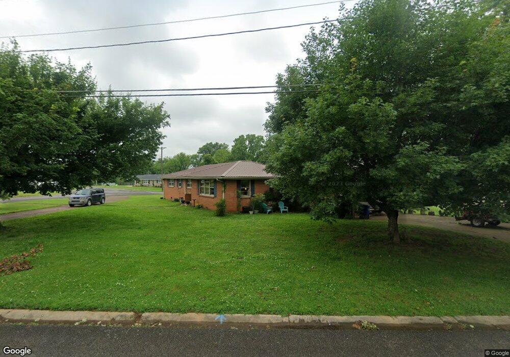
201 Fairlane Dr Shelbyville, TN 37160
Estimated Value: $304,733 - $444,000
--
Bed
2
Baths
2,527
Sq Ft
$156/Sq Ft
Est. Value
About This Home
This home is located at 201 Fairlane Dr, Shelbyville, TN 37160 and is currently estimated at $393,183, approximately $155 per square foot. 201 Fairlane Dr is a home located in Bedford County with nearby schools including East Side Elementary School, Harris Middle School, and Christian Chapel Academy.
Ownership History
Date
Name
Owned For
Owner Type
Purchase Details
Closed on
Sep 3, 2010
Sold by
Bennett David R
Bought by
Lfc Asset Recovery Inc
Current Estimated Value
Purchase Details
Closed on
Aug 19, 2010
Sold by
Idso David L
Bought by
Freeman Ernest J
Purchase Details
Closed on
Apr 9, 2010
Sold by
Allen Dorothy M
Bought by
Idso David L
Purchase Details
Closed on
Jun 18, 2009
Sold by
Allen Dorothy M
Bought by
Allen Ralph
Purchase Details
Closed on
Nov 1, 1976
Bought by
Allen Richard T and Allen Dorothy M
Purchase Details
Closed on
Nov 18, 1961
Create a Home Valuation Report for This Property
The Home Valuation Report is an in-depth analysis detailing your home's value as well as a comparison with similar homes in the area
Home Values in the Area
Average Home Value in this Area
Purchase History
| Date | Buyer | Sale Price | Title Company |
|---|---|---|---|
| Lfc Asset Recovery Inc | $17,500 | -- | |
| Freeman Ernest J | $185,000 | -- | |
| Idso David L | $110,000 | -- | |
| Allen Ralph | -- | -- | |
| Allen Richard T | -- | -- | |
| -- | -- | -- |
Source: Public Records
Tax History Compared to Growth
Tax History
| Year | Tax Paid | Tax Assessment Tax Assessment Total Assessment is a certain percentage of the fair market value that is determined by local assessors to be the total taxable value of land and additions on the property. | Land | Improvement |
|---|---|---|---|---|
| 2025 | -- | $61,575 | $0 | $0 |
| 2024 | -- | $61,575 | $9,450 | $52,125 |
| 2023 | $2,343 | $61,575 | $9,450 | $52,125 |
| 2022 | $2,411 | $61,575 | $9,450 | $52,125 |
| 2021 | $2,189 | $61,575 | $9,450 | $52,125 |
| 2020 | $2,012 | $61,575 | $9,450 | $52,125 |
| 2019 | $2,012 | $45,425 | $6,750 | $38,675 |
| 2018 | $1,967 | $45,425 | $6,750 | $38,675 |
| 2017 | $1,967 | $45,425 | $6,750 | $38,675 |
| 2016 | $1,949 | $45,425 | $6,750 | $38,675 |
| 2015 | $1,949 | $45,425 | $6,750 | $38,675 |
| 2014 | $1,799 | $45,901 | $0 | $0 |
Source: Public Records
Map
Nearby Homes
- 407 Dow Dr
- 1030 Union St
- 309 Honeysuckle Ln
- 223 Megan Cir
- 402 Rose Ln
- 1615 Elevation ABC Plan at Wheatfield
- 1567 Elevation ABC Plan at Wheatfield
- 122 Laurelwood Dr
- 225 Republic St
- 227 Republic St
- 119 Millet St
- 232 Republic St
- 226 Republic St
- 228 Republic St
- 410 Dover St
- 118 Millet St
- 130 Horseshoe Dr
- 102 Greystone Way
- 229 Millet St
- 101 Briar Patch Dr