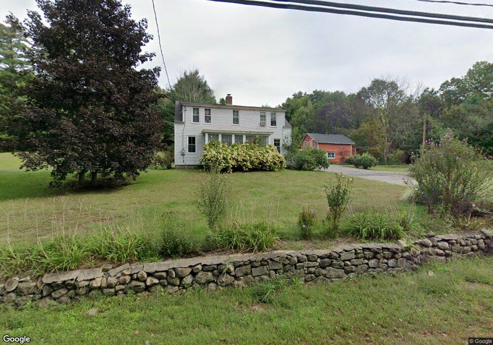
201 Goffstown Back Rd Goffstown, NH 03045
Estimated Value: $481,406 - $601,000
4
Beds
2
Baths
1,968
Sq Ft
$277/Sq Ft
Est. Value
About This Home
This home is located at 201 Goffstown Back Rd, Goffstown, NH 03045 and is currently estimated at $544,352, approximately $276 per square foot. 201 Goffstown Back Rd is a home with nearby schools including Mountain View Middle School, Goffstown High School, and Polaris Charter School.
Ownership History
Date
Name
Owned For
Owner Type
Purchase Details
Closed on
Jan 16, 2024
Sold by
Peace James S and Peace Kimberly R
Bought by
Peace
Current Estimated Value
Purchase Details
Closed on
Dec 1, 2000
Sold by
Dieteman Gregory
Bought by
Peace James S and Peace Kimberly R
Home Financials for this Owner
Home Financials are based on the most recent Mortgage that was taken out on this home.
Original Mortgage
$144,000
Interest Rate
7.76%
Mortgage Type
Purchase Money Mortgage
Purchase Details
Closed on
Jul 24, 1997
Sold by
Scruton John F and Scruton Sandra G
Bought by
Dietman Gregory and Dietman Kimberly
Home Financials for this Owner
Home Financials are based on the most recent Mortgage that was taken out on this home.
Original Mortgage
$115,770
Interest Rate
7.7%
Mortgage Type
Purchase Money Mortgage
Create a Home Valuation Report for This Property
The Home Valuation Report is an in-depth analysis detailing your home's value as well as a comparison with similar homes in the area
Home Values in the Area
Average Home Value in this Area
Purchase History
| Date | Buyer | Sale Price | Title Company |
|---|---|---|---|
| Peace | -- | None Available | |
| Peace James S | $160,000 | -- | |
| Dietman Gregory | $113,500 | -- |
Source: Public Records
Mortgage History
| Date | Status | Borrower | Loan Amount |
|---|---|---|---|
| Previous Owner | Dietman Gregory | $188,800 | |
| Previous Owner | Dietman Gregory | $175,000 | |
| Previous Owner | Dietman Gregory | $144,000 | |
| Previous Owner | Dietman Gregory | $115,770 |
Source: Public Records
Tax History Compared to Growth
Tax History
| Year | Tax Paid | Tax Assessment Tax Assessment Total Assessment is a certain percentage of the fair market value that is determined by local assessors to be the total taxable value of land and additions on the property. | Land | Improvement |
|---|---|---|---|---|
| 2024 | $7,520 | $367,900 | $174,100 | $193,800 |
| 2023 | $6,939 | $367,900 | $174,100 | $193,800 |
| 2022 | $6,422 | $244,100 | $113,400 | $130,700 |
| 2021 | $6,059 | $244,100 | $113,400 | $130,700 |
| 2020 | $6,059 | $244,100 | $113,400 | $130,700 |
| 2019 | $6,000 | $244,100 | $113,400 | $130,700 |
| 2018 | $4,540 | $244,100 | $113,400 | $130,700 |
| 2017 | $5,670 | $206,800 | $93,800 | $113,000 |
| 2016 | $5,466 | $206,800 | $93,800 | $113,000 |
| 2015 | $5,269 | $187,100 | $79,000 | $108,100 |
| 2014 | $4,698 | $174,000 | $79,000 | $95,000 |
Source: Public Records
Map
Nearby Homes
- 53 Rachael Cir
- 16 Roger Rd
- 243 Donald Dr
- 11-1 Chatel Rd
- 76 Donald Dr
- 4 Arabian Ct Unit B
- 5 Mustang Ct
- 4 Chip St
- 4B Dearborn Cir
- 3D Dearborn Cir
- 3B Dearborn Cir
- 3A Dearborn Cir
- 0 Mast Rd Unit 49 5054665
- 1306 Goffstown Rd Unit 9
- 46 Moose Club Park Rd
- 2 Shore Dr
- 115 Moose Club Park Rd
- 11 Timberwood Dr Unit 206
- 1021 Goffstown Rd
- 22 Peppermint St
- 212 Goffstown Back Rd
- 191 Goffstown Back Rd
- 233 Goffstown Back Rd
- 23 Mathew Cir
- 46 Country Way
- 63 Rachael Cir
- 21 Mathew Cir
- 12 Mathew Cir
- 25 Rachael Cir
- 76 Country Way
- 12 Rachael Cir
- 67 Country Way
- 13 Rachael Cir
- 76 Rachael Cir
- 54 Country Way
- 27 Mathew Cir
- 71 Country Way
- 9 Rachael Cir
- 22 Rachael Cir
- 30 Mathew Cir