
Seller's Agent in 2025
Julie Chown
RE/MAX Affiliates
(319) 430-6825
123 Total Sales
Estimated Value: $212,541 - $241,000
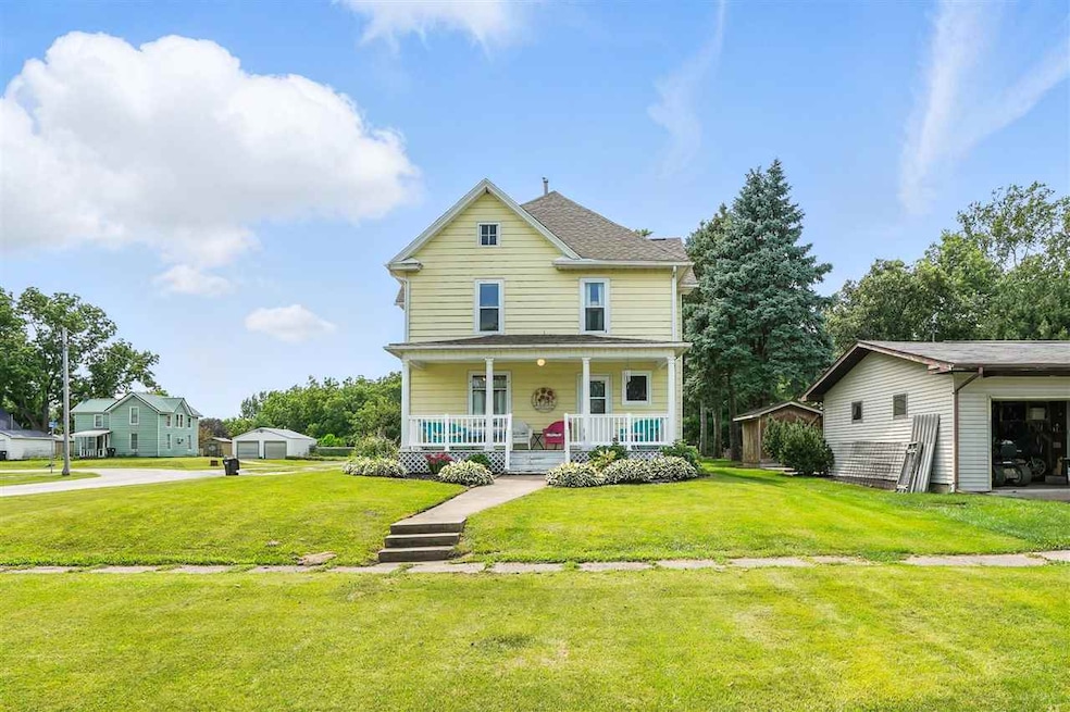
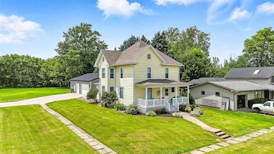
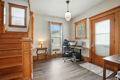
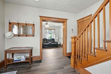
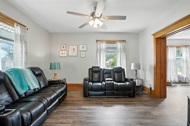
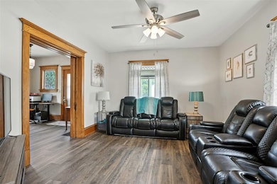
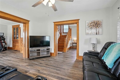
Step into timeless beauty with this beautifully maintained 2 story home featuring stunning original woodwork, built-ins, and thoughtful updates throughout. Nestled on a generous 0.57 acre lot, this property offers space, style and functionality. There is a spacious layout with 4 bedrooms and 2 full baths. Enjoy a tastefully updated kitchen with modern touches. Newer flooring combines with wood floors throughout for a fresh, cohesive feel. The main floor bath & laundry room is newly renovated for added convenience. Recent mechanical upgrades include a new water heater and HVAC system (approx. 5 years old). Bonus feature: Massive 30' X 48' garage/shop, perfect for hobbies, storage, or small business use. Prime location just 25 minutes to Iowa City and only 20 minutes to Muscatine. A quick 15 minute drive to Riverside Casino and the renowned Blue Top Ridge Golf Course-plus easy access to shopping, dining, and entertainment options. Peaceful location offering room to breathe and entertain!
| Date | Buyer | Sale Price | Title Company |
|---|---|---|---|
| Kloser Brian J | $110,000 | None Available |
| Date | Status | Borrower | Loan Amount |
|---|---|---|---|
| Open | Kloser Brian J | $114,240 |
| Date | Event | Price | List to Sale | Price per Sq Ft |
|---|---|---|---|---|
| 08/28/2025 08/28/25 | Sold | $224,900 | 0.0% | $108 / Sq Ft |
| 07/07/2025 07/07/25 | For Sale | $224,900 | -- | $108 / Sq Ft |
| Year | Tax Paid | Tax Assessment Tax Assessment Total Assessment is a certain percentage of the fair market value that is determined by local assessors to be the total taxable value of land and additions on the property. | Land | Improvement |
|---|---|---|---|---|
| 2025 | $2,625 | $176,730 | $13,030 | $163,700 |
| 2024 | $2,625 | $175,980 | $13,030 | $162,950 |
| 2023 | $251 | $160,950 | $13,006 | $147,944 |
| 2022 | $2,517 | $158,220 | $12,270 | $145,950 |
| 2021 | $2,747 | $136,310 | $12,270 | $124,040 |
| 2020 | $2,784 | $128,790 | $12,270 | $116,520 |
| 2019 | $2,848 | $125,570 | $0 | $0 |
| 2018 | $2,109 | $104,070 | $0 | $0 |
| 2017 | $1,758 | $107,030 | $0 | $0 |
| 2016 | $1,862 | $107,030 | $0 | $0 |
| 2015 | $1,862 | $97,350 | $0 | $0 |
| 2014 | $1,684 | $97,350 | $0 | $0 |
Seller's Agent in 2025
Julie Chown
RE/MAX Affiliates
(319) 430-6825
123 Total Sales
Source: Iowa City Area Association of REALTORS®
MLS Number: 202504390
APN: 0616229011
Disclaimer: Certain information contained herein is derived from information provided by parties other than Homes.com. All information provided is deemed reliable, but is not guaranteed to be accurate and should be independently verified.
![]() IDX information is provided exclusively for consumers’ personal, non-commercial use, that it may not be used for any purpose other than to identify prospective properties consumers may be interested in purchasing.
IDX information is provided exclusively for consumers’ personal, non-commercial use, that it may not be used for any purpose other than to identify prospective properties consumers may be interested in purchasing.
Listing information is deemed reliable, but not guaranteed accurate by the MLS.