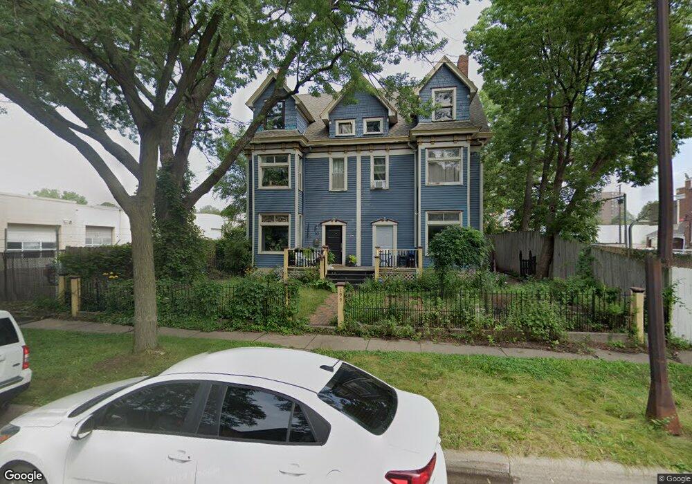
201 McBoal St Saint Paul, MN 55102
West Seventh NeighborhoodEstimated Value: $297,000 - $381,000
3
Beds
2
Baths
2,897
Sq Ft
$117/Sq Ft
Est. Value
About This Home
This home is located at 201 McBoal St, Saint Paul, MN 55102 and is currently estimated at $339,126, approximately $117 per square foot. 201 McBoal St is a home located in Ramsey County with nearby schools including Jackson Elementary, Maxfield Magnet Elementary School, and Hidden River Middle School.
Ownership History
Date
Name
Owned For
Owner Type
Purchase Details
Closed on
Jun 20, 2017
Sold by
Swanson Jason R and Swanson Katie A
Bought by
Vingers Andrea Cassandra and Thomas Daniel A
Current Estimated Value
Home Financials for this Owner
Home Financials are based on the most recent Mortgage that was taken out on this home.
Original Mortgage
$17,600
Outstanding Balance
$14,640
Interest Rate
4.02%
Estimated Equity
$324,486
Purchase Details
Closed on
May 1, 2006
Sold by
Henning Patrice M
Bought by
Swanson Jason R and Swanson Katie A
Purchase Details
Closed on
Jan 22, 1999
Sold by
Somers David A and Somers Lenora A
Bought by
Henning Patrice M
Create a Home Valuation Report for This Property
The Home Valuation Report is an in-depth analysis detailing your home's value as well as a comparison with similar homes in the area
Home Values in the Area
Average Home Value in this Area
Purchase History
| Date | Buyer | Sale Price | Title Company |
|---|---|---|---|
| Vingers Andrea Cassandra | $263,757 | Global Closing & Title Servi | |
| Swanson Jason R | $226,500 | -- | |
| Henning Patrice M | $126,500 | -- |
Source: Public Records
Mortgage History
| Date | Status | Borrower | Loan Amount |
|---|---|---|---|
| Open | Vingers Andrea Cassandra | $17,600 |
Source: Public Records
Tax History Compared to Growth
Tax History
| Year | Tax Paid | Tax Assessment Tax Assessment Total Assessment is a certain percentage of the fair market value that is determined by local assessors to be the total taxable value of land and additions on the property. | Land | Improvement |
|---|---|---|---|---|
| 2025 | $4,652 | $287,400 | $1,000 | $286,400 |
| 2023 | $4,652 | $280,100 | $1,000 | $279,100 |
| 2022 | $4,296 | $272,400 | $1,000 | $271,400 |
| 2021 | $4,288 | $266,500 | $1,000 | $265,500 |
| 2020 | $4,406 | $259,000 | $1,000 | $258,000 |
| 2019 | $4,178 | $255,900 | $1,000 | $254,900 |
| 2018 | $3,000 | $251,300 | $1,000 | $250,300 |
| 2017 | $2,802 | $192,300 | $1,000 | $191,300 |
| 2016 | $3,238 | $0 | $0 | $0 |
| 2015 | $3,254 | $201,500 | $20,200 | $181,300 |
| 2014 | $3,336 | $0 | $0 | $0 |
Source: Public Records
Map
Nearby Homes
- 212 McBoal St
- 89 Douglas St
- 275 Cliff St
- 310 Ryan Ave
- 360 Sherman St Unit 1607
- 185 Elm St
- 311 Pleasant Ave Unit 301
- 190 Elm St
- 312 Spring St Unit 309
- 175 Sherman St Unit 204
- 283 Irvine Ave
- 294 Spring St
- 383 Grand Ave Unit 1
- 383 Grand Ave Unit 9
- 256 Spring St Unit 413
- 5 Irvine Park Unit 5B
- 380 Ramsey St Unit 1B
- 391 Grand Ave Unit 304
- 398 Banfil St
- 240 Spring St Unit 303
- 201 McBoal St Unit 2
- 201 McBoal St Unit 3
- 199 McBoal St Unit 1
- 199 199 McBoal St
- 201 201 McBoal-street-
- 201 201 McBoal St
- 208 McBoal St
- 192 McBoal St
- 202 McBoal St
- 186 McBoal St Unit 186
- 85 Leech St Unit 85
- 83 Leech St Unit 83
- 194 McBoal St
- 424 Smith Ave N
- 72 Leech St
- 68 Leech St
- 58 Leech St
- 56 Leech St
- 95 Leech St Unit 95
- 93 Leech St Unit 93