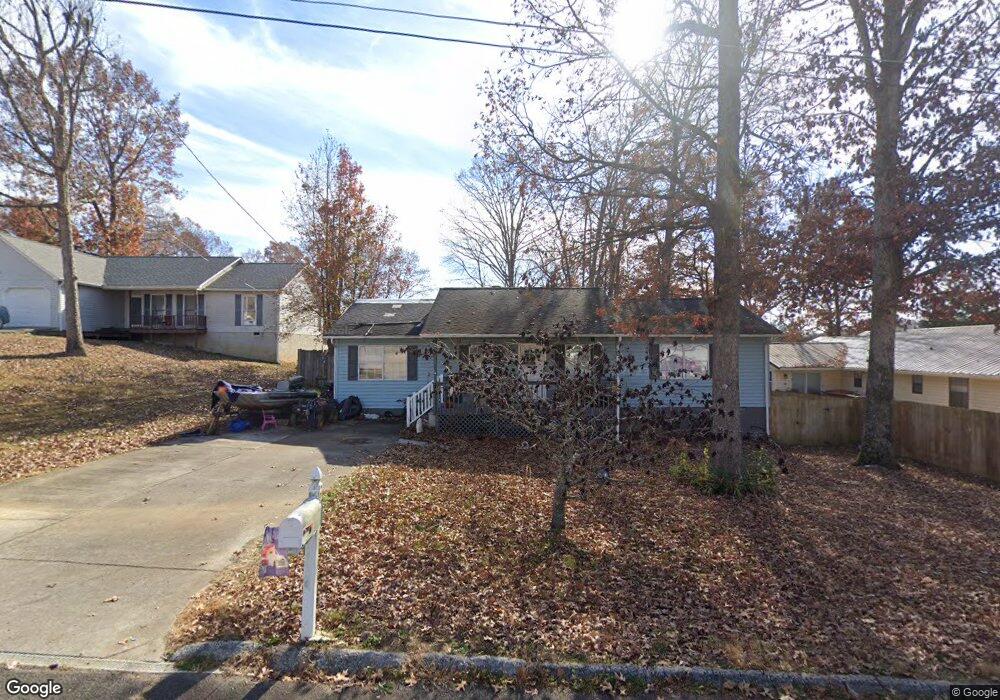
201 Parrot Ln Clinton, TN 37716
East Clinton NeighborhoodEstimated Value: $252,555 - $334,000
--
Bed
2
Baths
1,444
Sq Ft
$210/Sq Ft
Est. Value
About This Home
This home is located at 201 Parrot Ln, Clinton, TN 37716 and is currently estimated at $302,889, approximately $209 per square foot. 201 Parrot Ln is a home located in Anderson County with nearby schools including Norris Elementary School.
Ownership History
Date
Name
Owned For
Owner Type
Purchase Details
Closed on
May 10, 2019
Sold by
Bradshaw Tammy Gray and Gray Tammy Sue
Bought by
Adams Timothy Paul and Adams Brittany Kenya
Current Estimated Value
Home Financials for this Owner
Home Financials are based on the most recent Mortgage that was taken out on this home.
Original Mortgage
$165,938
Outstanding Balance
$144,904
Interest Rate
3.87%
Mortgage Type
FHA
Estimated Equity
$157,985
Purchase Details
Closed on
Jan 3, 2017
Sold by
Brown Kent C
Bought by
Brown Gray Tammy Sue Aka Tammy
Home Financials for this Owner
Home Financials are based on the most recent Mortgage that was taken out on this home.
Original Mortgage
$50,000
Interest Rate
4.03%
Mortgage Type
Unknown
Purchase Details
Closed on
Jul 8, 1998
Sold by
Ferry Dan H
Bought by
Brown Kent C
Purchase Details
Closed on
Sep 20, 1996
Bought by
Ferry Dan H and Ferry Wife Terri E
Purchase Details
Closed on
Nov 13, 1991
Bought by
Montaque Agnes J and Spicer Wilber J
Purchase Details
Closed on
Aug 6, 1991
Bought by
Architectural Building Corporation
Create a Home Valuation Report for This Property
The Home Valuation Report is an in-depth analysis detailing your home's value as well as a comparison with similar homes in the area
Home Values in the Area
Average Home Value in this Area
Purchase History
| Date | Buyer | Sale Price | Title Company |
|---|---|---|---|
| Adams Timothy Paul | $169,000 | Broadway Title Inc | |
| Brown Gray Tammy Sue Aka Tammy | -- | -- | |
| Gray Tammy Sue | $50,000 | None Available | |
| Brown Kent C | $81,000 | -- | |
| Ferry Dan H | $63,800 | -- | |
| Montaque Agnes J | $63,000 | -- | |
| Architectural Building Corporation | $9,400 | -- |
Source: Public Records
Mortgage History
| Date | Status | Borrower | Loan Amount |
|---|---|---|---|
| Open | Adams Timothy Paul | $165,938 | |
| Previous Owner | Gray Tammy Sue | $50,000 |
Source: Public Records
Tax History Compared to Growth
Tax History
| Year | Tax Paid | Tax Assessment Tax Assessment Total Assessment is a certain percentage of the fair market value that is determined by local assessors to be the total taxable value of land and additions on the property. | Land | Improvement |
|---|---|---|---|---|
| 2024 | $1,136 | $43,200 | $8,750 | $34,450 |
| 2023 | $1,136 | $43,200 | $0 | $0 |
| 2022 | $1,136 | $43,200 | $8,750 | $34,450 |
| 2021 | $1,136 | $43,200 | $8,750 | $34,450 |
| 2020 | $826 | $43,200 | $8,750 | $34,450 |
| 2019 | $856 | $29,600 | $5,625 | $23,975 |
| 2018 | $826 | $29,600 | $5,625 | $23,975 |
| 2017 | $826 | $29,600 | $5,625 | $23,975 |
| 2016 | $826 | $29,600 | $5,625 | $23,975 |
| 2015 | -- | $29,600 | $5,625 | $23,975 |
| 2014 | -- | $29,600 | $5,625 | $23,975 |
| 2013 | -- | $29,875 | $0 | $0 |
Source: Public Records
Map
Nearby Homes
- 124 Pheasant Rd
- 229 Doe Run Blvd
- 6 Lilac Ct
- 604 Bear Cub Ln
- 103 Witt Ct
- 380 Hillvale Rd
- 390 Hillvale Rd
- 400 Hillvale Rd
- 2025 N Charles G Seivers Blvd
- 500 Miller Rd
- 145 Grace Cir
- 149 Mike Miller Ln
- 221 Miller Rd
- 103 Wilson Ln
- 541 Hillvale Rd
- 703 Saulsbury Ln
- 707 Saulsbury Ln
- 702 Saulsbury Ln
- 711 Saulsbury Ln
- 0 Hillvale Rd
- 205 Parrot Ln
- 105 Pheasant Rd
- 102 Quail Run Ct
- 100 Quail Run Ct
- 207 Parrot Ln
- 202 Parrot Ln
- 200 Parrot Ln
- 104 Pheasant Rd
- 106 Pheasant Rd
- 209 Parrot Ln
- 204 Parrot Ln
- 108 Pheasant Rd
- 206 Parrot Ln
- 102 Pheasant Rd
- 111 Pheasant Rd
- 211 Parrot Ln
- 106 Quail Run Ct
- 110 Pheasant Rd
- 100 Pheasant Rd
- 101 Quail Run Ct