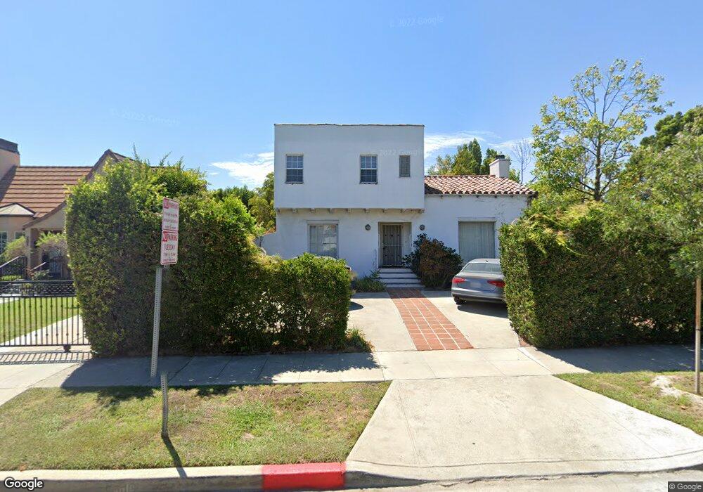
201 S Clark Dr Beverly Hills, CA 90211
Estimated Value: $2,772,000 - $3,400,000
3
Beds
2
Baths
2,700
Sq Ft
$1,099/Sq Ft
Est. Value
About This Home
This home is located at 201 S Clark Dr, Beverly Hills, CA 90211 and is currently estimated at $2,967,458, approximately $1,099 per square foot. 201 S Clark Dr is a home located in Los Angeles County with nearby schools including Horace Mann Elementary School, Beverly Hills High School, and Harkham Hillel Hebrew Academy.
Ownership History
Date
Name
Owned For
Owner Type
Purchase Details
Closed on
Jul 28, 2010
Sold by
Freedman Robet M and Freedman Joan G
Bought by
Freedman Robert M and Freedman Joan G
Current Estimated Value
Purchase Details
Closed on
Oct 25, 1994
Sold by
Lane Gila
Bought by
Freedman Robert M
Home Financials for this Owner
Home Financials are based on the most recent Mortgage that was taken out on this home.
Original Mortgage
$452,600
Interest Rate
8.25%
Create a Home Valuation Report for This Property
The Home Valuation Report is an in-depth analysis detailing your home's value as well as a comparison with similar homes in the area
Home Values in the Area
Average Home Value in this Area
Purchase History
| Date | Buyer | Sale Price | Title Company |
|---|---|---|---|
| Freedman Robert M | -- | None Available | |
| Freedman Robert M | $532,500 | Pacific Title Guaranty Compa |
Source: Public Records
Mortgage History
| Date | Status | Borrower | Loan Amount |
|---|---|---|---|
| Closed | Freedman Robert M | $452,600 |
Source: Public Records
Tax History Compared to Growth
Tax History
| Year | Tax Paid | Tax Assessment Tax Assessment Total Assessment is a certain percentage of the fair market value that is determined by local assessors to be the total taxable value of land and additions on the property. | Land | Improvement |
|---|---|---|---|---|
| 2025 | $10,718 | $894,420 | $660,116 | $234,304 |
| 2024 | $10,718 | $876,883 | $647,173 | $229,710 |
| 2023 | $10,529 | $859,690 | $634,484 | $225,206 |
| 2022 | $10,230 | $842,835 | $622,044 | $220,791 |
| 2021 | $9,920 | $826,310 | $609,848 | $216,462 |
| 2019 | $9,634 | $801,803 | $591,760 | $210,043 |
| 2018 | $9,222 | $786,082 | $580,157 | $205,925 |
| 2016 | $8,827 | $755,560 | $557,630 | $197,930 |
| 2015 | $8,453 | $744,211 | $549,254 | $194,957 |
| 2014 | $8,182 | $729,634 | $538,495 | $191,139 |
Source: Public Records
Map
Nearby Homes
- 209 S Swall Dr
- 240 S Swall Dr
- 138 N Swall Dr
- 143 N Arnaz Dr Unit 204
- 143 N Arnaz Dr Unit 304
- 121 N Almont Dr Unit 303
- 121 N Almont Dr Unit 103
- 272 S Doheny Dr Unit 1
- 152 S Oakhurst Dr Unit 304
- 869 S Wooster St Unit 103
- 858 S Shenandoah St
- 200 N Swall Dr Unit PH53
- 130 S Carson Rd
- 828 S Bedford St Unit 202
- 121 S Palm Dr Unit 203
- 9200 Wilshire Blvd Unit 203E
- 9200 Wilshire Blvd Unit 406W
- 9200 Wilshire Blvd Unit 202E
- 9200 Wilshire Blvd Unit 201W
- 9200 Wilshire Blvd Unit 201E
- 205 S Clark Dr
- 209 S Clark Dr
- 157 S Clark Dr
- 200 S Swall Dr Unit PH 1
- 200 S Swall Dr Unit PH
- 200 S Swall Dr Unit 558
- 200 S Swall Dr Unit 351
- 200 S Swall Dr Unit 304
- 200 S Swall Dr Unit PH58
- 200 S Swall Dr Unit PH1
- 200 S Swall Dr Unit PH9
- 200 S Swall Dr Unit P-54
- 200 S Swall Dr Unit 502
- 200 S Swall Dr Unit 511
- 200 S Swall Dr Unit 507
- 200 S Swall Dr Unit 460
- 200 S Swall Dr Unit 302
- 200 S Swall Dr Unit 355
- 200 S Swall Dr Unit 402
- 200 S Swall Dr Unit 360