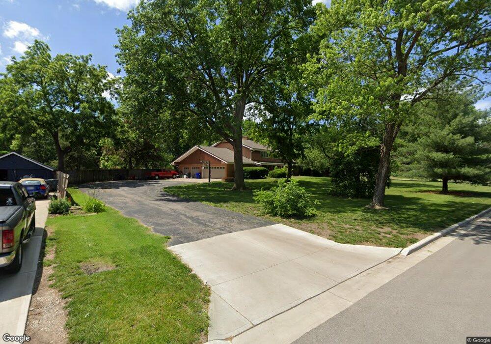
201 S Troost St Olathe, KS 66061
Estimated Value: $486,000 - $743,557
5
Beds
5
Baths
4,738
Sq Ft
$130/Sq Ft
Est. Value
About This Home
This home is located at 201 S Troost St, Olathe, KS 66061 and is currently estimated at $616,639, approximately $130 per square foot. 201 S Troost St is a home located in Johnson County with nearby schools including Westview Elementary School, Oregon Trail Middle School, and Olathe West High School.
Ownership History
Date
Name
Owned For
Owner Type
Purchase Details
Closed on
Oct 21, 2011
Sold by
Garner Laird S and Garner Amy R
Bought by
Smith Eric and Smith April
Current Estimated Value
Purchase Details
Closed on
May 20, 2008
Sold by
Phillips Bryan and Phillips Barbara J
Bought by
Garner Larid S and Garner Amy R
Home Financials for this Owner
Home Financials are based on the most recent Mortgage that was taken out on this home.
Original Mortgage
$212,000
Interest Rate
5.42%
Mortgage Type
New Conventional
Purchase Details
Closed on
Sep 18, 2001
Sold by
Godfrey Donna M and Godfrey William A
Bought by
Phillips Bryan and Phillips Barbara J
Home Financials for this Owner
Home Financials are based on the most recent Mortgage that was taken out on this home.
Original Mortgage
$150,000
Interest Rate
6.84%
Create a Home Valuation Report for This Property
The Home Valuation Report is an in-depth analysis detailing your home's value as well as a comparison with similar homes in the area
Home Values in the Area
Average Home Value in this Area
Purchase History
| Date | Buyer | Sale Price | Title Company |
|---|---|---|---|
| Smith Eric | -- | Chicago Title Company Llc | |
| Garner Larid S | -- | Chicago Title Ins Co | |
| Phillips Bryan | -- | Chicago Title Insurance Co |
Source: Public Records
Mortgage History
| Date | Status | Borrower | Loan Amount |
|---|---|---|---|
| Previous Owner | Garner Larid S | $212,000 | |
| Previous Owner | Phillips Bryan | $150,000 |
Source: Public Records
Tax History Compared to Growth
Tax History
| Year | Tax Paid | Tax Assessment Tax Assessment Total Assessment is a certain percentage of the fair market value that is determined by local assessors to be the total taxable value of land and additions on the property. | Land | Improvement |
|---|---|---|---|---|
| 2024 | $6,685 | $58,892 | $9,465 | $49,427 |
| 2023 | $6,345 | $55,051 | $9,465 | $45,586 |
| 2022 | $6,028 | $50,864 | $8,589 | $42,275 |
| 2021 | $5,990 | $48,288 | $7,791 | $40,497 |
| 2020 | $5,679 | $45,379 | $7,070 | $38,309 |
| 2019 | $5,238 | $41,596 | $6,162 | $35,434 |
| 2018 | $4,782 | $37,731 | $5,597 | $32,134 |
| 2017 | $4,406 | $34,431 | $5,597 | $28,834 |
| 2016 | $4,149 | $33,258 | $5,597 | $27,661 |
| 2015 | $3,933 | $31,556 | $5,597 | $25,959 |
| 2013 | -- | $26,450 | $5,098 | $21,352 |
Source: Public Records
Map
Nearby Homes
- 573 W Loula St
- 600 W Elm St
- 507 W Park St
- 617 S Grant St
- 812 S Troost St
- 1106 W Sheridan St
- 1200 W Sheridan St
- 1425 W Poplar St
- 109 E Cedar St
- 612 N Logan St
- 1545 W Park St
- 1604 W Cedar St
- 531 S Oscar St
- 335 S Water St
- 706 S Kansas Ave
- 619 N Walnut St
- 401 S Harrison St
- 336 E Park St
- 631 N Willie St
- 1549 W Mulberry St
- 207 S Troost St
- 711 W Loula St
- 204 S Troost St
- 200 S Troost St
- 710 W Loula St
- 700 W Cedar St
- 208 S Troost St
- 712 W Loula St
- 594 W Loula St
- 717 W Loula St
- 698 W Cedar St
- 593 W Loula St
- 714 W Cedar St
- 714 W Loula St
- 120 S Troost St
- 716 W Cedar St
- 589 W Loula St
- 588 W Loula St
- 307 S Troost St
- 721 W Loula St