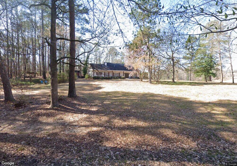
201 SE Linda Dr Clinton, MS 39056
Estimated Value: $266,000 - $338,000
4
Beds
3
Baths
3,452
Sq Ft
$90/Sq Ft
Est. Value
About This Home
This home is located at 201 SE Linda Dr, Clinton, MS 39056 and is currently estimated at $309,146, approximately $89 per square foot. 201 SE Linda Dr is a home located in Hinds County with nearby schools including Clinton Park Elementary School, Eastside Elementary School, and Northside Elementary School.
Ownership History
Date
Name
Owned For
Owner Type
Purchase Details
Closed on
Apr 15, 2016
Sold by
Cronin Irvin H
Bought by
Marett Allen and Marett Carley
Current Estimated Value
Home Financials for this Owner
Home Financials are based on the most recent Mortgage that was taken out on this home.
Original Mortgage
$211,983
Interest Rate
3.73%
Mortgage Type
Construction
Purchase Details
Closed on
Sep 8, 2015
Sold by
Cronin Irvin H and Cronin Howard
Bought by
Cronin Irvin H
Create a Home Valuation Report for This Property
The Home Valuation Report is an in-depth analysis detailing your home's value as well as a comparison with similar homes in the area
Home Values in the Area
Average Home Value in this Area
Purchase History
| Date | Buyer | Sale Price | Title Company |
|---|---|---|---|
| Marett Allen | -- | Attorney | |
| Cronin Irvin H | -- | Attorney |
Source: Public Records
Mortgage History
| Date | Status | Borrower | Loan Amount |
|---|---|---|---|
| Closed | Marett Allen | $211,983 |
Source: Public Records
Tax History
| Year | Tax Paid | Tax Assessment Tax Assessment Total Assessment is a certain percentage of the fair market value that is determined by local assessors to be the total taxable value of land and additions on the property. | Land | Improvement |
|---|---|---|---|---|
| 2025 | $1,753 | $13,707 | $2,900 | $10,807 |
| 2024 | $1,753 | $13,373 | $2,900 | $10,473 |
| 2023 | $1,753 | $13,373 | $2,900 | $10,473 |
| 2022 | $2,033 | $13,373 | $2,900 | $10,473 |
| 2021 | $1,733 | $13,373 | $2,900 | $10,473 |
| 2020 | $1,697 | $13,229 | $2,900 | $10,329 |
| 2019 | $1,737 | $13,229 | $2,900 | $10,329 |
| 2018 | $1,737 | $13,229 | $2,900 | $10,329 |
| 2017 | $2,448 | $13,229 | $2,900 | $10,329 |
| 2016 | $2,448 | $16,512 | $4,350 | $12,162 |
| 2015 | $2,392 | $16,190 | $4,350 | $11,840 |
| 2014 | $2,957 | $20,012 | $8,175 | $11,837 |
Source: Public Records
Map
Nearby Homes
- 306 Linda Dr
- 1609 Linda Dr SW
- 1700 Linda Dr NW
- 114 Trace Pointe Place
- 110 Trace Pointe Place
- 116 Trace Pointe Place
- 107 Trace Pointe Place
- 123 Oakhurst Dr
- 1508 Huntcliff Way
- 1421 Huntcliff Way
- 1419 Huntcliff Way
- 001 Pinehaven Dr
- 00002 E Northside Dr
- 00001 E Northside Dr
- 118 Bentwood Dr
- 100 Coldwater Cir
- 0 Vernon Rd Unit 4128562
- 0 Copper Creek Dr Unit 4113527
- 0 Copper Creek Dr Unit 4113564
- 73 Canebrake Ct
Your Personal Tour Guide
Ask me questions while you tour the home.