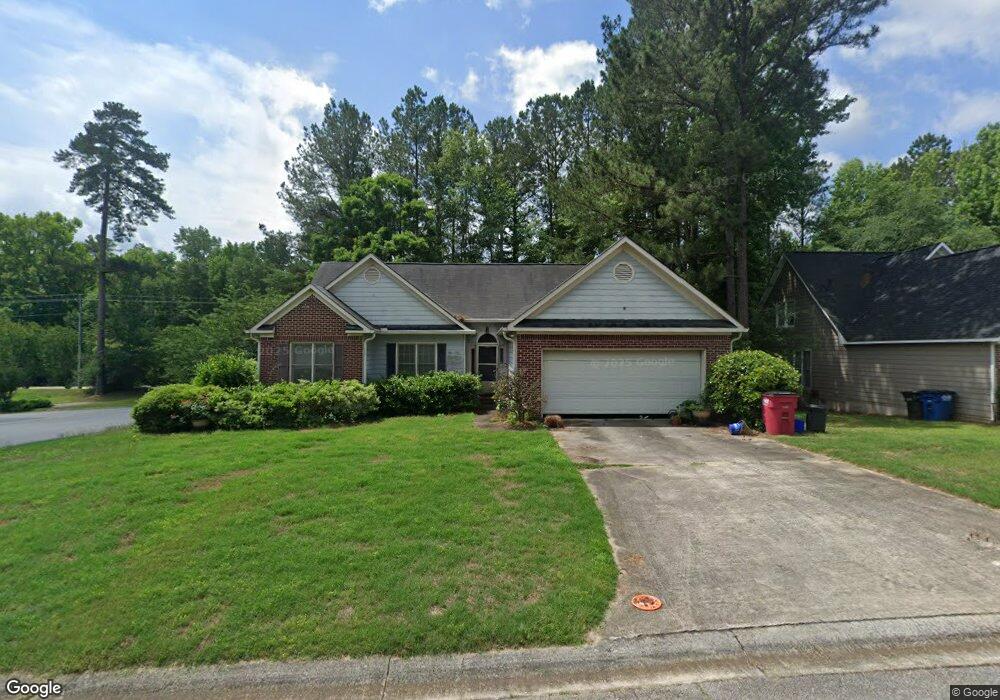
201 Spring Hill Ct Macon, GA 31210
Estimated Value: $208,000 - $215,821
3
Beds
2
Baths
1,555
Sq Ft
$136/Sq Ft
Est. Value
About This Home
This home is located at 201 Spring Hill Ct, Macon, GA 31210 and is currently estimated at $212,205, approximately $136 per square foot. 201 Spring Hill Ct is a home located in Bibb County with nearby schools including Springdale Elementary School, Howard Middle School, and Howard High School.
Ownership History
Date
Name
Owned For
Owner Type
Purchase Details
Closed on
Sep 28, 2007
Sold by
Haygood Russell D and Haygood Jennifer C
Bought by
Dechant Jenee M
Current Estimated Value
Home Financials for this Owner
Home Financials are based on the most recent Mortgage that was taken out on this home.
Original Mortgage
$126,000
Outstanding Balance
$79,081
Interest Rate
6.49%
Mortgage Type
Unknown
Estimated Equity
$133,124
Purchase Details
Closed on
Oct 31, 2003
Create a Home Valuation Report for This Property
The Home Valuation Report is an in-depth analysis detailing your home's value as well as a comparison with similar homes in the area
Home Values in the Area
Average Home Value in this Area
Purchase History
| Date | Buyer | Sale Price | Title Company |
|---|---|---|---|
| Dechant Jenee M | $140,000 | None Available | |
| -- | $131,800 | -- |
Source: Public Records
Mortgage History
| Date | Status | Borrower | Loan Amount |
|---|---|---|---|
| Open | Dechant Jenee M | $126,000 |
Source: Public Records
Tax History Compared to Growth
Tax History
| Year | Tax Paid | Tax Assessment Tax Assessment Total Assessment is a certain percentage of the fair market value that is determined by local assessors to be the total taxable value of land and additions on the property. | Land | Improvement |
|---|---|---|---|---|
| 2025 | $1,755 | $78,410 | $12,000 | $66,410 |
| 2024 | $1,740 | $75,523 | $12,000 | $63,523 |
| 2023 | $1,086 | $67,748 | $10,000 | $57,748 |
| 2022 | $1,886 | $61,470 | $10,170 | $51,300 |
| 2021 | $1,873 | $56,289 | $9,450 | $46,839 |
| 2020 | $1,914 | $56,289 | $9,450 | $46,839 |
| 2019 | $1,685 | $50,036 | $8,550 | $41,486 |
| 2018 | $2,760 | $50,036 | $8,550 | $41,486 |
| 2017 | $1,445 | $45,567 | $7,650 | $37,917 |
| 2016 | $1,334 | $45,567 | $7,650 | $37,917 |
| 2015 | $1,889 | $45,567 | $7,650 | $37,917 |
| 2014 | $1,892 | $45,567 | $7,650 | $37,917 |
Source: Public Records
Map
Nearby Homes
- 199 Springfield Blvd
- 150 Springdale Ct
- 178 Springfield Blvd
- 108 Hillbrooke Ct
- 1297 Wesleyan Dr
- 5341 Northside Dr
- 5161 Wesleyan Cir
- 200 N Wesleyan Cir
- 115 Saddle Run Ct
- 171 Lake View Dr N
- 920 Wesleyan Dr
- 123 Saddle Run Ct
- 5369 Rivoli Dr
- 4964 Kathryn Dr
- 5104 Pine Ridge Dr
- 181 Rivoli Landing
- 1231 Woodcrest Dr
- 137 Senora Place
- 1643 Wesleyan Hills Dr
- 4726 Cheryle Ann Dr
- 207 Spring Hill Ct
- 209 Spring Hill Ct
- 205 Spring Hill Ct
- 176 Spring Hill Ct
- 200 Spring Hill Ct
- 215 Spring Hill Ct
- 204 Spring Hill Ct
- 208 Spring Hill Ct
- 109 Springfield Blvd
- 107 Springfield Blvd Unit 47
- 107 Springfield Blvd
- 212 Spring Hill Ct
- 219 Spring Hill Ct
- 111 Springfield Blvd
- 301 Ashville Ct
- 309 Ashville Ct
- 223 Spring Hill Ct
- 216 Spring Hill Ct
- 216 Spring Hill Ct Unit 8
- 113 Springfield Blvd