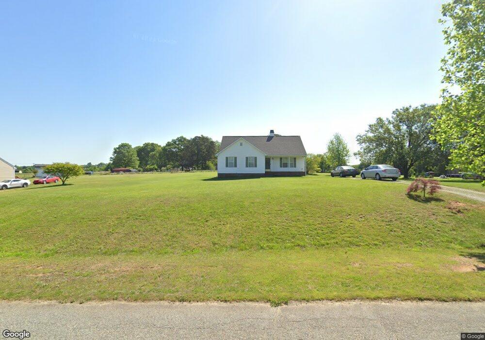
201 Whitestone Dr Greensboro, NC 27455
Estimated Value: $282,253 - $348,000
3
Beds
2
Baths
1,352
Sq Ft
$240/Sq Ft
Est. Value
About This Home
This home is located at 201 Whitestone Dr, Greensboro, NC 27455 and is currently estimated at $323,813, approximately $239 per square foot. 201 Whitestone Dr is a home located in Guilford County with nearby schools including Northern Elementary School, Northern Guilford Middle School, and Northern Guilford High School.
Ownership History
Date
Name
Owned For
Owner Type
Purchase Details
Closed on
Jun 14, 2001
Sold by
Cranford David K and Land Sandra D
Bought by
Cranford David K
Current Estimated Value
Home Financials for this Owner
Home Financials are based on the most recent Mortgage that was taken out on this home.
Original Mortgage
$114,000
Outstanding Balance
$43,425
Interest Rate
7.14%
Estimated Equity
$280,388
Purchase Details
Closed on
Aug 29, 1997
Bought by
Cranford David K
Create a Home Valuation Report for This Property
The Home Valuation Report is an in-depth analysis detailing your home's value as well as a comparison with similar homes in the area
Home Values in the Area
Average Home Value in this Area
Purchase History
| Date | Buyer | Sale Price | Title Company |
|---|---|---|---|
| Cranford David K | -- | -- | |
| Cranford David K | $107,500 | -- |
Source: Public Records
Mortgage History
| Date | Status | Borrower | Loan Amount |
|---|---|---|---|
| Open | Cranford David K | $114,000 |
Source: Public Records
Tax History Compared to Growth
Tax History
| Year | Tax Paid | Tax Assessment Tax Assessment Total Assessment is a certain percentage of the fair market value that is determined by local assessors to be the total taxable value of land and additions on the property. | Land | Improvement |
|---|---|---|---|---|
| 2025 | $1,681 | $188,800 | $60,000 | $128,800 |
| 2024 | $1,681 | $188,800 | $60,000 | $128,800 |
| 2023 | $1,681 | $188,800 | $60,000 | $128,800 |
| 2022 | $1,616 | $188,800 | $60,000 | $128,800 |
| 2021 | $1,147 | $134,100 | $38,000 | $96,100 |
| 2020 | $1,147 | $134,100 | $38,000 | $96,100 |
| 2019 | $1,147 | $134,100 | $0 | $0 |
| 2018 | $1,142 | $134,100 | $0 | $0 |
| 2017 | $1,142 | $134,100 | $0 | $0 |
| 2016 | $1,100 | $124,300 | $0 | $0 |
| 2015 | $1,106 | $124,300 | $0 | $0 |
| 2014 | $1,119 | $124,300 | $0 | $0 |
Source: Public Records
Map
Nearby Homes
- 7720 Whipple Trail
- 7807 Whipple Trail
- 400 Lauryn Waverly Way
- WILMINGTON Plan at Cedar Oaks
- GEORGETOWN Plan at Cedar Oaks
- HAYDEN Plan at Cedar Oaks
- COLUMBIA Plan at Cedar Oaks
- ABERDEEN Plan at Cedar Oaks
- 3409 Millennium Dr
- 200 James Doak Pkwy
- 6095 Clopton Dr
- 6232 Cadence Dr
- 6253 Cadence Dr
- 6231 Cadence Dr
- 7910 E Gander Ct
- 6125 Blue Streak Ct
- 597 Tillie Scott Ct
- 7896 Shoveler Dr
- 7780 Sutter Rd
- 3303 Nc Highway 150 E
- 109 Whitestone Dr
- 203 Whitestone Dr
- 155 White Stone Dr
- 107 Whitestone Dr
- 205 Whitestone Dr
- 200 Whitestone Dr
- 112 Whitestone Dr
- 202 Whitestone Dr
- 5685 Church St
- 110 Whitestone Dr
- 5705 Prima Ct
- 5687 N Church St
- 207 Whitestone Dr
- 5703 Prima Ct
- 5689 N Church St
- 204 Whitestone Dr
- 105 Whitestone Dr
- 5704 Prima Ct
- 203 Cattail Ct
- 202 Cattail Ct