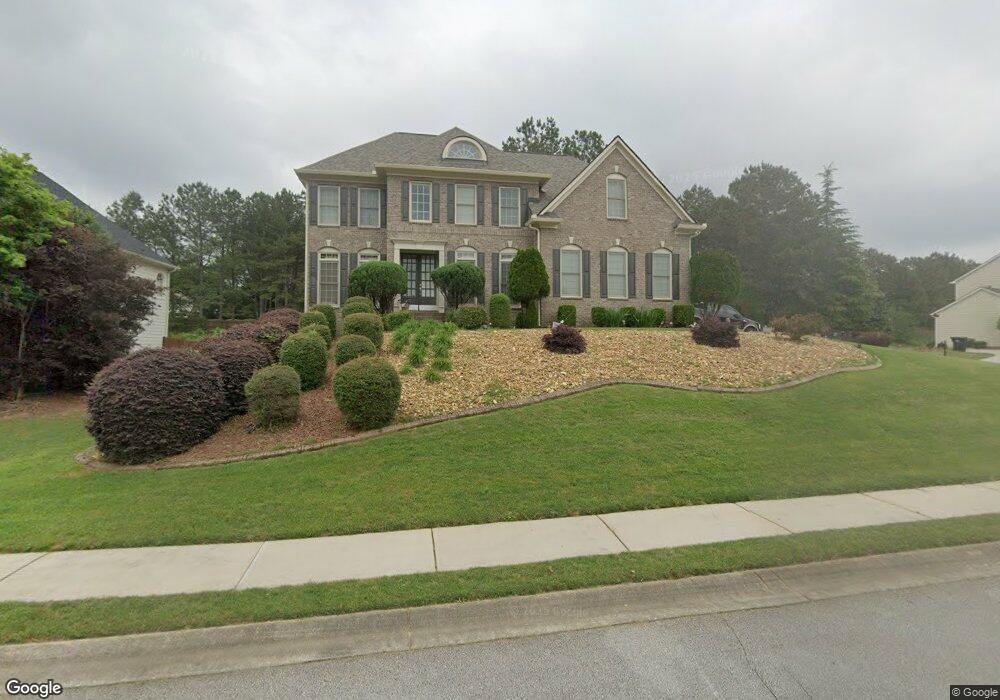
201 Wynfield Dr Tyrone, GA 30290
Estimated Value: $525,246 - $637,000
--
Bed
1
Bath
2,858
Sq Ft
$202/Sq Ft
Est. Value
About This Home
This home is located at 201 Wynfield Dr, Tyrone, GA 30290 and is currently estimated at $576,312, approximately $201 per square foot. 201 Wynfield Dr is a home located in Fayette County with nearby schools including Robert J. Burch Elementary School, Flat Rock Middle School, and Sandy Creek High School.
Ownership History
Date
Name
Owned For
Owner Type
Purchase Details
Closed on
Nov 12, 2004
Sold by
Smith Edward
Bought by
Smith Edward
Current Estimated Value
Home Financials for this Owner
Home Financials are based on the most recent Mortgage that was taken out on this home.
Original Mortgage
$271,200
Interest Rate
5.66%
Create a Home Valuation Report for This Property
The Home Valuation Report is an in-depth analysis detailing your home's value as well as a comparison with similar homes in the area
Home Values in the Area
Average Home Value in this Area
Purchase History
| Date | Buyer | Sale Price | Title Company |
|---|---|---|---|
| Smith Edward | -- | -- | |
| Smith Edward | $339,000 | -- |
Source: Public Records
Mortgage History
| Date | Status | Borrower | Loan Amount |
|---|---|---|---|
| Previous Owner | Smith Edward | $271,200 | |
| Previous Owner | Smith Edward | $33,900 |
Source: Public Records
Tax History Compared to Growth
Tax History
| Year | Tax Paid | Tax Assessment Tax Assessment Total Assessment is a certain percentage of the fair market value that is determined by local assessors to be the total taxable value of land and additions on the property. | Land | Improvement |
|---|---|---|---|---|
| 2024 | $1,961 | $191,548 | $32,000 | $159,548 |
| 2023 | $1,618 | $166,480 | $32,000 | $134,480 |
| 2022 | $2,574 | $159,520 | $32,000 | $127,520 |
| 2021 | $2,494 | $139,080 | $24,000 | $115,080 |
| 2020 | $2,732 | $131,600 | $24,000 | $107,600 |
| 2019 | $2,636 | $125,800 | $24,000 | $101,800 |
| 2018 | $2,397 | $113,680 | $24,000 | $89,680 |
| 2017 | $2,517 | $118,640 | $24,000 | $94,640 |
| 2016 | $2,135 | $98,600 | $14,400 | $84,200 |
| 2015 | $2,871 | $90,240 | $14,400 | $75,840 |
| 2014 | $2,733 | $84,680 | $14,400 | $70,280 |
| 2013 | -- | $85,400 | $0 | $0 |
Source: Public Records
Map
Nearby Homes
- 101 Westmont Way
- 125 Westmont Way
- 219 Brunswick Dr
- 125 Meadowview Cir
- 131 Lincoln Rd
- 0 Georgia 74
- 110 Calypso Ct
- 0 Erwin Run Unit 10585589
- 105 Delamere Place
- 325 Park Haven Ln
- 91 Goodlin Rd
- 365 Pendleton Trail
- 475 Castlewood Rd
- 170 Brennan Dr
- 240 Lynnwood Ave
- 180 Park Haven Ln
- 500 Laurelwood Dr
- 575 Laurelwood Dr
- 242 Kirkley Rd
- 230 Hedgewick Way
- 119 Green Branch Dr
- 308 Wynfield Dr
- 140 Green Branch Dr
- 117 Green Branch Dr
- 122 Green Branch Dr
- 0 Green Branch Dr Unit 7121964
- 0 Green Branch Dr Unit 3250095
- 0 Green Branch Dr Unit 8647604
- 0 Green Branch Dr Unit 8650637
- 0 Green Branch Dr Unit 8361081
- 0 Green Branch Dr Unit 3150784
- 0 Green Branch Dr Unit 8084003
- 0 Green Branch Dr Unit 8025209
- 0 Green Branch Dr Unit 7377620
- 0 Green Branch Dr Unit 7576037
- 0 Green Branch Dr Unit 3126169
- 0 Green Branch Dr Unit 8503768
- 0 Green Branch Dr Unit 7407272
- 0 Green Branch Dr Unit 7132944
- 0 Green Branch Dr