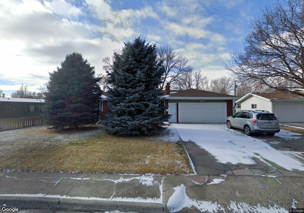
2010 15th St W Billings, MT 59102
North Central Billings NeighborhoodEstimated Value: $437,000 - $483,016
5
Beds
3
Baths
3,664
Sq Ft
$124/Sq Ft
Est. Value
About This Home
This home is located at 2010 15th St W, Billings, MT 59102 and is currently estimated at $453,754, approximately $123 per square foot. 2010 15th St W is a home located in Yellowstone County with nearby schools including Rose Park School, Lewis & Clark Junior High School, and Billings Senior High School.
Ownership History
Date
Name
Owned For
Owner Type
Purchase Details
Closed on
Aug 27, 2025
Sold by
Rice Robert J and Rice Judy K
Bought by
Nelson-Sutherland Gwendolyn
Current Estimated Value
Purchase Details
Closed on
Mar 27, 2023
Sold by
Snyder Jacqueline A
Bought by
Rice Robert J and Rice Judy K
Purchase Details
Closed on
Oct 11, 2018
Sold by
Anderson Carl J and Anderson Cheryl A
Bought by
Snyder John L and Snyder Jacqueline A
Purchase Details
Closed on
Aug 8, 2014
Sold by
Baston Virgil F and Bastonz Mary Kathryn
Bought by
Anderson Carl J and Anderson Cheryl A
Home Financials for this Owner
Home Financials are based on the most recent Mortgage that was taken out on this home.
Original Mortgage
$219,200
Interest Rate
4.12%
Mortgage Type
New Conventional
Purchase Details
Closed on
Sep 29, 2010
Sold by
Dierenfield Clem A and Dierenfield Marianne M
Bought by
Baston Virgil F and Baston Mary Kathryn
Home Financials for this Owner
Home Financials are based on the most recent Mortgage that was taken out on this home.
Original Mortgage
$175,000
Interest Rate
4.35%
Mortgage Type
New Conventional
Create a Home Valuation Report for This Property
The Home Valuation Report is an in-depth analysis detailing your home's value as well as a comparison with similar homes in the area
Home Values in the Area
Average Home Value in this Area
Purchase History
| Date | Buyer | Sale Price | Title Company |
|---|---|---|---|
| Nelson-Sutherland Gwendolyn | -- | None Listed On Document | |
| Rice Robert J | -- | -- | |
| Snyder John L | -- | -- | |
| Anderson Carl J | -- | American Title & Escrow | |
| Baston Virgil F | -- | Ctic |
Source: Public Records
Mortgage History
| Date | Status | Borrower | Loan Amount |
|---|---|---|---|
| Previous Owner | Anderson Carl J | $219,200 | |
| Previous Owner | Baston Virgil F | $175,000 |
Source: Public Records
Tax History Compared to Growth
Tax History
| Year | Tax Paid | Tax Assessment Tax Assessment Total Assessment is a certain percentage of the fair market value that is determined by local assessors to be the total taxable value of land and additions on the property. | Land | Improvement |
|---|---|---|---|---|
| 2025 | $4,540 | $461,300 | $53,888 | $407,412 |
| 2024 | $4,540 | $457,000 | $48,753 | $408,247 |
| 2023 | $4,535 | $457,000 | $48,753 | $408,247 |
| 2022 | $3,088 | $327,100 | $0 | $0 |
| 2021 | $3,550 | $327,100 | $0 | $0 |
| 2020 | $3,631 | $321,200 | $0 | $0 |
| 2019 | $3,471 | $321,200 | $0 | $0 |
| 2018 | $3,050 | $272,300 | $0 | $0 |
| 2017 | $2,970 | $272,300 | $0 | $0 |
| 2016 | $2,688 | $246,600 | $0 | $0 |
| 2015 | $2,631 | $246,600 | $0 | $0 |
| 2014 | $2,736 | $138,277 | $0 | $0 |
Source: Public Records
Map
Nearby Homes
- 1444 Colton Blvd
- 1436 Parkhill Dr
- 46 Shadow Place Unit 6B
- 56 Shadow Place
- 24 Heatherwood Ln Unit 12D
- 41 Heatherwood Ln
- 2202 13th St W
- 1400 Poly Dr Unit 4D
- 1734 Mariposa Ln
- 1745 Parkhill Dr
- 1240 Avenue D Unit 8
- 1240 Avenue D Unit 7
- 1229 Avenue E
- 1121 Parkhill Dr
- 1124 Parkhill Dr
- 1214 Harvard Ave
- 1833 Iris Ln
- 1034 Avenue F
- 1723 Alderson Ave
- 2124 Dahlia Ln
- 2016 15th St W
- 1505 Parkhill Dr
- 2009 Lamar Dr
- 2020 15th St W
- 2015 Lamar Dr
- 1515 Parkhill Dr
- 2011 15th St W
- 2005 15th St W
- 2019 15th St W
- 2015 15th St W
- 1441 Parkhill Dr
- 2025 15th St W
- 2017 Lamar Dr
- 2024 15th St W
- 1502 Parkhill Dr
- 1512 Parkhill Dr
- 2021 Lamar Dr
- 1444 Parkhill Dr
- 1516 Parkhill Dr
- 2012 Wilshire St