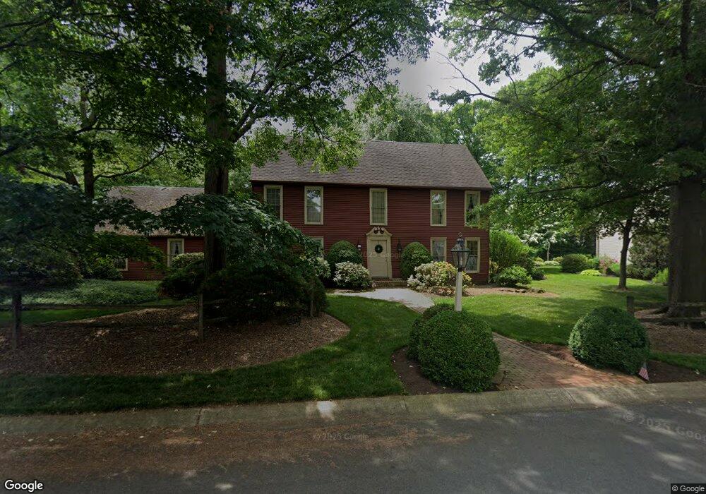
2010 Maplewood Ln Allentown, PA 18103
Lower Macungie Township East NeighborhoodEstimated Value: $528,639 - $719,000
4
Beds
3
Baths
2,760
Sq Ft
$223/Sq Ft
Est. Value
About This Home
This home is located at 2010 Maplewood Ln, Allentown, PA 18103 and is currently estimated at $614,660, approximately $222 per square foot. 2010 Maplewood Ln is a home located in Lehigh County with nearby schools including Wescosville Elementary School, Lower Macungie Middle School, and Emmaus High School.
Ownership History
Date
Name
Owned For
Owner Type
Purchase Details
Closed on
Feb 5, 2010
Sold by
Baum Richard S
Bought by
Palazzo Michael D
Current Estimated Value
Home Financials for this Owner
Home Financials are based on the most recent Mortgage that was taken out on this home.
Original Mortgage
$292,000
Outstanding Balance
$192,964
Interest Rate
5%
Mortgage Type
New Conventional
Estimated Equity
$421,696
Purchase Details
Closed on
Oct 25, 1996
Bought by
Baum Richard S and Baum Barbara E
Purchase Details
Closed on
Oct 28, 1989
Sold by
Baker Daniel B and Baker Saundra
Bought by
Lytle George C and Mc Niel M M
Purchase Details
Closed on
Feb 9, 1984
Bought by
Baker Daniel B and Baker Saundra
Purchase Details
Closed on
Sep 27, 1983
Bought by
Canouse John J and Howard Bruce J
Create a Home Valuation Report for This Property
The Home Valuation Report is an in-depth analysis detailing your home's value as well as a comparison with similar homes in the area
Home Values in the Area
Average Home Value in this Area
Purchase History
| Date | Buyer | Sale Price | Title Company |
|---|---|---|---|
| Palazzo Michael D | $370,000 | -- | |
| Baum Richard S | $270,000 | -- | |
| Lytle George C | $297,500 | -- | |
| Baker Daniel B | -- | -- | |
| Canouse John J | $62,500 | -- |
Source: Public Records
Mortgage History
| Date | Status | Borrower | Loan Amount |
|---|---|---|---|
| Open | Palazzo Michael D | $292,000 |
Source: Public Records
Tax History Compared to Growth
Tax History
| Year | Tax Paid | Tax Assessment Tax Assessment Total Assessment is a certain percentage of the fair market value that is determined by local assessors to be the total taxable value of land and additions on the property. | Land | Improvement |
|---|---|---|---|---|
| 2025 | $7,335 | $287,300 | $45,800 | $241,500 |
| 2024 | $7,096 | $287,300 | $45,800 | $241,500 |
| 2023 | $6,955 | $287,300 | $45,800 | $241,500 |
| 2022 | $6,790 | $287,300 | $241,500 | $45,800 |
| 2021 | $6,646 | $287,300 | $45,800 | $241,500 |
| 2020 | $6,582 | $287,300 | $45,800 | $241,500 |
| 2019 | $6,470 | $287,300 | $45,800 | $241,500 |
| 2018 | $6,385 | $287,300 | $45,800 | $241,500 |
| 2017 | $6,274 | $287,300 | $45,800 | $241,500 |
| 2016 | -- | $287,300 | $45,800 | $241,500 |
| 2015 | -- | $287,300 | $45,800 | $241,500 |
| 2014 | -- | $287,300 | $45,800 | $241,500 |
Source: Public Records
Map
Nearby Homes
- 2117 Isabel Ln
- 2153 Isabel Ln
- 2096 Gregory Dr
- Henley Plan at Mountainview Estates
- Penny Plan at Mountainview Estates
- 2041 Gregory Dr
- 2300 S Cedar Crest Blvd
- 4762 Steeplechase Dr Unit 13C
- 2518 Stanford Cir
- 2570 Millbrook Dr
- 2560 Gracie Lone
- 2834 Sheffield Dr
- 1270 Minesite Rd
- 5175 Meadowview Dr
- 5133 Meadow Ln
- 2980 Sheffield Dr
- 3045 Sheffield Dr
- 1675 Hamlet Dr
- 4881 Spruce Rd
- 1385 Brookside Rd
- 4269 Rosewood Ln
- 1990 Maplewood Ln
- 2011 Maplewood Ln
- 1957 Maplewood Cir
- 4260 Rosewood Ln
- 1989 Maplewood Ln
- 4230 Rosewood Ln
- 1958 Maplewood Cir
- 4285 Rosewood Ln
- 1960 Maplewood Ln
- 4270 Rosewood Ln
- 2040 Riverbend Rd
- 4210 Rosewood Ln
- 1965 Maplewood Ln
- 1991 Forest Ln
- 2000 Riverbend Rd
- 4307 Rosewood Ln
- 2080 Riverbend Rd
- 1951 Maplewood Ln
- 1956 Maplewood Cir